
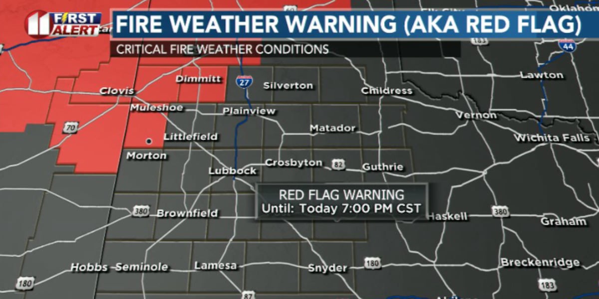
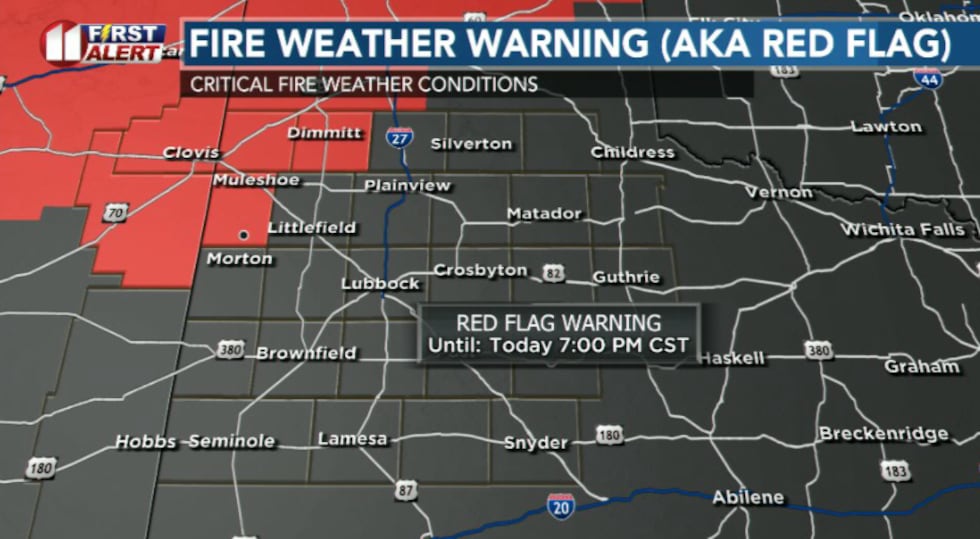
LUBBOCK, Texas (KCBD) – Very warm, dry and breezy conditions this afternoon will create critical wildfire potential across the northwestern portion of the viewing area, with a Red Flag Warning now in effect from noon until 7 p.m.
 KCBD(KCBD)
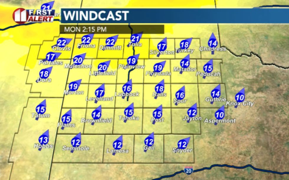
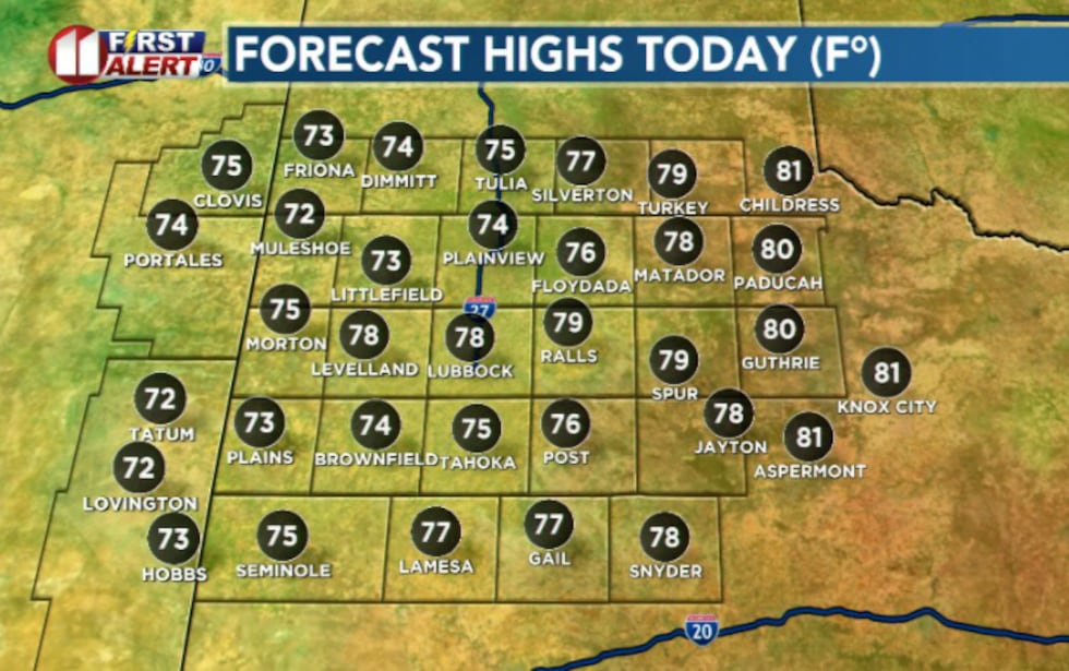
Afternoon highs will reach the 70s on the Caprock with lower 80s elsewhere, fueled by unseasonably warm southwest winds. These temperatures are running 10 to 20 degrees above normal for this time of year.
 KCBD(KCBD)What to Expect Today
The combination of warm temperatures, low humidity and gusty winds will raise wildfire danger area-wide. Afternoon relative humidity will drop into the low to mid teens, creating dangerous fire conditions. The highest fire danger will be across northwestern zones where wind speeds will be strongest and humidity will be lowest. Winds will begin to decrease by sunset.
 KCBD(KCBD)Tonight and Beyond
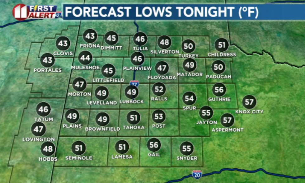
Mild lows in the 40s and 50s are expected tonight under partly cloudy skies as conditions gradually calm down.
 KCBD(KCBD)
A cold front will push southward by sunset, entering northern zones by sunrise Tuesday and moving south of the viewing area by noon.
Looking Ahead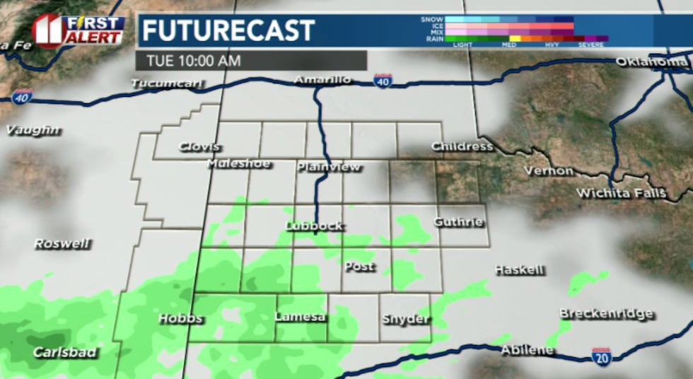 KCBD(KCBD)
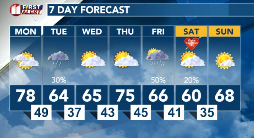
Rain chances return Tuesday afternoon, followed by another opportunity for precipitation Thursday night into the weekend. Temperatures will cool off by the end of the week.
 KCBD(KCBD)
Copyright 2026 KCBD. All rights reserved.