
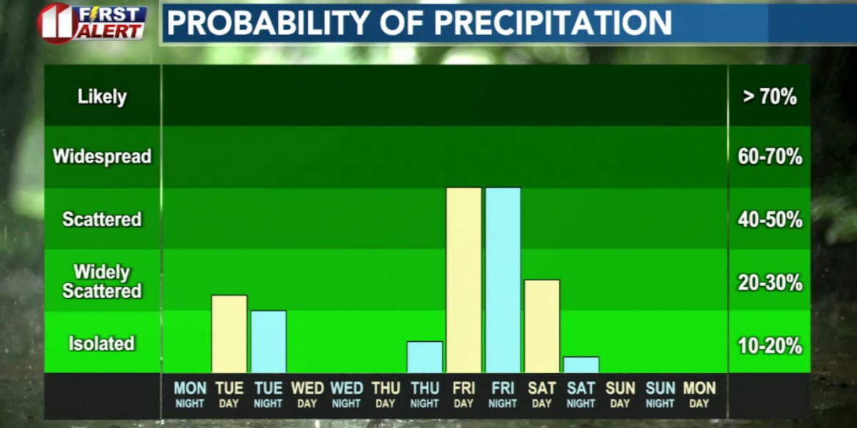
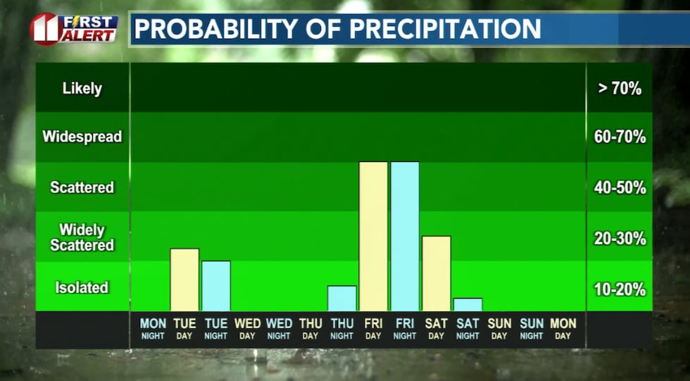
LUBBOCK, Texas (KCBD) – Lubbock and the KCBD/FOX34 viewing area will see increasing rain chances this week. The first chance is Tuesday, with the best opportunity for meaningful moisture Friday.
First Chance of Rain
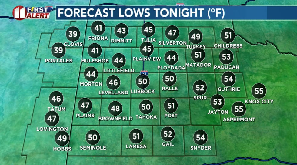
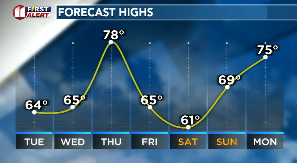
Tonight will be mostly cloudy and breezy. The combination, along with a southwesterly component to the breeze, will result in a quite warm night — for February — about 20 degrees above average.
 Mild for February overnight temperatures!(KCBD First Alert)
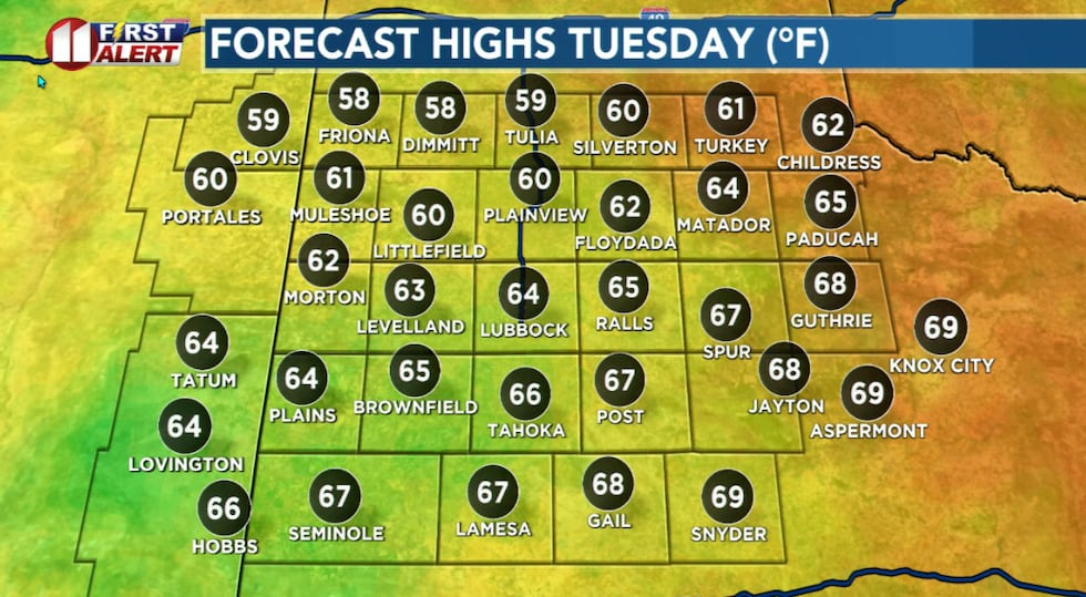
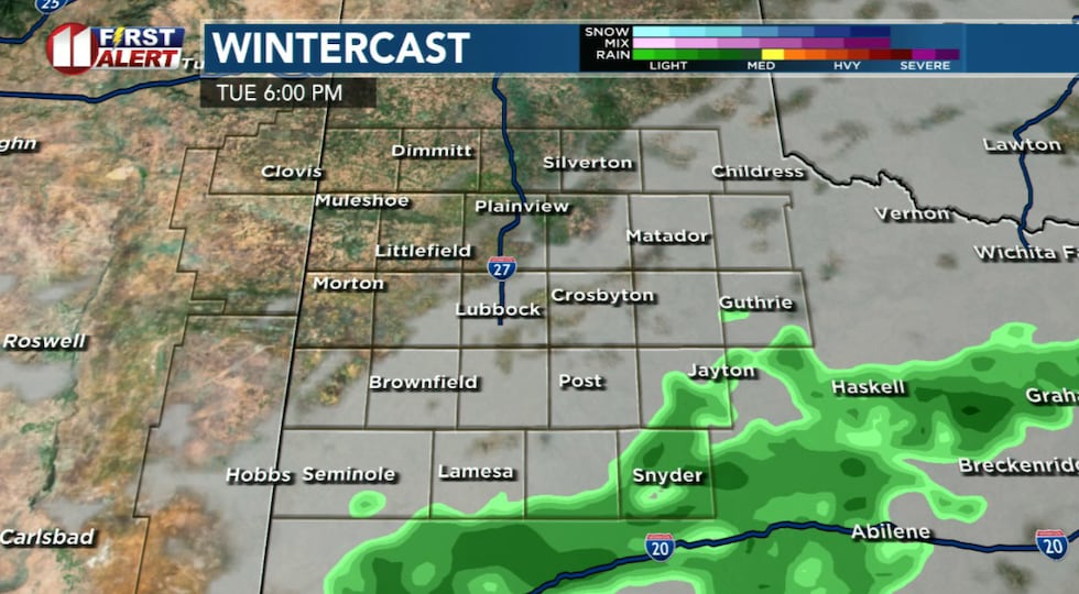
A thicker layer of clouds tomorrow will bring a chance of rain Tuesday afternoon. Shower chances will be greatest over the southern viewing area. Even there, however, amounts are expected to be light. In general, total rainfall is likely to be no more than a tenth of an inch.
 Cooler but still above average temperatures Tuesday.(KCBD First Alert)
The clouds, showers, and morning arrival of a cold front, will result in a much cooler afternoon. Highs Tuesday will be around 10 degrees cooler in the southwestern viewing area to around 20 degrees cooler than today over the northeastern viewing area.
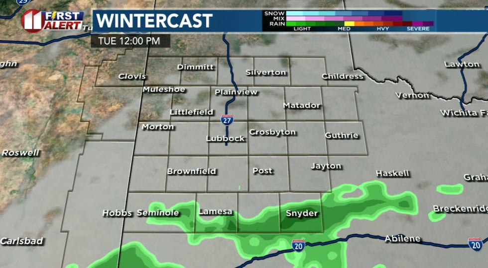 Spotty light rain showers, favoring the southern viewing area, expected Tuesday.(KCBD First Alert)
Spotty rain showers are likely to continue into Tuesday evening. You may want to have an umbrella handy if you’ll be out in the afternoon and evening.
 Spotty light rain showers, favoring the southern viewing area, expected Tuesday.(KCBD First Alert)
Tuesday night will be colder, with lows in the 30s.
Dry Mid-Week
Wednesday, though a little cool, is looking like a mild day. After a very chilly morning, temperatures will peak in the 60s under a mostly sunny sky.
 Cooler temperatures coincide with rain chances this week.(KCBD First Alert)
Temperatures will again soar Thursday with highs back in the 70s. Clouds will increase late in the day leading up to a slight chance of rain late Thursday night.
Meaningful Rain
Friday is interesting in that, based on today’s data, our area has a good chance for measurable rainfall. It should be the wettest day of the week. Showers will be possible in the morning, but become likely in the afternoon. The clouds and showers, along with a weak cold front, will hold highs to the 60s. Still a bit above average for mid-February.
 Tuesday’s showers are expected to be very light, favoring the southern viewing area.(KCBD First Alert)
The greatest potential for rain currently appears to be Friday night. We can expect wet but not icy roads and other surfaces into Saturday morning..
Valentine’s Day
Saturday is likely to start off wet. Clearing is expected during the day, which will be cool and breezy.
Late Weekend
Saturday night will be mostly clear and cold. Sunday should be a nice finish to the weekend with sunny skies.
On This Date
On this date in 1959, the season worst dust storm of the young year struck much of West Texas, including the South Plains. Wind gusts were estimated
as high as 90 mph. Visibility was reduced to zero in areas and winds at Lubbock were clocked at 69 mph with sustained speeds as high as 52 mph during the peak of the storm at 6:42 PM. The thick blowing dust contributed to a five-car wreck near Plainview resulting in five injuries. Reports of wind damage were commonplace.
(Source: National Weather Service, Lubbock)
Copyright 2026 KCBD. All rights reserved.