

The gorgeous weather this past weekend that drew you and many folks outdoors also might have you now dealing with sinus pressure, itchy eyes, a scratchy throat or a lingering cough.
You’re likely caught up in what is commonly known in Central Texas as cedar fever, or feeling the effects of high concentrations of Ashe juniper pollen in the air.
Since Feb. 1, cedar pollen levels have stayed in moderate to very high range, peaking on Monday at 9,477 grains per cubic meter, according to the Allergy and Asthma Center of Georgetown. That’s also the highest count of the season so far.
While we have some rain in the forecast that could settle down the airborne tree pollen for a bit, we also could see the mold allergy counts rise because of the extra moisture in the atmosphere. It doesn’t seem like we can win the allergy war in Texas.
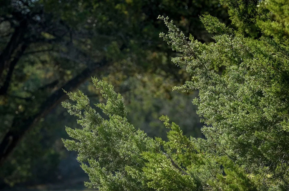
Ashe juniper trees blow in the wind at Mary Moore Searight Metropolitan Park in Austin on Jan. 14, during a period of high cedar pollen conccentration in the air. (Jay Janner/Austin American-Statesman)
Next rain chance
Tuesday morning: The day will begin dry and mild across Central Texas, but southerly winds from the Gulf will bring higher humidity and increased cloud cover.
Some locally dense fog remains possible Tuesday as dew point temperatures and air temperatures reach the low 60s. This essentially condenses the air, forming clouds at the surface that could reduce visibility to less than a mile.
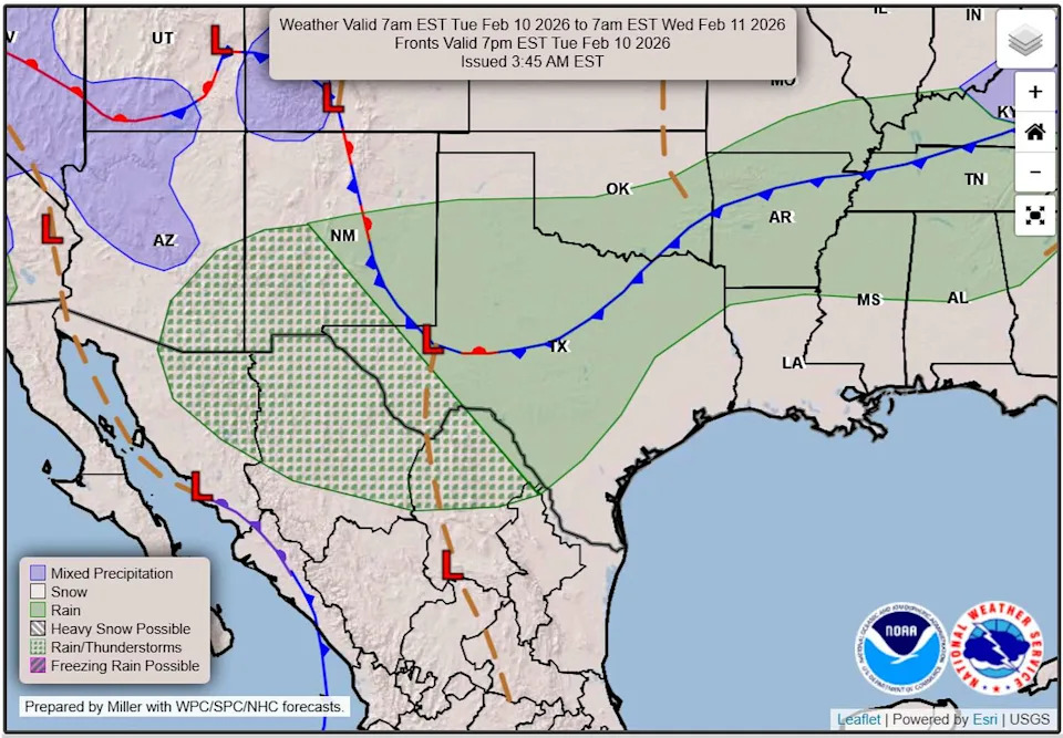
A Pacific storm system will move over the Lone Star State on Tuesday and into Wednesday with a good rain chance for Central and South Texas. (Weather Prediction Center)
The highest probability for fog looks to be along the Balcones Escarpment, with patchy fog also possible across the Coastal Plains and along the Interstate 35 corridor.
Once the fog lifts mid-morning, the sky will still be full of clouds as a Pacific atmospheric disturbance slowly moves across northern Mexico and into Texas.
Tuesday afternoon: Temperatures will climb from the low 60s into the middle and upper 70s by the afternoon. South winds will be a little breezy with gusts as strong as 20 mph.
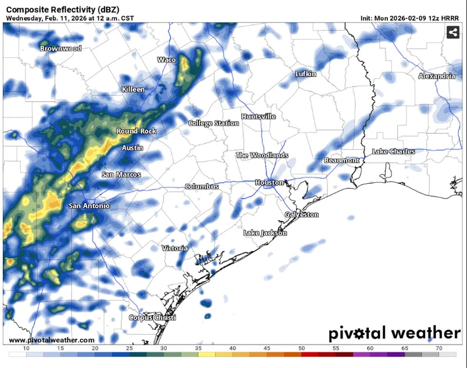
Rain showers will begin Tuesday evening, peaking overnight. Here’s a look at what the weather radar could look like at midnight Wednesday. (Pivotal)
Rain chances will hold off until the afternoon. Expect some light spotty showers at first, then they will become more scattered as the evening marches on. The highest rain chance will be from 5 p.m. through overnight.
Tuesday night: Most of the rain will move east after daybreak Wednesday, leaving only a few lingering showers along a weak cold front. Rainfall totals will be fairly light with most locations getting less than a quarter-inch.
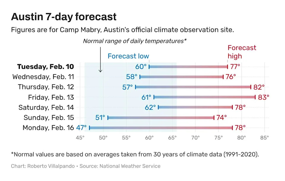
Despite the rain in the forecast, Austin temperatures will continue to be warm and unseasonably high for February. (Roberto Villalpando)
Winds will shift to the north behind the front. But that won’t bring much relief from unseasonable warmth as afternoon temperatures will still climb into the 70s. Across the region, skies will clear from west to east.
Drier weather late week
A ridge of high atmospheric pressure will build over South and Central Texas from Wednesday afternoon through Friday, bringing partly cloudy skies and near-record highs. Thursday’s forecast calls for a peak daytime temperature of 82 degrees, just a degree shy of Austin’s record high of 83 set in 1951. On Friday, temperatures are expected to reach 83 degrees, only a single degree below the record set more than a century ago in 1924.