
LUBBOCK, Texas (KCBD) – We’re currently sitting under a ridge of high pressure, which is doing an excellent job keeping our weather quiet and our skies clear.
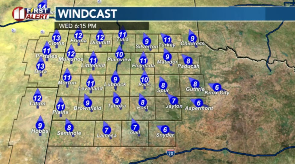 Southerly winds today(KCBD)
Temperatures will reach the mid to low 60s across the region with light mostly southerly winds.
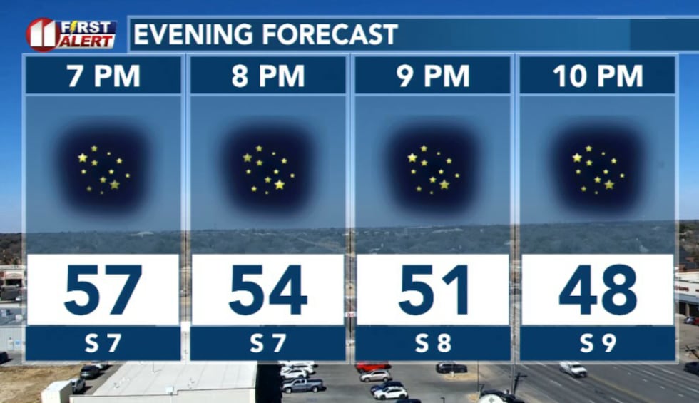 This evening will be calm and clear(KCBD)
Thursday will be the overachieving day as far as temperatures are concerned.
Morning starts in the mid 40s, but we warm quickly. Highs jump to around 79 degrees here in Lubbock, and some areas briefly touch the low 80s. 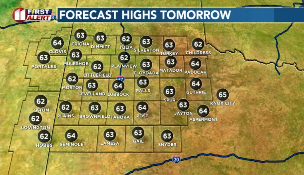 Highs(KCBD)
Those southerly winds of today are expected to turn westerly, and that matters here because westerly winds mean that air coming off the higher terrain of Easter New Mexico descends onto the Caprock and Rolling Plains. As it does that, the air compresses and warms and will help prop up our temperatures.
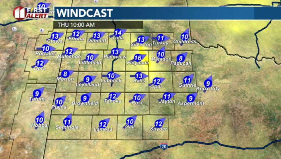 Westerly winds Thursday(KCBD)
Friday is when things begin to change.
That ridge will shift to the east and a storm system moves in from the southwest. Instead of air sinking like it is now, air starts rising. And rising air is how we make clouds and rain.
Highs drop back into the upper 60s. Clouds will increase throughout the day.
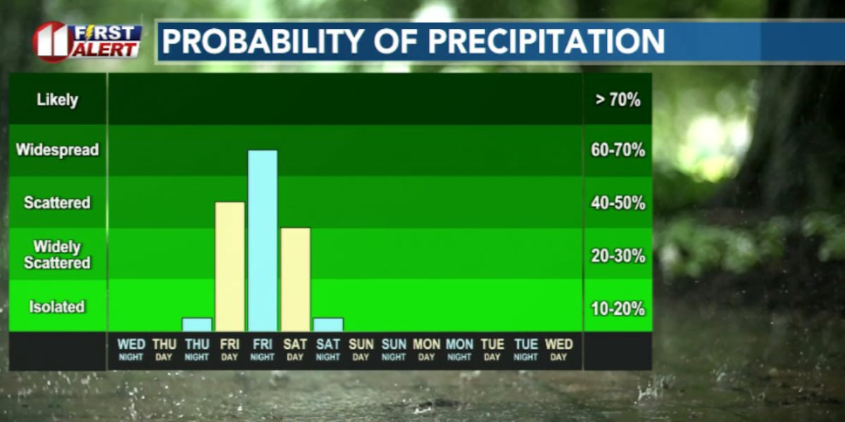
Rain chances begin increasing by late Friday morning but really ramp up Friday evening and overnight.
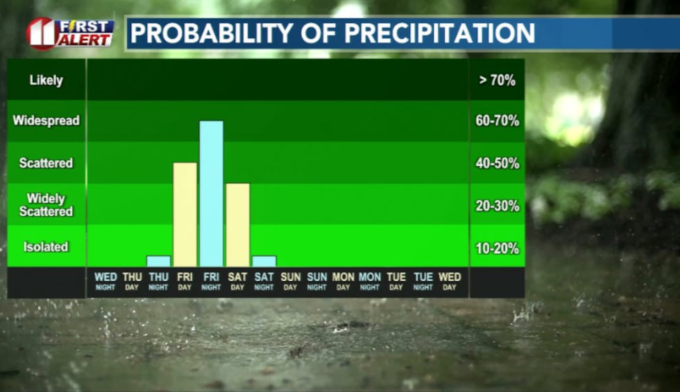 Rain chances move in for Valentine’s Day weekend(KCBD)
While the severe risk is low, a few thunderstorms are possible with gusty winds, lightning, and heavy downpours.
Some bands of rain may train over the same area and cause low lying flooding or ponding on the road.
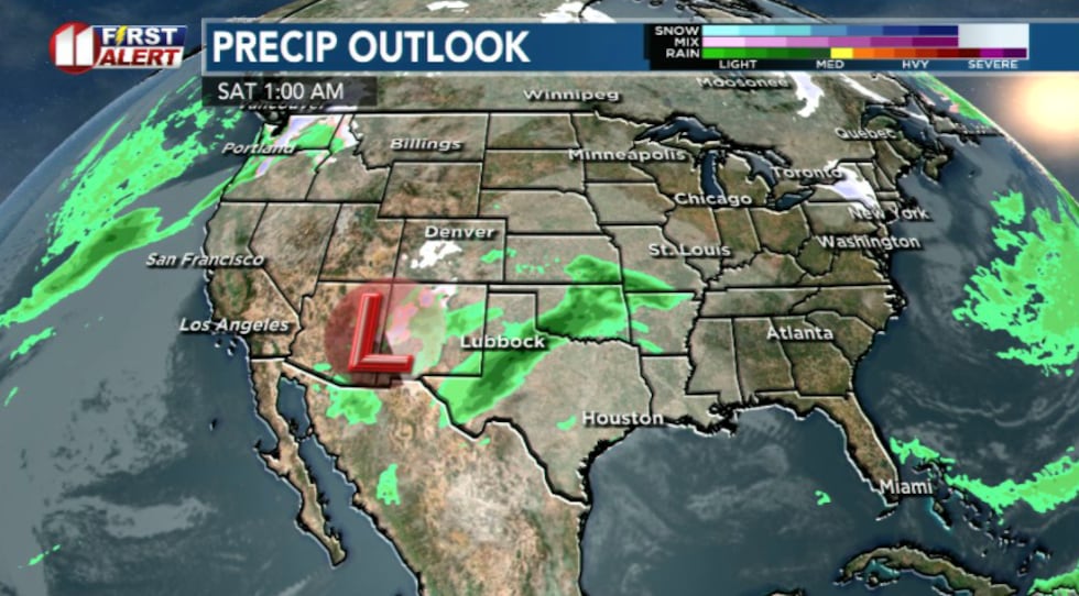 Upper level system bringing back rain chances this weekend(KCBD)
This system is pulling in moisture from the Pacific Ocean. That means the air overhead will hold more moisture than we usually see in February. When you combine that extra moisture with rising air, rainfall becomes more efficient.
That’s why this looks like a widespread rain event instead of just scattered showers.
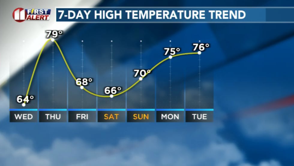 Temperatures will peak tomorrow before cooling off this weekend(KCBD)
Saturday stays unsettled. Highs only reach around 60 degrees and north winds around 15-20mph will make it feel cooler and damp.
Rain may continue into the afternoon but taper off by Saturday afternoon.
Once this system moves out, high pressure builds back in and we climb back into the mid 70s by Monday.
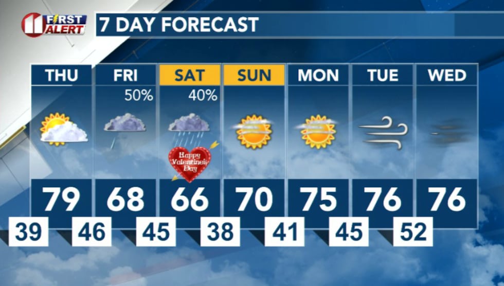 7 Day forecast(KCBD)
Copyright 2026 KCBD. All rights reserved.