
SAN ANTONIO — A weak cold front early this week left drier, breezy conditions today with temperatures climbing into the upper 80s to near 90F.
Those breezy, dry conditions are raising local fire-weather concerns in dry hill-country areas and keeping air quality in the Moderate range for San Antonio this afternoon; sensitive groups should limit prolonged outdoor exertion.
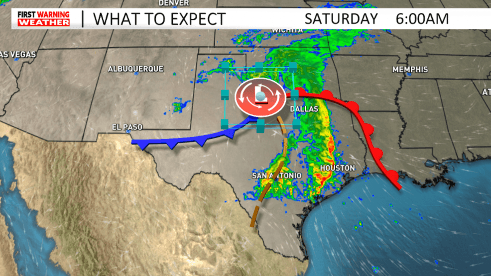
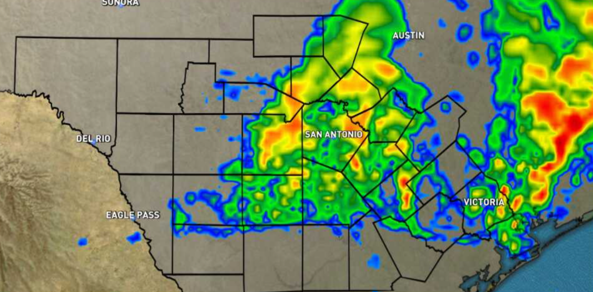
{p}A stronger storm system is expected Friday night into Saturday, when Gulf moisture and an approaching front could produce scattered to widespread showers, a few strong thunderstorms, and pockets of heavy rain. (SBG San Antonio){/p}
A stronger storm system is expected Friday night into Saturday, when Gulf moisture and an approaching front could produce scattered to widespread showers, a few strong thunderstorms, and pockets of heavy rain.
Model runs differ on exact amounts and placement (guidance shows anywhere from light totals to locally heavy 1–4 amounts in parts of central Texas) so, have alternate outdoor plans Saturday morning.
TODAY:
Clouds to Sun
HIGHS: 84 – 88
WINDS: NE to SE 6 – 12mph
A fairly cloudy start then partly sunny in the afternoon. Humidity is fairly low through the day then goes up Wednesday night into Thursday.
THURSDAY:
Partly Sunny, Hot
HIGHS: 88 – 92
WINDS: SSE 7 – 14mph
A mix of clouds and sun. Isolated chance of sprinkles or a shower in the eastern half of our area. It’ll be hot and humid through the day.
FRIDAY:
Partly Sunny, 20% Rain
HIGHS: 88 – 92
WINDS: SSE 7 – 14mph
Comment with Bubbles
BE THE FIRST TO COMMENT
Partly sunny with an isolated rain chance through the day. The chance of showers and thunderstorms in the area (50% chance) will increase Friday night to early Saturday as a system moves across Texas.