
Active weather is returning to Texas, and the severe storm threat has increased for parts of the state on Saturday.
While this does not look like a widespread, high-end outbreak, some storms could become strong to severe, especially across Southeast and East Texas late Saturday afternoon and evening.
Here’s what to expect and when.
Tonight: Storms Develop in West Texas
The first round of storms will develop late Friday afternoon into the evening across:
Big Bend
Trans Pecos
Permian Basin
Concho Valley
Northwest Texas
Eastern Texas Panhandle
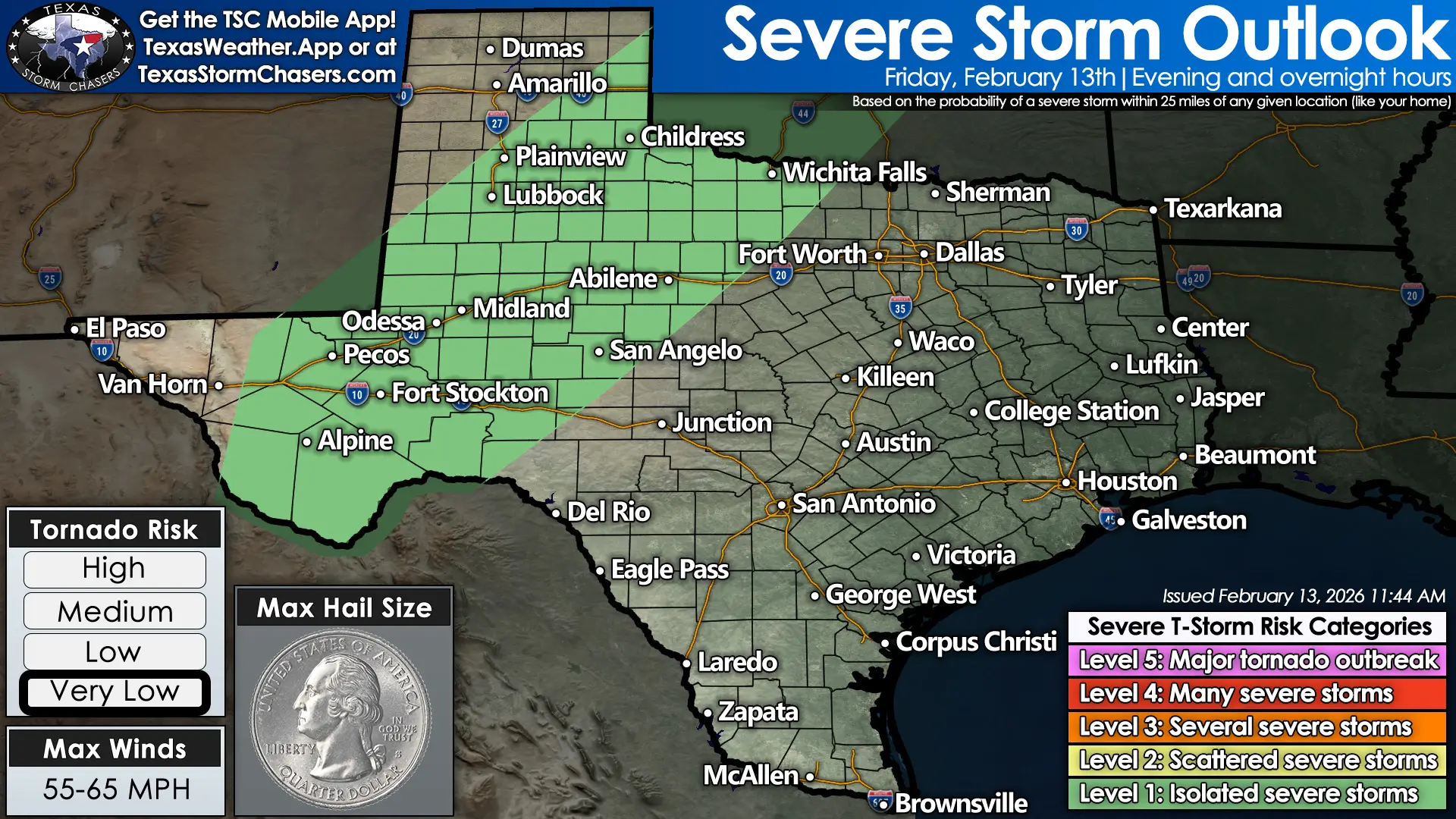
Isolated strong to severe storms possible across West Texas Friday evening into the overnight hours.
Most storms will behave like typical thunderstorms — lightning, heavy rain, gusty winds. However, a few could produce:
The tornado threat tonight is extremely low.
Storms will continue overnight, moving northeast into the Big Country and Northwest Texas before weakening toward daybreak Saturday.
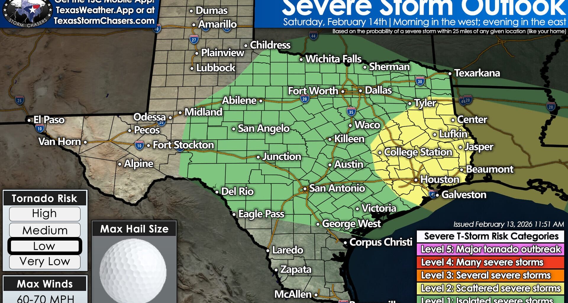
Saturday: Threat Shifts East and Intensifies
Saturday is the day to watch.
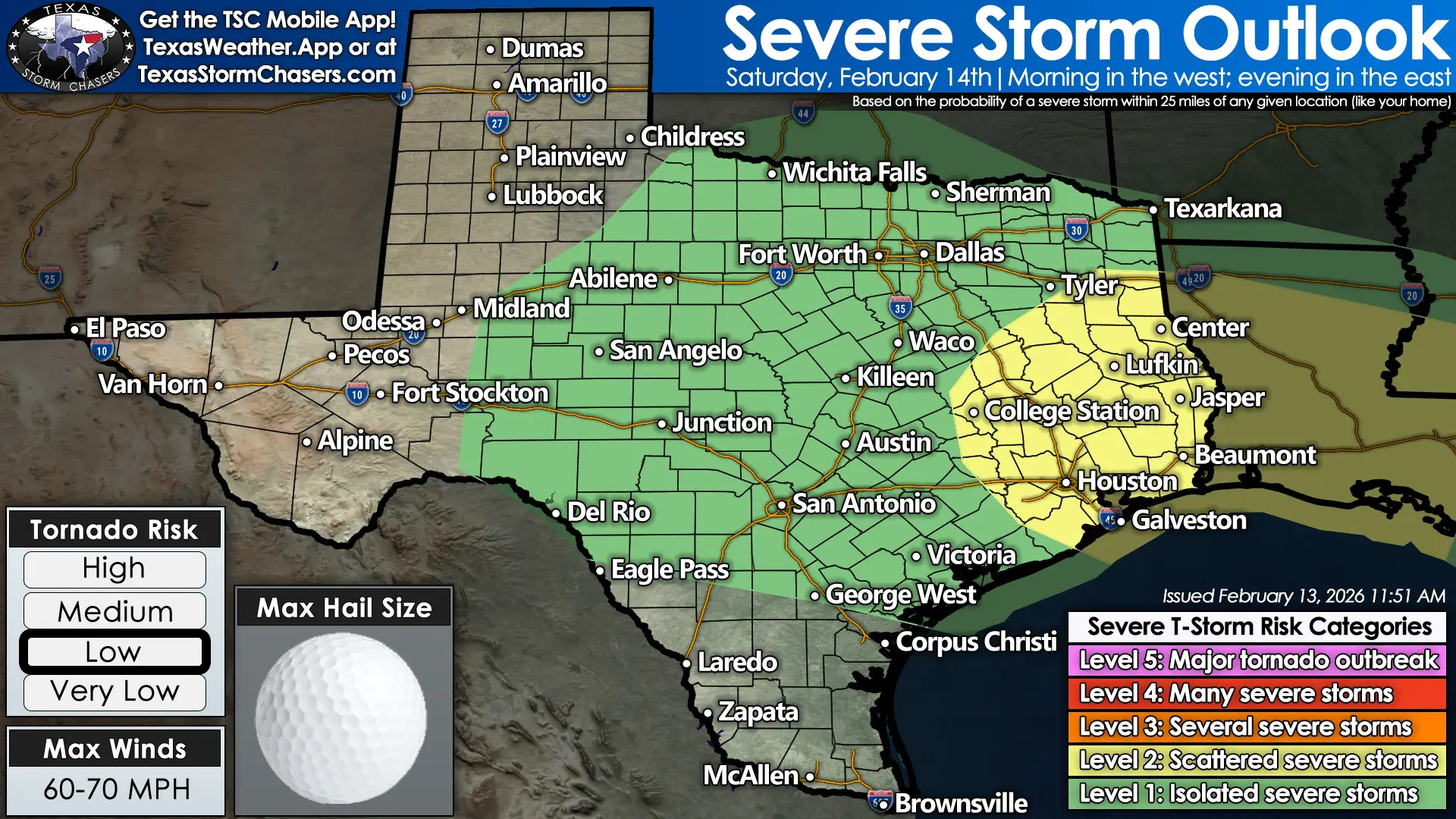
Storms shift east Saturday with increasing severe potential across East Texas during the afternoon and evening.
The severe weather risk has been upgraded to a Level 2 out of 5 across parts of:
Brazos Valley
Southeast Texas
East Texas
Golden Triangle
Into western Louisiana
Cities including College Station, Houston, Galveston, Beaumont, Lufkin, Longview, and surrounding communities fall within this upgraded zone.
A Level 2 risk means scattered severe storms are possible — roughly a 15 percent chance of a severe storm within 25 miles of any given location.
Timing: Later Than Previously Expected
Storm timing has slowed slightly.
Instead of a mainly Saturday morning event, the main line of storms now looks more likely to:
Develop or intensify mid to late Saturday afternoon
Move east Saturday evening
Possibly linger into early Sunday morning across far East Texas
That means storms could still be active along I-35 during the late afternoon hours before pushing east.
Main Threats on Saturday
The strongest storms Saturday could produce:
Damaging wind gusts over 60 mph
Hail, possibly up to quarter size or larger
Heavy rain
Frequent lightning
The tornado threat has increased slightly from earlier forecasts. It remains low overall, but not zero — especially across Southeast Texas and the Golden Triangle where atmospheric instability may be a bit higher.
Most of the severe threat appears tied to a squall line — a line of storms moving west to east. Within that line, small bowing segments could produce localized wind damage. A brief, spin-up tornado cannot be ruled out.
One lower-probability scenario we’re monitoring: if isolated storms develop ahead of the main line Saturday afternoon. Those individual storms would carry a somewhat higher tornado risk. Current guidance does not strongly suggest this, but it’s something we always watch closely.
Rainfall: Beneficial, But Locally Heavy
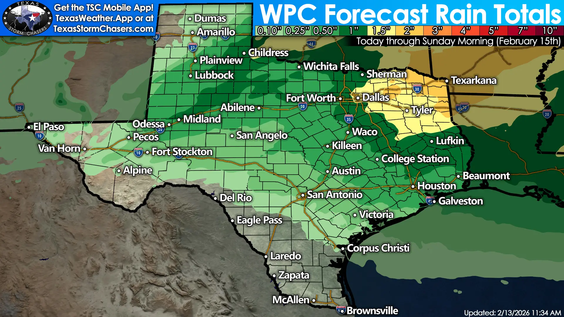
Widespread rain chances continue across Texas through Sunday morning, with locally higher totals in North and East Texas.
Rainfall totals through early Sunday are expected to range:
1–3 inches across Northeast and East Texas
0.5–1 inch across parts of North and Central Texas
0.25–0.75 inches across South Central and parts of West Texas
Localized flooding is possible in areas that receive repeated heavy downpours, particularly in Northeast Texas. Ponding on roads and quick rises on creeks and streams are possible.
Given how dry soils have been, widespread flash flooding is not expected, but localized issues cannot be ruled out.
What Happens After the Storms?
Rain exits early Sunday morning.
Behind this system, Texas turns drier again — and potentially much windier next week.
A powerful upper-level storm system is forecast to move across the southern United States Monday through Wednesday. At this time, most of Texas appears likely to remain on the dry side of that system.
If that holds, we could see:
This could become a multi-day fire weather concern, particularly in areas that receive little rainfall this weekend.
We’ll monitor that closely.
What You Should Do Now
Make sure you can receive warnings Saturday afternoon and evening.
Have multiple ways to get alerts — not just social media.
If you have outdoor plans Saturday, especially later in the day, stay weather-aware.
Secure loose outdoor items ahead of potential strong winds.
This is a manageable setup, but it deserves attention.
We’ll continue providing updates throughout the weekend.