
SAN ANTONIO – Latest data trends continue to support a welcome opportunity for much needed rain in our region and San Antonio. This will include the risk for thunderstorms as well.
They system of interest we’ve been tracking for last couple of days is now moving into the Southwest. The forecast details on this upper level low remain unchanged. The track is right across Texas and it’s strong enough to produce good dynamics to develop showers and storms.
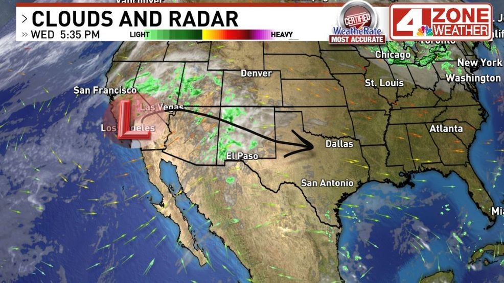
Tracking big system out in California
As this system pushes into Texas, it will also pull moisture in to work with impressive dynamics for rain and storms. Some storms will have high rainfall rates of 2″ – 3″ per hour or even higher in stronger downpour cores. We will also be on the lookout for brief strong gusts especially if the storms form into a complex or line. This mode of thunderstorms typically is a wind risk and lower on the large hail risk.
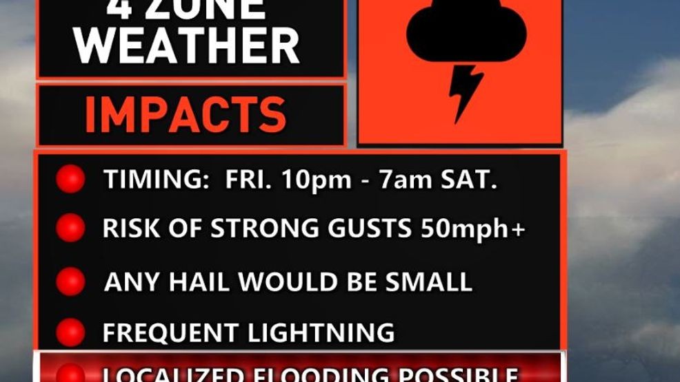
4 Zone Weather Impacts
As for the flooding risk, we’re in a level 1 of 4 flood outlook but the Hill Country is in a level 2 of 4 outlook where probabilities of some flooding are higher.
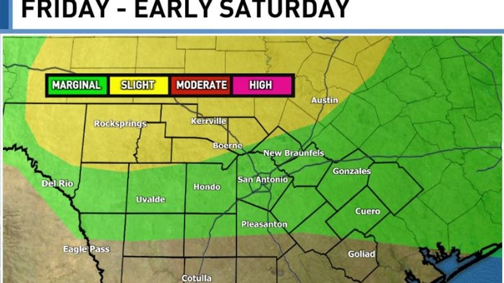
Flood Risk Outlook from the Weather Prediction Center (WPC)
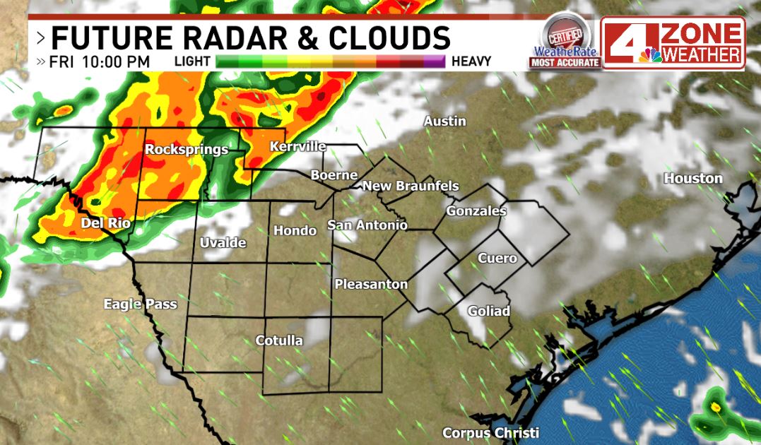
Storms will develop out west then move into our area late evening to midnight. They’ll move across overnight to Saturday morning then push east. That said, we may see additional pop-up showers or a t-storm develop Saturday into the afternoon. The big system moves away Saturday night to Sunday.
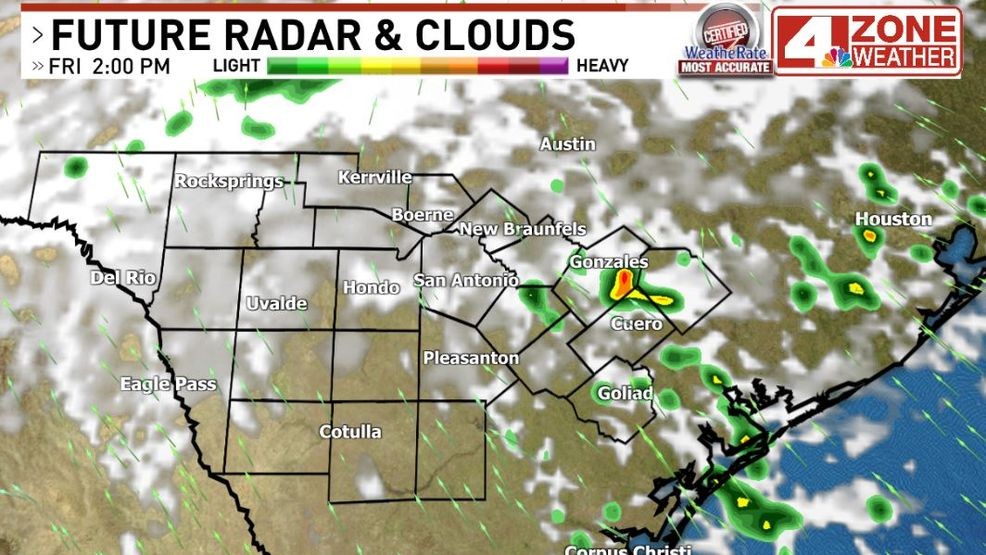
IBM GRAF model Future radar 2pm Fri.
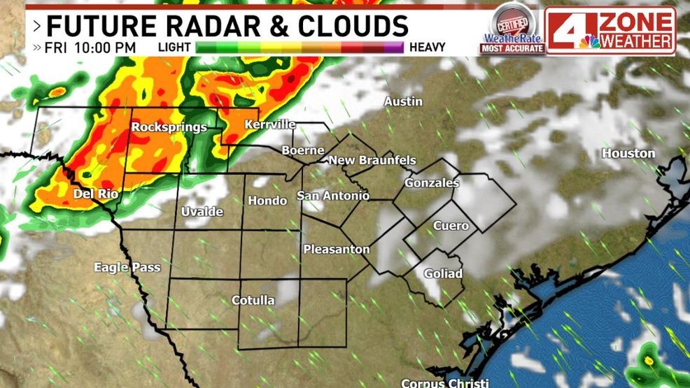
IBM GRAF model Future radar 10pm Friday
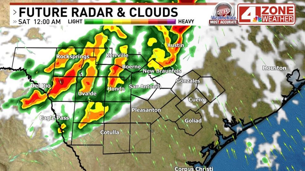
IBM GRAF model Future radar midnight
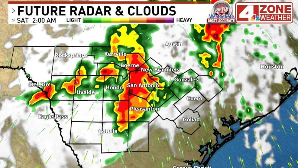
IBM GRAF model Future radar 2am Sat.
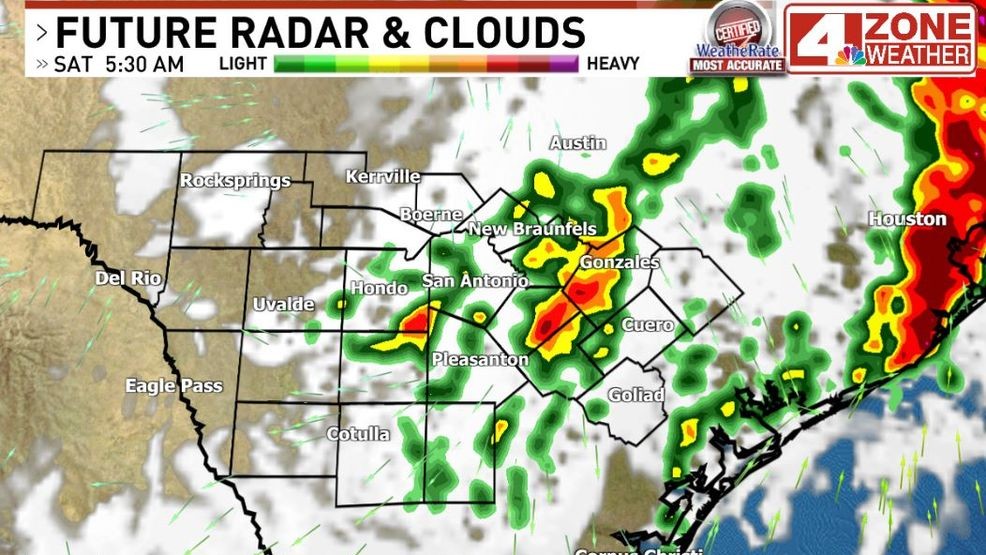
IBM GRAF model Future radar 5:30am Sat.
Comment with Bubbles
BE THE FIRST TO COMMENT
Total rainfall, I expect a .50″ – 1.50″+ rainfall. Our far southern tier counties will see much less unfortunately based on current forecast trends as there will be a sharp drop off with shield of rain and storms.
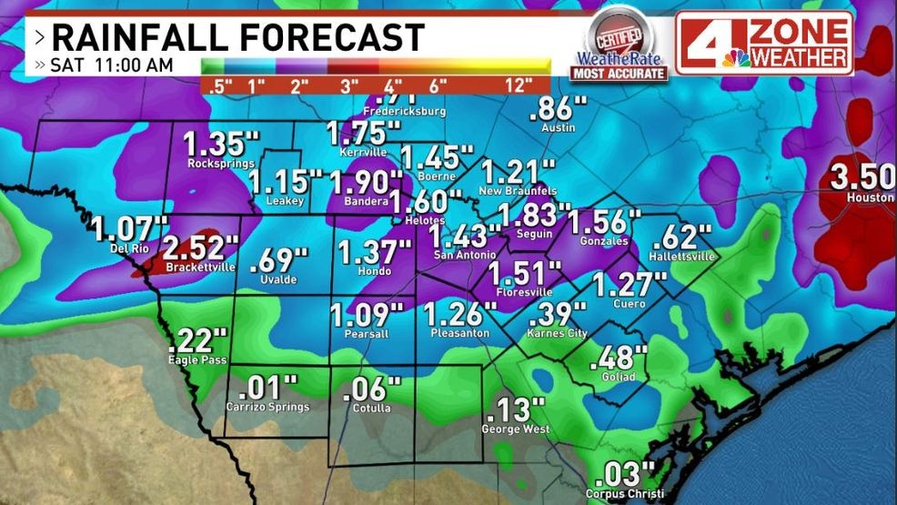
Forecast rainfall