
Neon radar maps and live TV feeds fill a sea of screens throughout the National Weather Service’s Fort Worth office.
Meteorologists work around the clock, serving the community through daily updates, graphics and one-on-one communication. The Fort Worth office, which is co-located with the West Gulf River Forecast Center, covers 46 counties across North and Central Texas and provides daily, plus aviation-specific, forecasts, as well as real-time updates when dangerous weather looms.
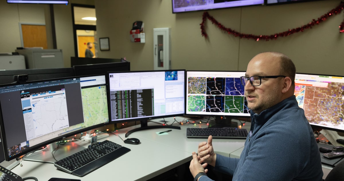
Science and operations officer David Bonnette said much of the office’s work lives in the Advanced Weather Interactive Processing System (AWIPS), a software system used to view satellite and radar data at different atmospheric levels, and to issue watches and warnings during severe weather events.
Bonnette explained successful weather phenomena predictions involve studying interactions between different layers of the atmosphere, part of why the office tracks multiple indicators — including temperature, cloud formation and wind speed. To illustrate this, he used a metaphor about a fish tank packed with small motors.
D-FW Weather Wise
“At each one of the [tank’s] layers — so let’s say the upper levels, the mid levels and the surface — we’re gonna move the water at a different speed and a different direction,” he said. “Our job, and why it’s so difficult to forecast the weather, is … forecast where [that drop of food coloring] will reach the surface.”
“The analogy is, the atmosphere is a fluid,” Bonnette continued. “It’s all connected, from the surface all the way up to the stratosphere. Everything works off of each other, so if one thing is out of balance, that will impact the layers beneath it.”
The map rows populating his screens were organized by those layers. When it’s time to draw a warning area during severe weather, forecasters switch from a multimap view to one. By drawing on top of the data in AWIPS, meteorologists can add the storm’s motion and use the program to estimate the time a storm will reach a specific location. He said forecasters regularly practice sending out alerts, perfecting their craft to 30 seconds or less during urgent situations.
Those skills may soon be put to use with North Texas’ severe weather season just around the corner. Jennifer Dunn, the office’s warning coordination meteorologist, said chances of severe thunderstorms and tornadoes peak from mid-March to early June, and correspondingly, so do damage surveys.
Related

Damage surveys occur when a team of meteorologists travels to an affected area to observe the scale and intensity of weather-related havoc. They also follow patterns of debris, combining all three elements with radar data to make a final determination. Dunn said these surveys are necessary for confirming tornadoes and determining the maximum wind speeds and their path.
In some instances, whether or not intense winds actually produced a tornado creates debate among hobbyist forecasters, putting the weather service in a position to set the record straight.
“Things have changed a lot since the radar became available in your pocket,” Dunn said.
Dunn explained that if you’re not experienced in working with radar tools, it’s easy to draw a conclusion from a single snapshot. Meteorologists with the weather service instead look at events holistically, combining radar observations with the conclusions from those ground surveys.
Severe weather education classes are being offered by the weather service now through April 25 for anyone wanting a better understanding of one of Texas’ most turbulent weather seasons.
“There’s a lot of forecasting, science,outreach and education that comes from this office to everybody living in North and Central Texas,” Dunn said, “hopefully [making us] a trusted source for weather information right here in the area.”