
LUBBOCK, Texas (KCBD) – Love is in the air. So is fire weather.
Valentine’s Day started with clouds and scattered showers, then cleared as a Pacific cold front slid through.
Last night’s storm dropped beneficial amounts of rainfall.
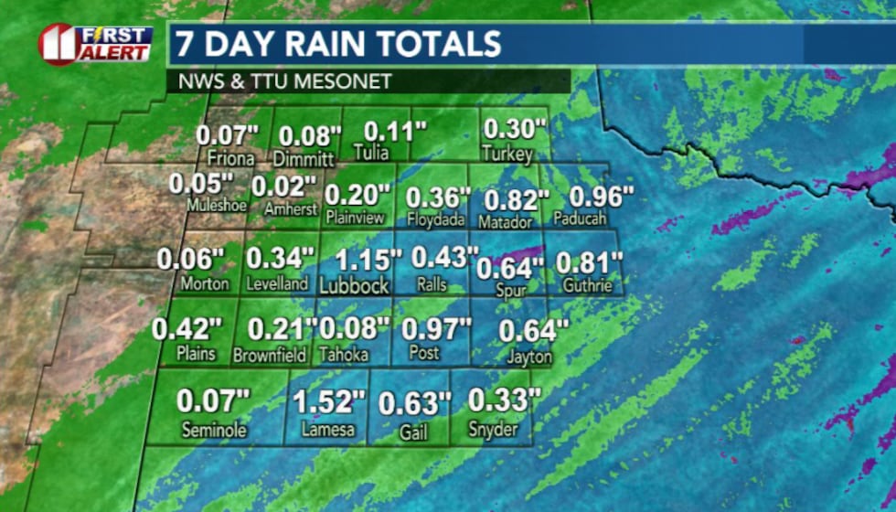 Rainfall totals(KCBD)
Showers have since tapered off. Drier air continues to move in, and northwest winds ease as surface high pressure settles overhead.
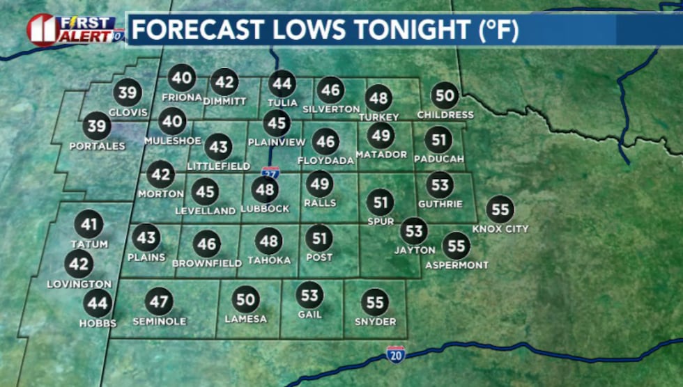 Lows tonight(KCBD)
Overnight lows fall into the 30s and 40s.
Sunday looks calm and mild with lighter winds and plenty of sun.
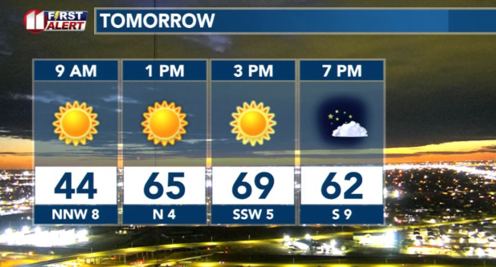 Hourly weather tomorrow(KCBD)
High pressure aloft builds in, which promotes sinking air. As the air sinks, it dries, so clouds struggle to form. Highs climb back into the low 70s.
 Temperature trend(KCBD)
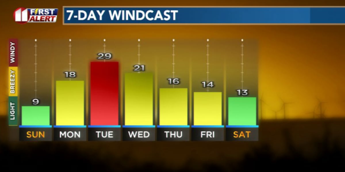
Early next week, winds pick up as temperatures push into the 80s. Warm temperatures combined with low humidity and sustained winds of 30 to 40 mph create elevated to critical fire weather conditions, especially in areas that did not receive meaningful rainfall this weekend.
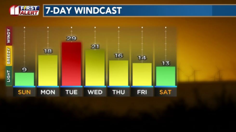 Winds pick up and increase fire danger next week.(KCBD)
Blowing dust is also possible Tuesday given the winds speeds and dry soils.
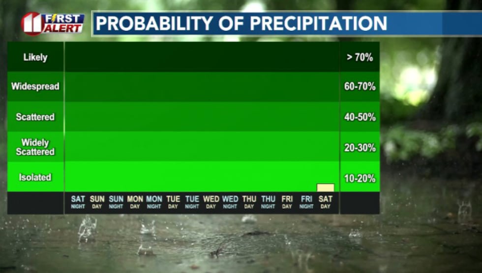 Rain chances(KCBD)
Rain chances remain essentially zero for now with above average temperatures next week.
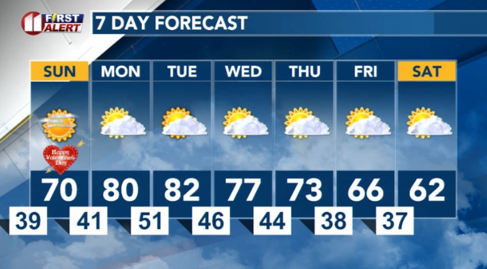 7 Day Forecast(KCBD)
Copyright 2026 KCBD. All rights reserved.