

LUBBOCK, Texas (KCBD) – Dangerous winds are expected to sweep across portions of the forecast area today, bringing high wind warnings and critical fire conditions that could impact your commute and outdoor plans.
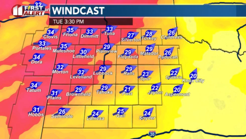
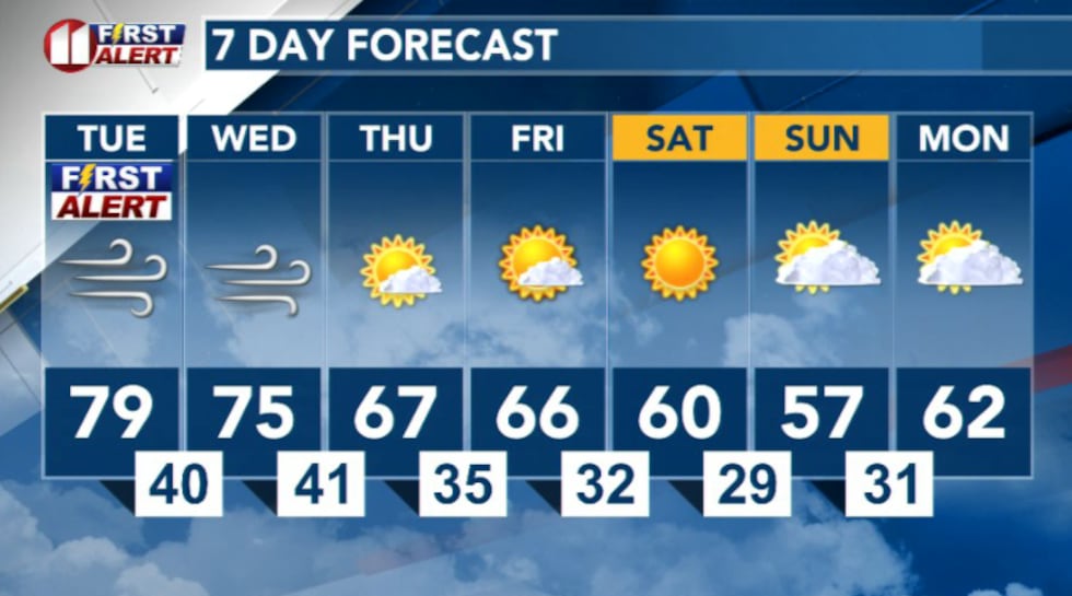
A strong upper-level weather system moving across the Great Basin will create a sharp wind/pressure gradient Tuesday afternoon, with gusts potentially reaching 50 to 60 mph. The strongest winds are expected to affect northwestern portion of the viewing area.
 KCBD(KCBD)
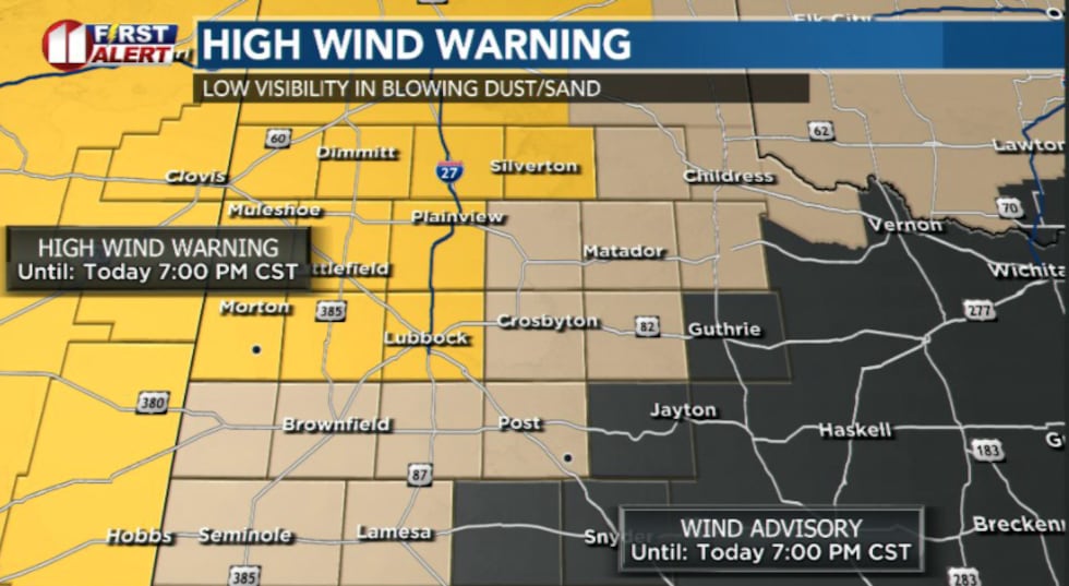
Even with cloud cover early in the day, we expect conditions to clear this afternoon, which will allow winds to mix down from higher levels and strengthen at the surface. High wind warnings are in effect for most areas on the Caprock, with wind advisories extending to surrounding regions.
 KCBD(KCBD)
Along with the dangerous winds comes a significant blowing dust threat. This marks the first widespread high wind event of the season, making visibility conditions unpredictable. Residents should prepare for reduced visibility on roadways and take precautions when traveling.
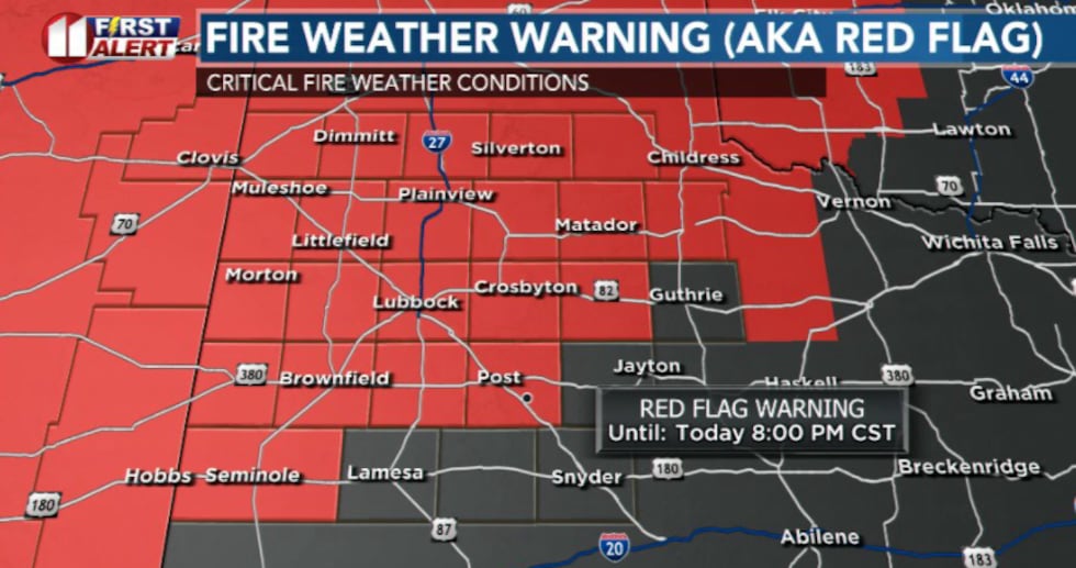
Fire danger reaches critical levels
The combination of high winds, low humidity and dry conditions will create critical fire danger across the region today and Wednesday. Any fires that develop could spread rapidly given the wind speeds and lack of moisture in the air.
 KCBD(KCBD)
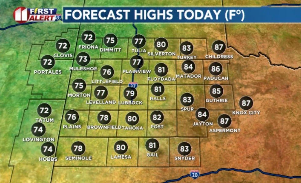
Temperatures will vary widely across the area, ranging from near-record highs around 87 degrees at Childress to the lower 70s near the Texas-New Mexico border.
 KCBD(KCBD)What to expect Wednesday and beyond
Wednesday will bring slightly cooler conditions, but critical fire danger will persist as dry and windy conditions continue. Warm and breezy weather is expected through Thursday before slightly cooler and calmer conditions return to the area.
 KCBD(KCBD)
Copyright 2026 KCBD. All rights reserved.