
LUBBOCK, Texas (KCBD) – Expect wind and dust to kick back up this afternoon.
A weather disturbance passing north of Texas is tightening the pressure gradient across the region.
 Hourly forecast tonight(KCBD First Alert)
Strong gradient equals strong wind. Air naturally wants to move from higher pressure to lower pressure. When that difference becomes large over a short distance, the air moves faster.
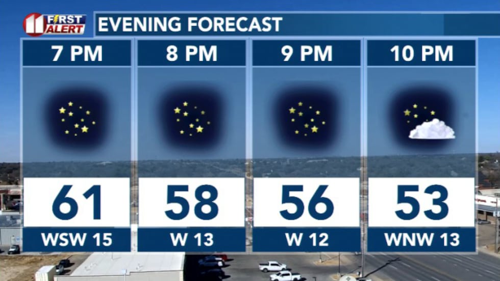
This afternoon, winds turn westerly and increase to 25 to 35 mph with gusts near 40 mph.
As that happens, the air compresses and warms and the relative humidity will fall into the low to mid teens.
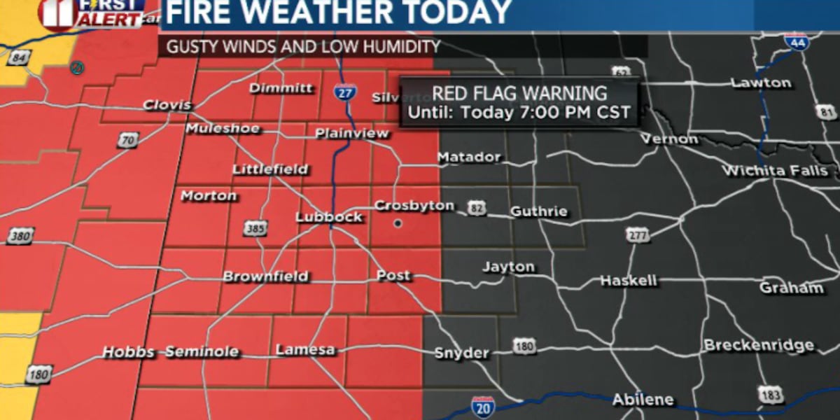
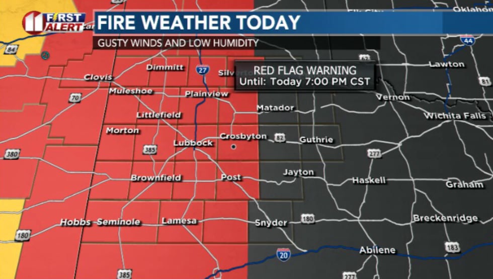
That combination of strong wind, very dry air, and dry fuels has prompted a Red Flag Warning through 7 pm for areas indicated on the map below.
 Red flag warning in effect through this evening(KCBD First Alert)
This doesn’t mean that a fire is imminent. But if one gets started it could spread quickly.
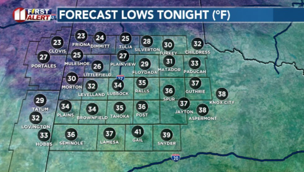
Overnight, winds will taper off with clear skies and lows falling into the mid 20s and low 30s.
 Lows tonight(KCBD First Alert)
A second front arrives Saturday from the north and brings a more seasonable air mass.
Highs Saturday stay in the 50s areawide with north winds around 15 to 20 mph before easing late in the day.
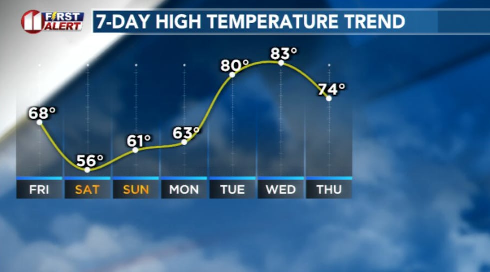 Temperature trend(KCBD First Alert)
By Sunday and Monday, we enter a warming trend as an upper level ridge builds over the Western U.S.
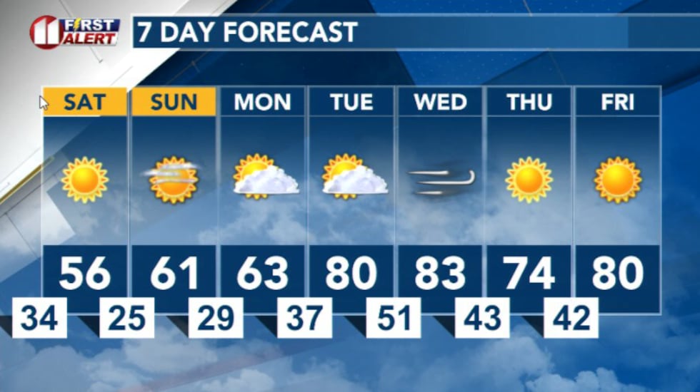 7 Day Forecast(KCBD First Alert)
Copyright 2026 KCBD. All rights reserved.