
 article
DALLAS – A much-needed rainy, fall-like weekend is expected in North Texas, promising some relief from the ongoing drought but likely impacting outdoor plans.
Thursday Forecast: Evening Storms Possible 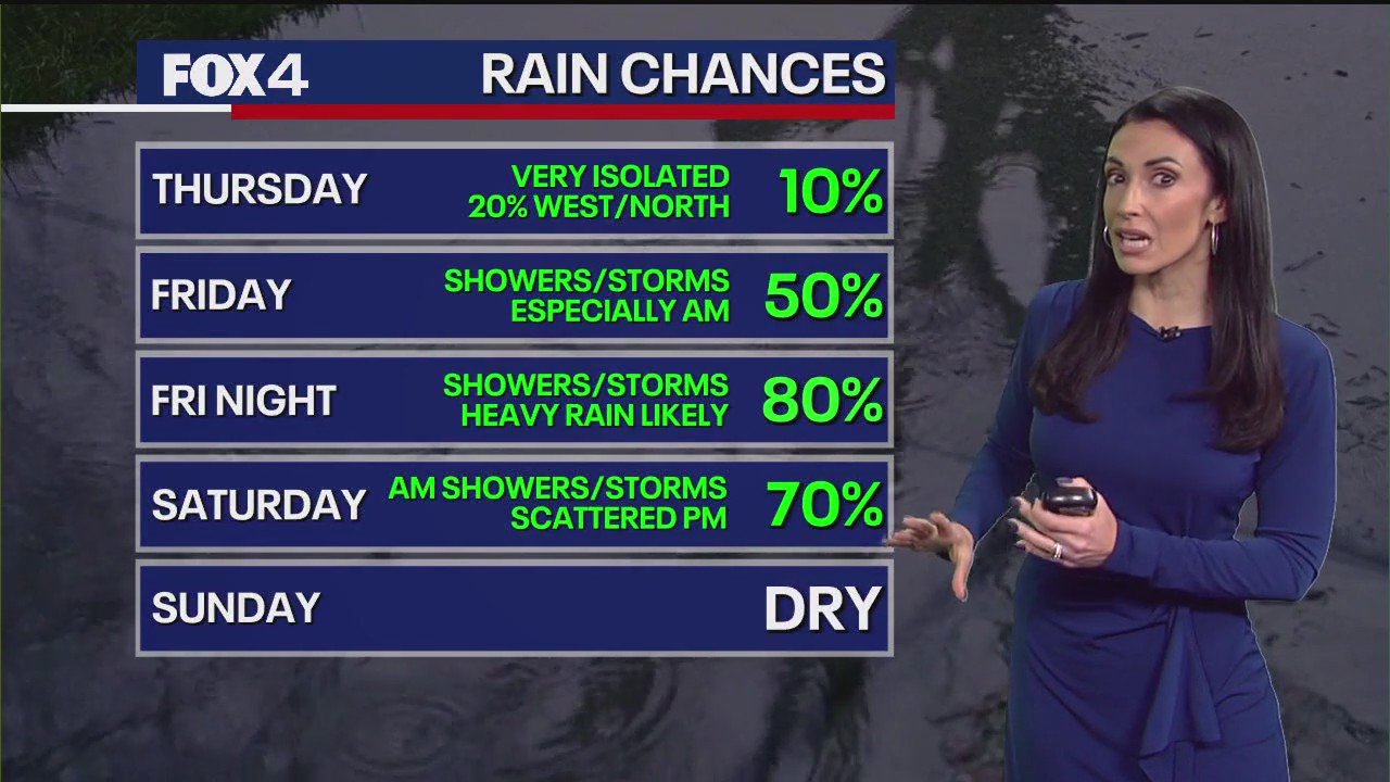
Cloud cover will begin forming Thursday morning, bringing milder temperatures. There is a low chance for scattered showers early in the day, but activity should break during the midday and through the early evening. Temperatures will climb into the 80s, and while humidity will not be extreme, the dry air will be gone.
The primary period for showers and storms begins Thursday night, mostly north and west of the Dallas-Fort Worth Metroplex. A few strong storms Thursday night could produce small hail and gusty winds.
Live Radar: Dallas-Fort Worth  High School Football Games Moved
Due to the severe weather threat, several high school football games have been moved to Thursday night. Districts including Duncanville, Lewisville, Plano, McKinney, Highland Park, and Denton have confirmed schedule changes.
This includes the “Battle of Beltline” game between DeSoto and Cedar Hill, which moves to Thursday at Eagle Stadium. Changes to varsity schedules are also forcing shifts for junior varsity and freshman games. Fans should check directly with their respective school districts for the latest schedule updates.
Weekend Forecast: Wind and Hail Risks 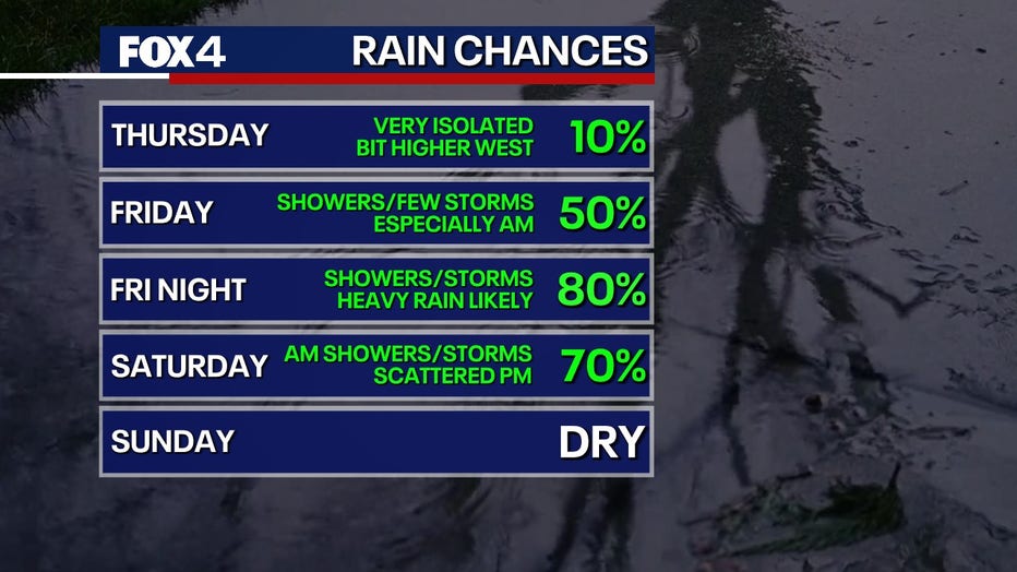
The best chances for rain and storms Friday morning will be north and east of DFW. Cloud cover will be general, with a breeze pulling in moisture, though not all areas will receive rain. Highs will remain near 80 degrees, with shower chances increasing throughout the day, peaking in the evening.
The main weather disturbance arrives Friday night, bringing heavy rain and a potential flood threat. Stronger wind gusts are possible and could be severe, but the risk of large hail remains low.
Saturday will see lingering, scattered showers but will be drier during the day. Another batch of storms is expected Saturday evening, bringing gusty winds and a low chance of small hail.
By Sunday morning, the upper-level storm system will exit the region. Expect patchy clouds with lingering light drizzle early, giving way to partly cloudy skies by noon. Temperatures will drop back into the 70s, near the seasonal average.
7-Day Forecast 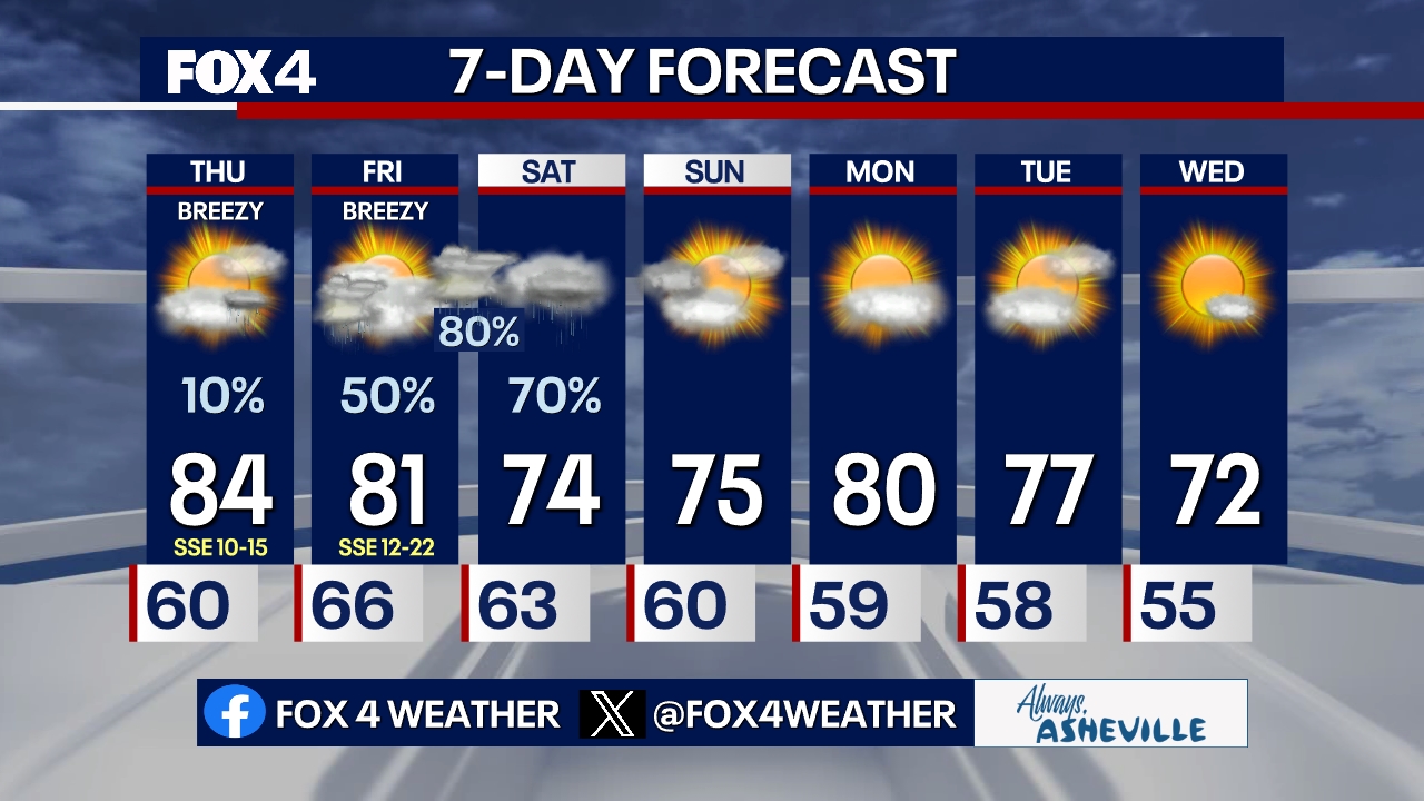
A weaker system moves in Monday, bringing partly cloudy skies and possible passing showers before the air dries out overnight. Tuesday will deliver cooler, drier air, with temperatures in the low 70s, which is average for October. Cool weather will continue through Wednesday, with a chilly morning expected on Thursday.
The Source: Information in this article comes from the National Weather Service.
WeatherDallasHigh School SportsFort WorthDuncanvilleLewisvillePlanoMcKinneyHighland ParkDenton