
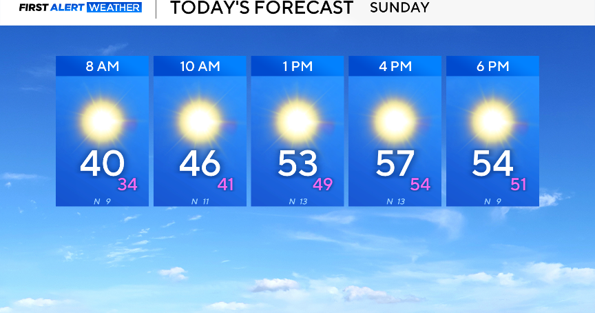
It has been a pleasant, cool and windy weekend. Those conditions will persist on Sunday.
Grab the jacket because it will be chilly. Temperatures will climb into the low 50s by lunch and reach into the upper 50s by the late afternoon. There will be plenty of sunshine and winds from the north, gusting up to 20 mph at times.
The wind will make the temperature outside feel around 5 to 10 degrees cooler.

Another cold start to the day will be expected on Monday. Temperatures across North Texas will be flirting with the freezing line. A gradual warm-up is expected throughout the day, with highs eventually reaching into the upper 50s.

A high-pressure system continues to influence the forecast through the beginning of the week, bringing on the heat. Sunny skies and southerly winds on Tuesday and Wednesday will result in warmer-than-average temperatures. The high on Wednesday will even reach into the mid-80s.
A cold front will move through the area late Wednesday into Thursday, causing gusty winds and high fire danger. As of now, no rain is in the forecast over the next seven days.
