
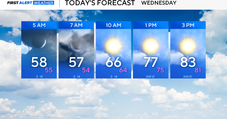
It’s a breezy and mild Wednesday morning, as most North Texans wake up to temperatures in the 50s.
By the afternoon, expect partly cloudy skies and temperatures in the lower 80s.
The elevated fire threat continues, especially across the western counties. Please avoid any outdoor burning, as any fires that start will spread rapidly.


Looking ahead to the rest of the week, a weak cold front is expected to move through later Wednesday, dropping temperatures a few degrees.
It’ll warm right back up this weekend with highs in the 80s, making it perfect for any outdoor plans.
Sunday is March 1, along with the start of meteorological spring, and it will start on an above-average note.
There are some signals that rain chances will start to increase by the middle of next week as a high-pressure ridge starts to break down, and a series of shortwaves (small disturbances) move through. The rain is needed as a majority of the viewing area is experiencing drought conditions.
