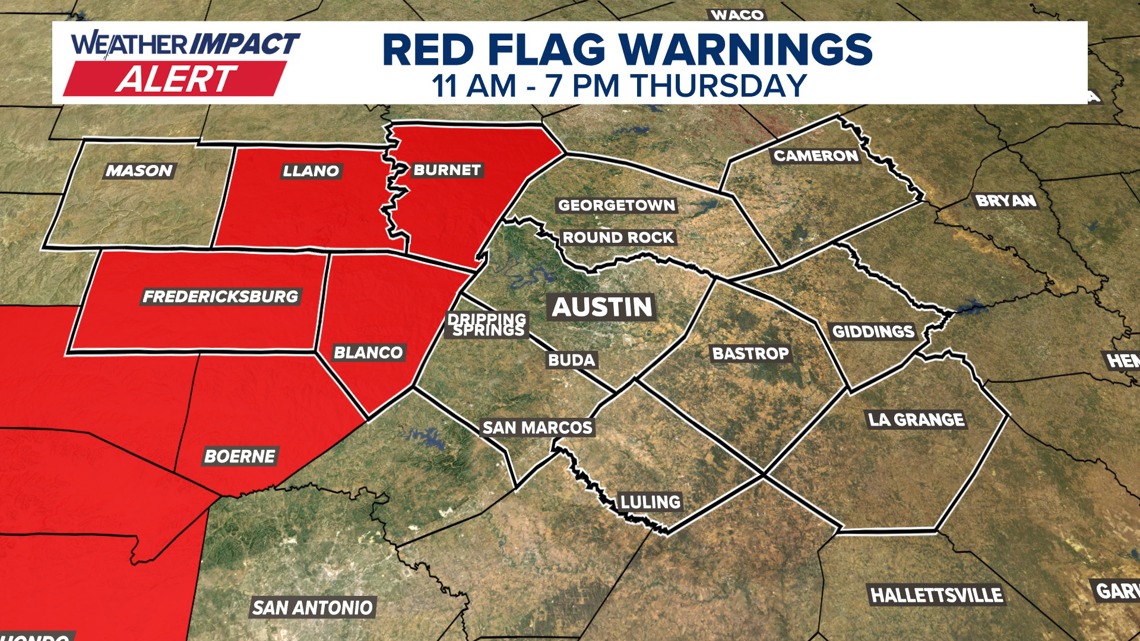
A Red Flag Warning has been issued for most of the Hill Country from 11 a.m. to 7 p.m. Thursday.
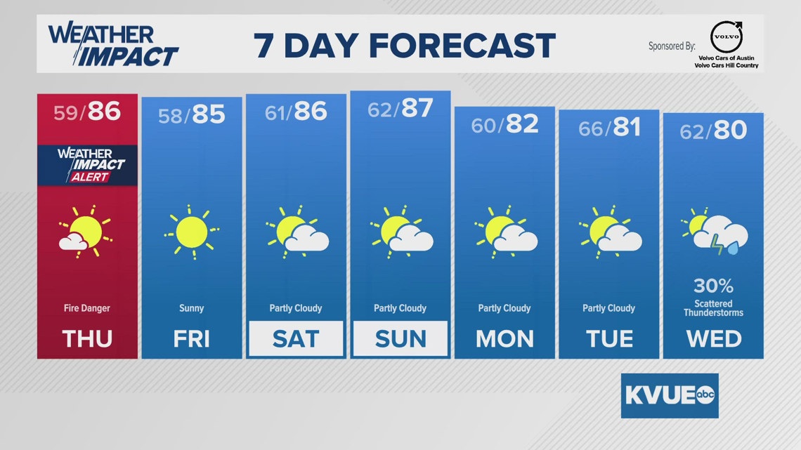
A warm and breezy day is in the forecast across Central Texas on Thursday, prompting the KVUE Weather Team to issue a Weather Impact Alert Day due to elevated fire weather conditions.
The greatest concern will be across the Hill Country, where Llano, Burnet, Gillespie and Blanco counties are under a Red Flag Warning from 11 a.m. to 7 p.m. Thursday.
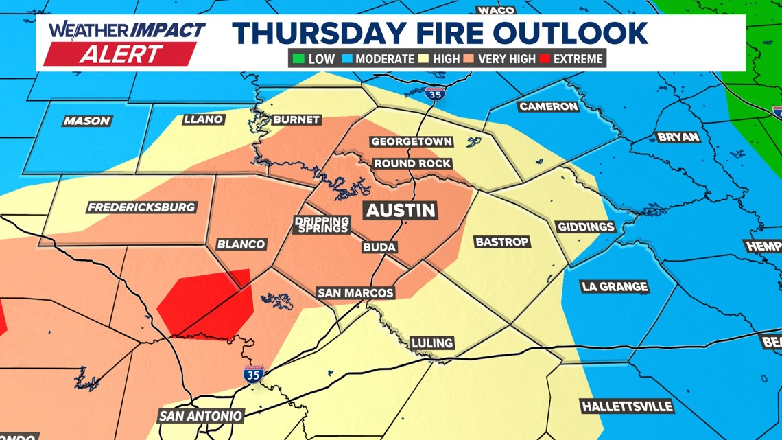
We’ll have the classic combination of gusty winds, low humidity and very dry fuels. That means fire danger will be elevated across all of Central Texas, but especially west of I-35 and in the Hill Country.
Because of this, please avoid any outdoor burning.

The latest outlook from the Texas A&M Forrest Service also illustrates that all of the KVUE area will experience “high” to “very high” fire danger on Thursday.

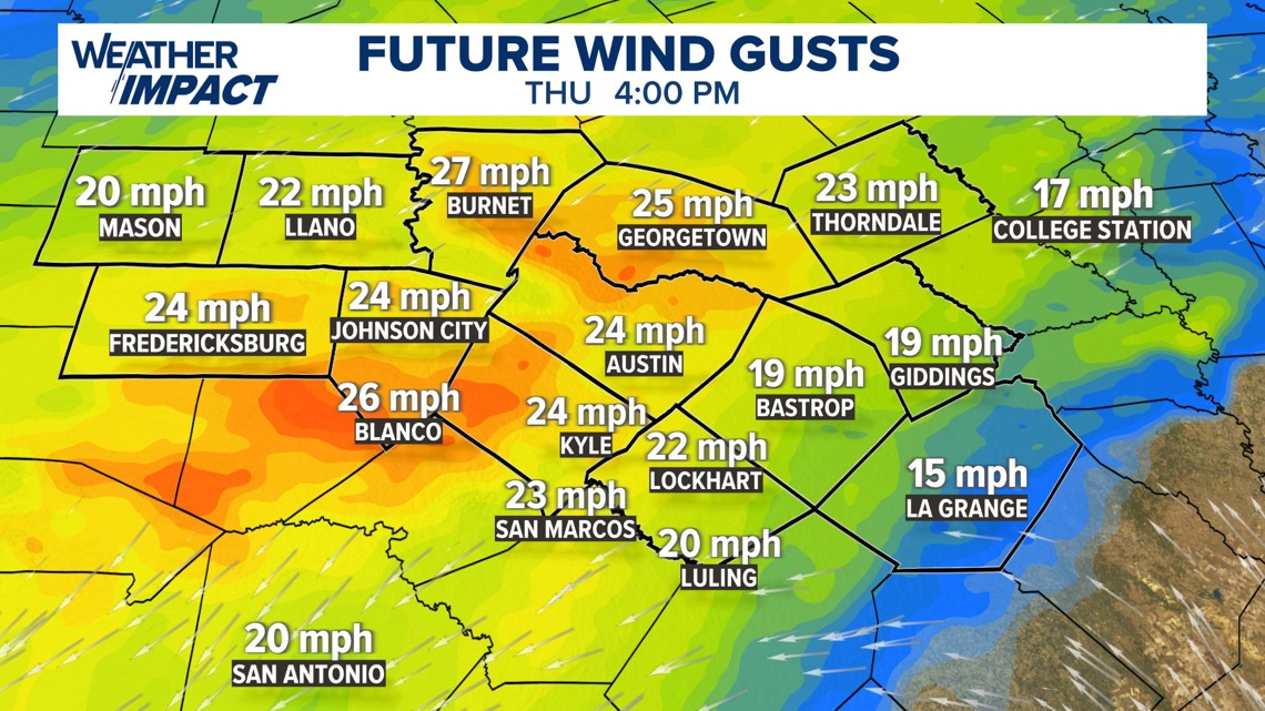
Winds will increase Thursday late morning into the afternoon behind a weak cold front, although this front will not bring much cooler air. Afternoon highs on Thursday will still climb well into the 80s, mainly mid to upper 80s. However, the front will shift winds to the north-northeast at 5 to 15 mph, with gusts as high as 25 to 30 mph, helping to ramp up the fire threat.

By Friday, the fire danger will begin to ease somewhat. Winds will turn back to the southeast, allowing humidity levels to recover. It will remain warm into the weekend, with afternoon highs in the mid to upper 80s. With the added moisture, mornings Saturday and Sunday may start with some low cloud cover and patchy fog.
Looking ahead to early next week, the warm and mainly dry pattern continues Monday and Tuesday with highs still in the low 80s. However, forecast models are beginning to hint at our next opportunity for rain around the middle of next week.
For now, rain chances remain low, around 30% next Wednesday, and we’ll continue to monitor trends closely. Central Texas could certainly use the rainfall.
The KVUE Weather Team will continue to watch this developing forecast. The extended forecast can be found below.