
LUBBOCK, Texas (KCBD) –
TONIGHT
A cold front will push through the South Plains by Thursday morning, bringing with it a decent but not too dramatic drop in temperatures.
 Overnight lows stay relatively mild for this time of year, still hovering around 15 to 20 degrees above average(Steve Divine)
Overnight lows drop into the mid 40s for most which will be a slight cooldown compared with the mornings lows of Tuesday we had around 50 degrees.
TOMORROW (Thursday)
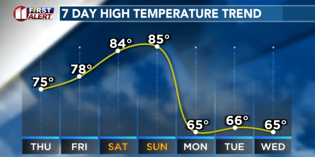
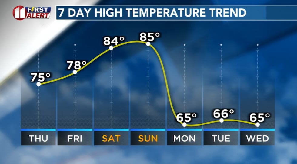
We’ve got a gorgeous day in store after the cold front arrives in the morning. Following the front, high temps for the afternoon will be slightly cooler, but still a little above average for the end of February.
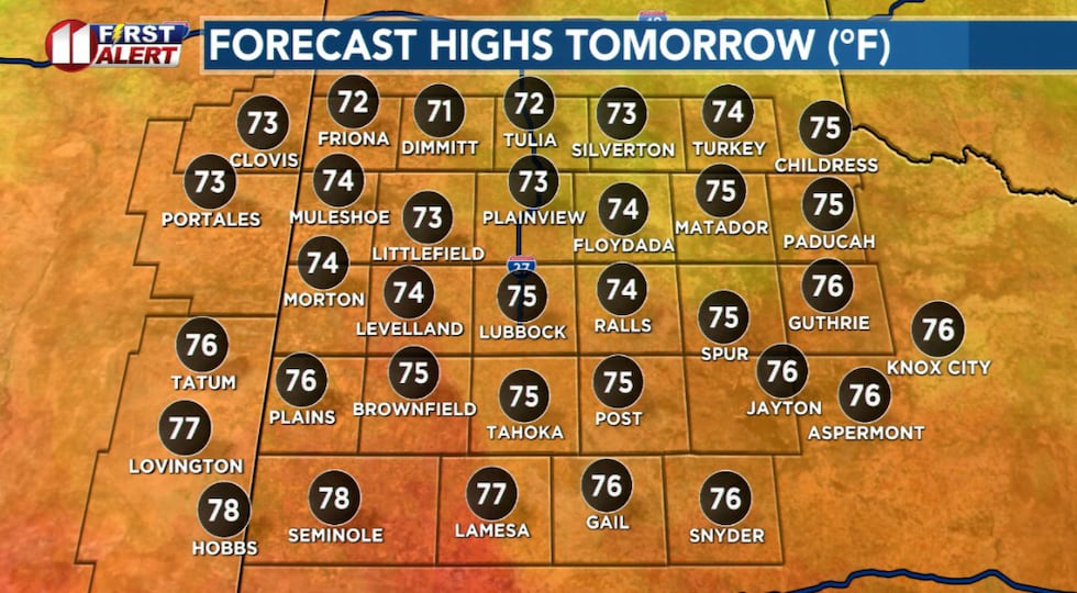 High temps will fall slightly from Wednesday after a cold front arrives Thursday morning(Steve Divine)
For most of the area just a little breeze, at around 10 to 20 mph out of the northwest. Plenty of sunshine to go around as we leave behind the critical fire danger of, at least for now.
UPCOMING WEATHER PATTERN
We’re nearing the end of February and start of March and the weather pattern seems to be rounding a corner in the long-term 7-day forecast. After the brief cooldown we’ll be seeing Thursday, temperatures will rebound to the upper 70s and lower 80s for the weekend.
 High temps will fall after a cold front tonight but rebound by the weekend(Steve Divine)
That will also be paired with a return in strong winds for the weekend which will most likely re-introduce more critical fire weather conditions across the South Plains.
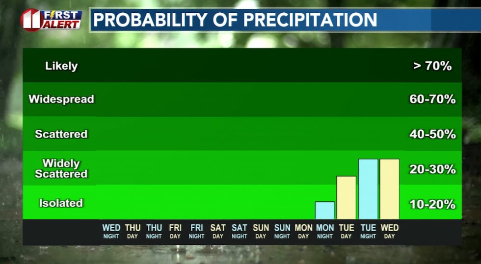 Rain creeps back into the forecast heading into the first week of March(Steve Divine)
Looking slightly beyond the weekend, we’re also eyeing a stark change in the forecast as a strong cold front is anticipated to push through the area Sunday into Monday, which will bring with it cooler temperatures and what’s looking like some decent shots of rain in the early and middle portions of next week.
TODAY IN HISTORY: 2013
A blizzard slammed the Panhandle and west Texas after what had been a relatively mild February up until this point. Snowfall in excess of a foot fell across Swisher and Briscoe counties, with 3-8″ of snowfall more widespread around the
area. Snowdrifts of several feet piled up in parts of the South Plains, driven by wind gusts of up to 70 mph at times at the peak of the blizzard. Many roads were closed for several days, including I-27 between Lubbock and Amarillo.
Copyright 2026 KCBD. All rights reserved.