
SAN ANTONIO – We’re closing in on an old fashioned rainy night with storms moving across our area. It has been 46 days since our last good rain in San Antonio and we’re on track to end that streak.
The big system of interest is moving across the Southwest and ready to take a track across Texas over the next 48 – 72 hours. This system will initially develop strong to severe storms in far West Texas with a gradual evolution of these storms into a large complex that will move east across Texas.
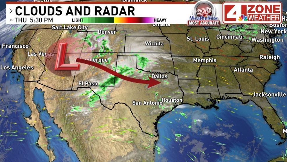
Tracking our big system out west
In our area, they’ll arrive in our far western tier counties between 7pm – 10pm. As they move in, there will be risk of strong wind gusts and hail in our western counties.
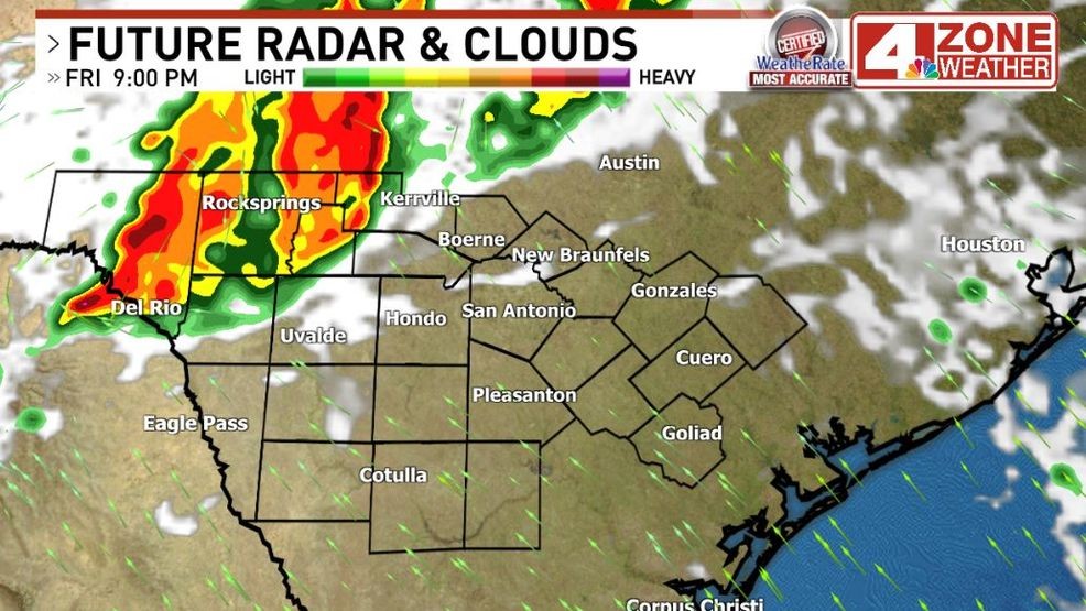
Future radar Fri. 9pm
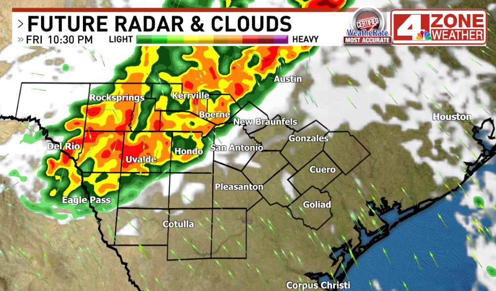
These storms will then spread east arriving in and around Bexar County from 10pm – 1am. Our in-house computer model brings them into Bexar County around 11pm but other models vary on the timing. Storms will then shift east overnight to very early Saturday.
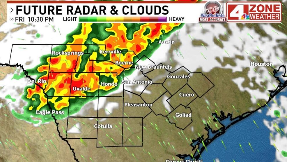
Future radar Fri. 10:30pm
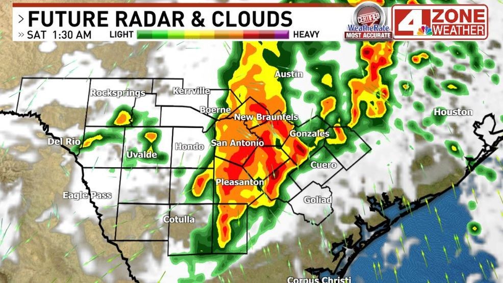
Future radar Sat. 2am
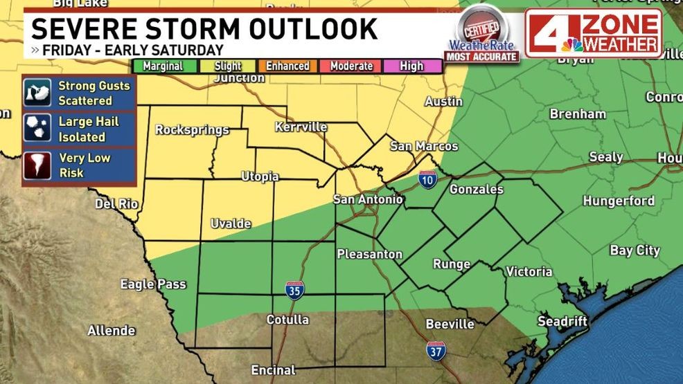
Severe storm outlook late Friday to early Saturday
There will be a slow weakening trend as they move east. This is the reason for the “slight” severe risk dropping to a “marginal” severe risk. Bexar County has both outlooks cutting across the county. There will be risk of mainly strong gusts 40 – 55mph with possibly a gust to 60. Any hail potential is a secondary hazard and mainly below the 1″ severe criteria. I could see reports of pea, dime to penny size hail though.
The severe storm risk shifts into our eastern zone counties Saturday to Saturday night and beyond into the Houston area.
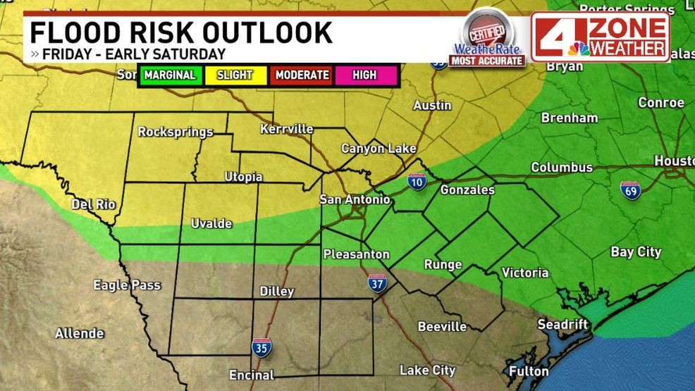
Flood risk outlook from Weather Prediction Center
Of course, we can expect pockets of frequent lightning and heavy rainfall with some risk of flooding.
Comment with Bubbles
BE THE FIRST TO COMMENT
Total rainfall remains in the .50″ to 1.50″+ range to me. Areas way down south would see less. As for the weekend, I’ll keep a lingering 30% rain chance in the forecast for a few showers or a t-storm possible through the day but the heavier storms will likely be in the Houston area and possibly a pocket of stronger storms developing in the Austin area near the upper low.
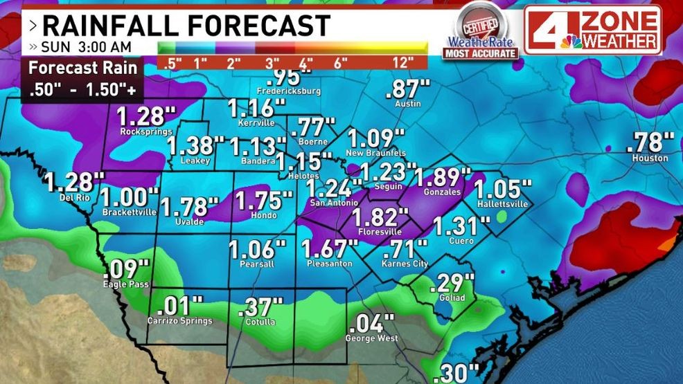
Forecast rainfall
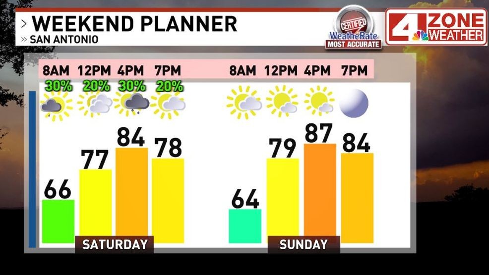
Weekend forecast