
LUBBOCK, Texas (KCBD) – Sunshine and dry air are doing the heavy lifting today, pushing temperatures into the 80s without much resistance from the atmosphere.
The air mass over us is stable and relatively dry, and without any strong storm systems nearby, the sun is doing most of the work with a light breeze.
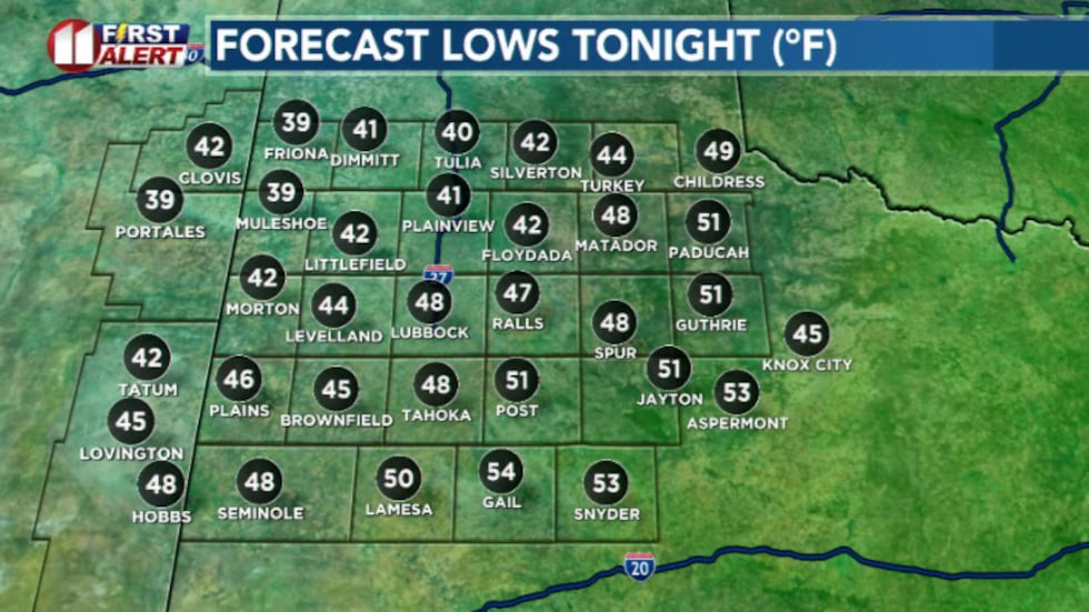 Overnight lows(KCBD)
Cool temperatures are expected tonight, with a mostly clear sky and light winds transitioning to the northeast.
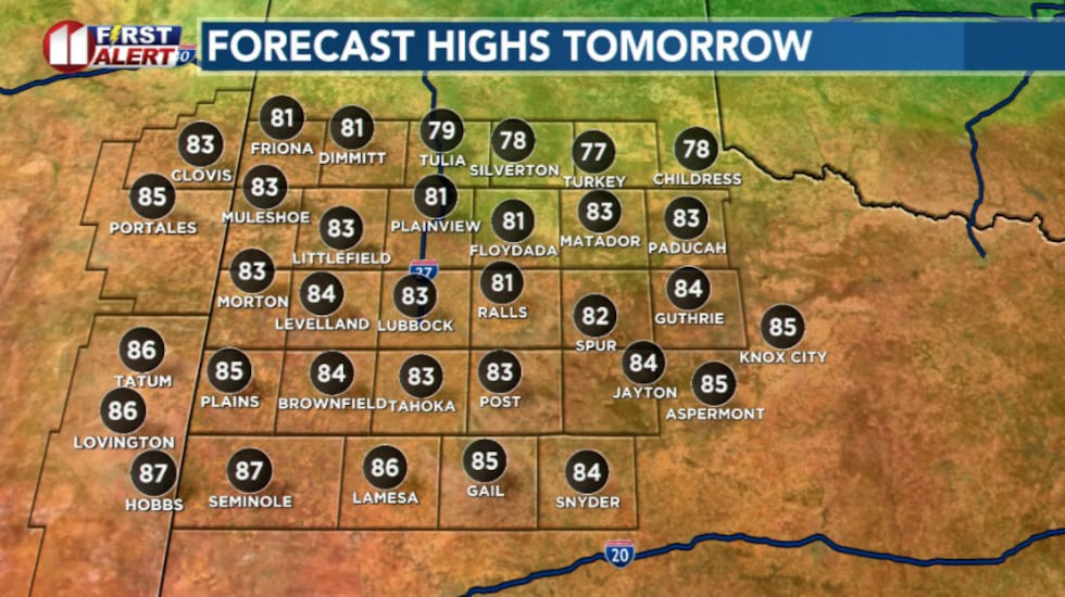
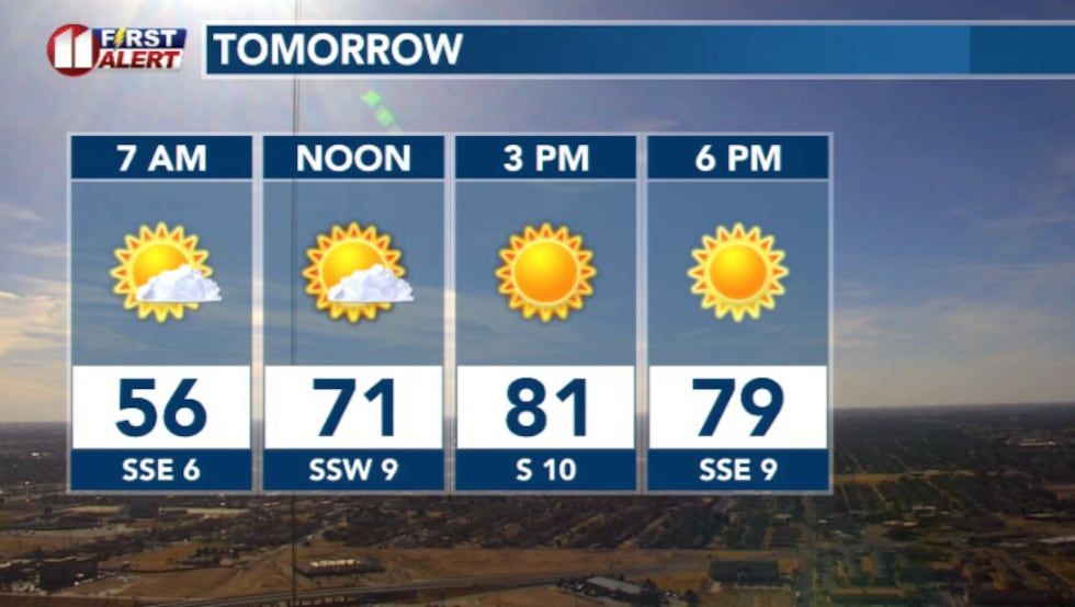 Tomorrow will be warm(KCBD)
By morning, some areas, especially toward northeastern areas may wake up to more cloud cover. Sunday is expected to be very warm, pushing record breaking but temperatures depend on how far those clouds push.
If they linger, highs may run a bit cooler. If they don’t, much of the area warms back into the lower to mid 80s. Either way, Sunday stays well above average for late February.
 Sunday highs(KCBD)
Average high is around 63 degrees. The record high for Sunday March 1st is 89 degrees set back in 2006.
A front moves through late Sunday into Monday and brings a modest cool down. High Monday will likely sit above seasonal averages.
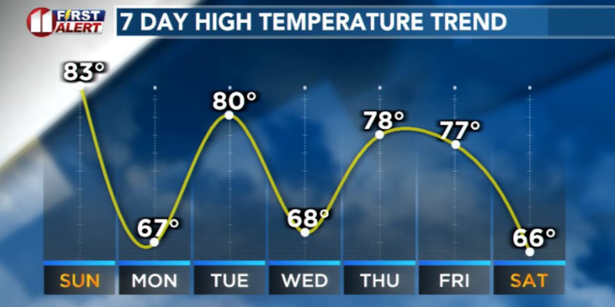
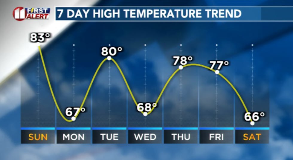 Temperature rollercoaster next week(KCBD)
By Tuesday temperatures rebound close to 80 again with breezy southwest winds. That warms sets the stage for a stronger system arriving midweek.
An upper-level trough moving out of the western U.S. will push a more defined cold front through Tuesday evening. That’s our next opportunity for showers and possible thunderstorms east of the Caprock.
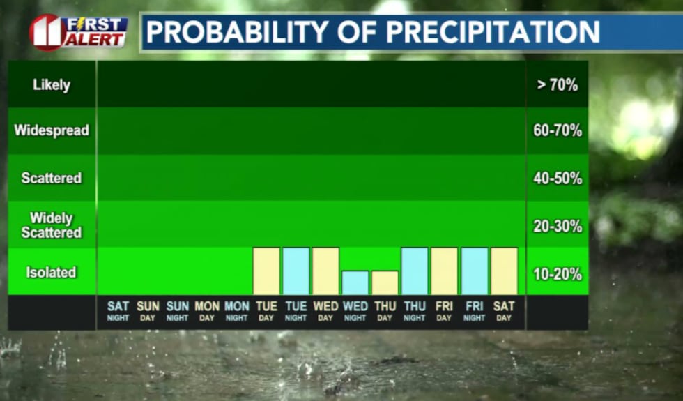 Rain chances possible next week(KCBD)
It’s too far out to nail down specifics, and models disagree on the timing and track of that system. But in practical terms, keep in mind there is a window for storms Tuesday night into Wednesday, but confidence in widespread rain is shaky.
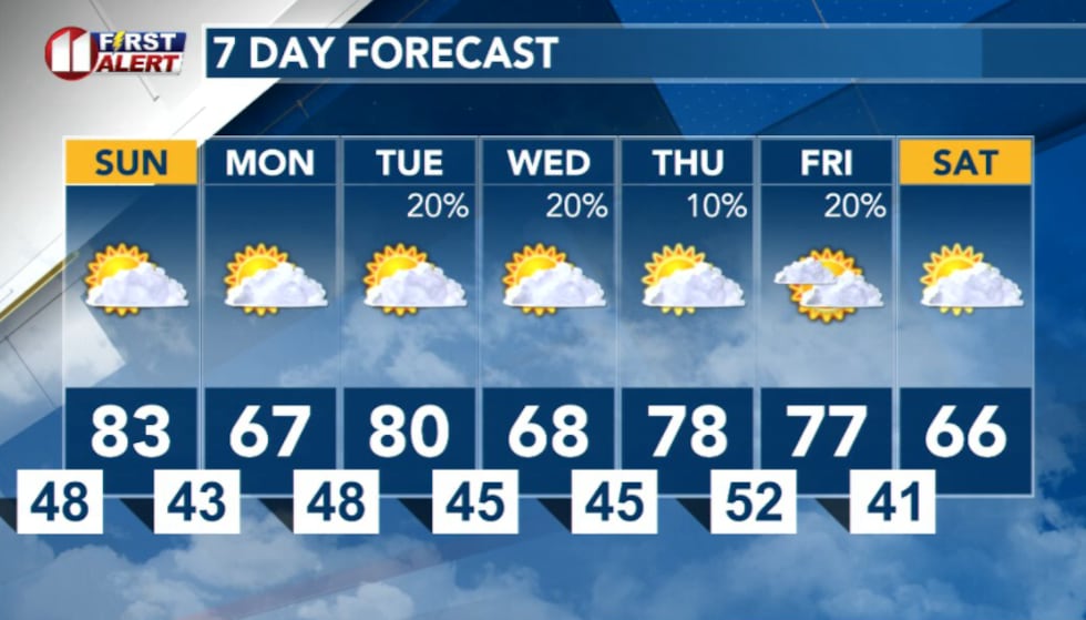 7 Day Forecast(KCBD)
Copyright 2026 KCBD. All rights reserved.