
Big changes are on the horizon later this week and into the weekend as a storm system moves our way.
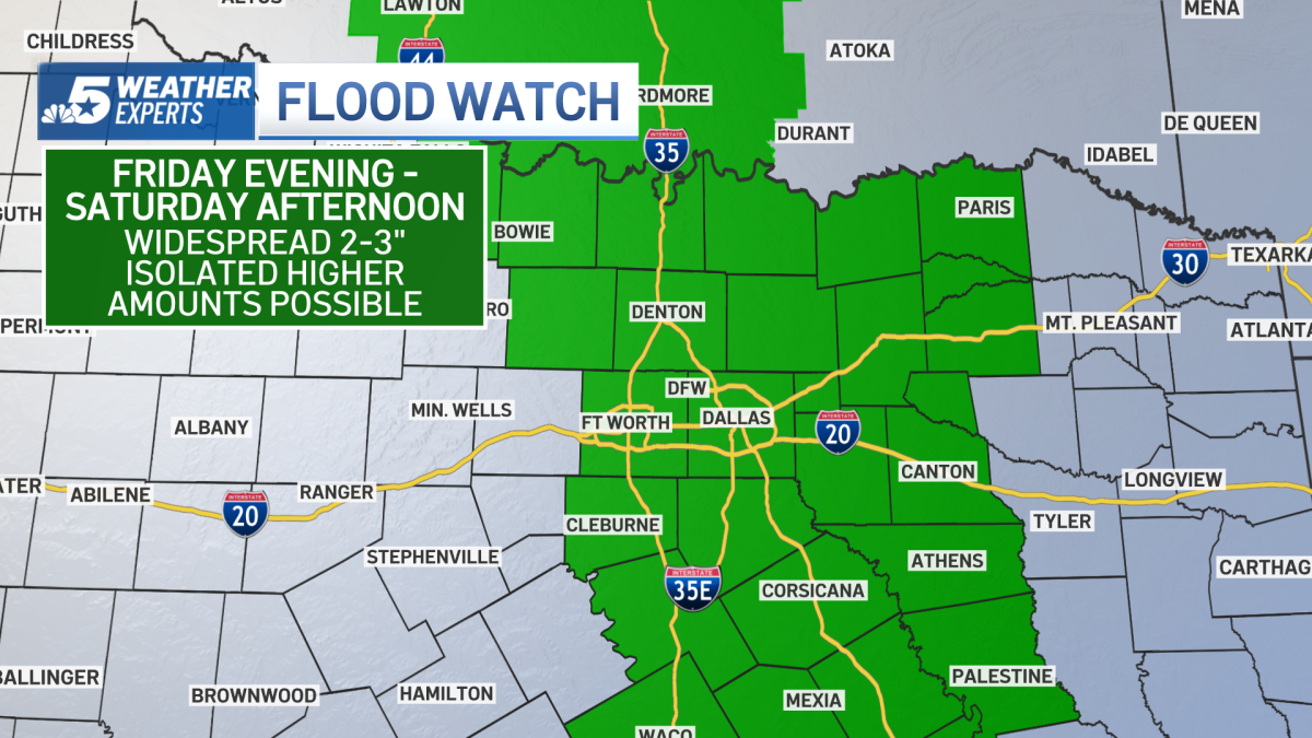
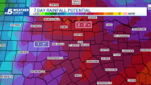
Widespread rain and thunderstorms arrive Friday into Saturday, with the highest coverage expected Friday evening and overnight. Some of the rain will be heavy at times and could produce two to three inches of rain with isolated totals in excess of five inches.
A Flood Watch has been posted for much of North Texas from 7 p.m. Friday until 1 p.m. Saturday for portions of North, Central and East Texas
The greatest flood threat will be locations near and east of Interstate 35.
While the overall severe weather threat is low, some of the storms could contain damaging winds and hail. On Friday, parts of North Texas are included in a level 1 severe weather risk.
High school football games change schedules due to weather
The rain has prompted several area high school football teams to reconsider their Friday night plans and move their football games.
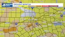
Rain is needed to hold off severe drought
October is normally our second‑wettest month of the year — averaging just over four inches of rain at DFW Internatioanl Airport. So far this October, we’ve recorded only 0.24″ of rain.
This is much-needed moisture, with many locations across the area experiencing abnormally dry, moderate or severe drought conditions.

Make sure you download the NBC DFW App for the latest forecast and radar.