
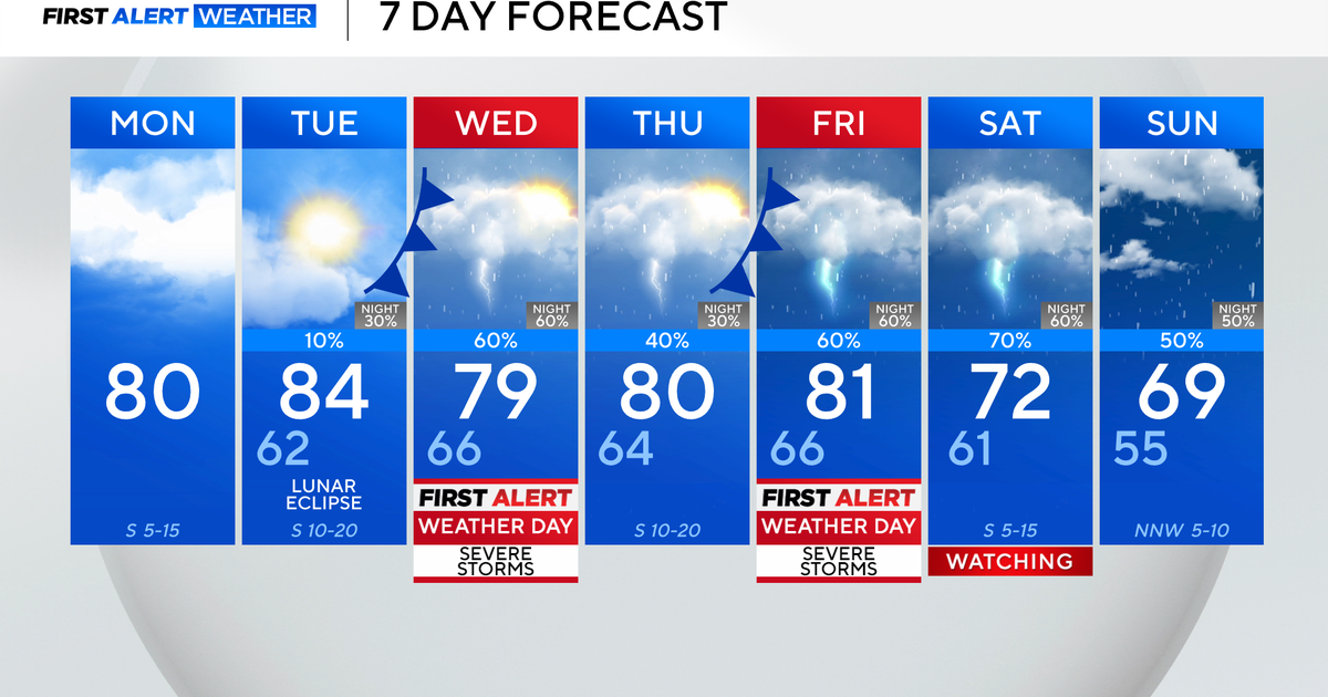
It’s a busy weather week, with an unsettled pattern moving in on Wednesday.
To start the workweek, Monday morning is mild, with temperatures in the 50s and 60s. There’s a stalled front to the north, which will create a temperature contrast across the Red River counties and Dallas-Fort Worth.

The northern counties may be stuck in the upper 60s and low 70s, while parts of the DFW will push close to the 80°. There will be plenty of clouds in the sky on Monday, with a few peeks of sunshine.
Looking ahead to the middle of the week, it turns unsettled. First Alert Weather Days are in place for Wednesday and Friday due to the threat of scattered severe storms both days.

A front moves in by Wednesday afternoon, bringing a series of disturbances, increasing the severe weather threat for damaging winds, large hail and isolated tornadoes. Then, there’s another threat of severe storms on Friday, which may continue overnight into early Saturday.
Most of North Texas has been highlighted in this risk.


Another thing to keep an eye on this week is the potential for flooding, as up to 4″ of rain will be possible when all is said and done this weekend. Expect daily showers and thunderstorm chances to continue well into this weekend.
