

TEXAS — Parts of Texas are gearing up for a busy Wednesday afternoon and evening thanks to potential severe storms. This unsettled weather pattern will come to a brief halt Thursday before additional showers and storms return Friday and Saturday.
What You Need To Know
Parts of North and Central Texas are under a level 1 and level 2 risk for severe weather
Pea-size to quarter-size hail and gusty winds are the primary threats
Thursday will feature some light rain showers, severe weather not expected
Rounds of heavy rain could lead to some localized flooding Friday through Saturday
North Texas will have the greatest chance of severe storms. Damaging winds, large hail up to 2” in diameter and heavy rain will be possible, and even an isolated tornado.
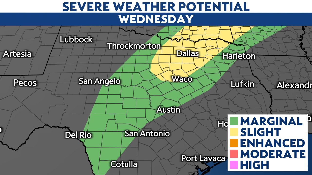
Storms will likely develop and move west to east before moving in between Sanger to Granbury between 3 and 7 p.m., Fort Worth 5 and 7 p.m. and move east towards the Dallas-Fort Worth metroplex between 7 and 11 p.m.
Areas along and west of Williamson County to McLennon County including the cities of Georgetown, Killeen and Waco will see the chance of storm to severe storms between 6 and 11 p.m. Large hail, heavy rain and gusty winds is possible.
As for areas across the Texas Hill country and into Travis County, chances for storms decrease due to a limited chance to break the temperature inversion or CAP. If storms do develop the timeline would be between 7 p.m. and midnight.
For South-Central Texas including Bexar County and points south, chances for storms remain limited with only and isolated storm or two possible into the early overnight hours. Storms have a greater chance of development along the border and near Eagle Pass between 8 p.m. and midnight.
As always, stay with Spectrum News 1 for the latest updates.