
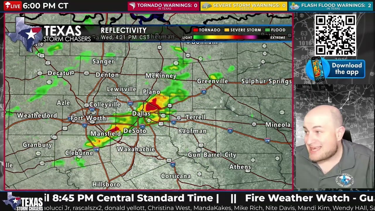
Scattered thunderstorms are moving across North Texas, Texoma, and Northeast Texas this evening, and while most storms have remained below severe limits so far, flash flooding has already become a concern in the Dallas–Fort Worth Metroplex.
As of the 6 PM update on March 4, 2026, Flash Flood Warnings are in effect for parts of eastern Tarrant County, Dallas County, and Rockwall County where thunderstorms have been stalled for more than an hour producing heavy rainfall. Flooded roads and rising creeks and streams are likely in these areas.
Additional thunderstorms are also developing across the Texas Hill Country from San Saba and Llano to Fredericksburg, producing lightning, small hail, and beneficial rainfall.
The overall severe weather threat should gradually decrease later tonight, but thunderstorms with lightning, heavy rain, and localized flooding could continue into early Thursday morning.
Stay weather aware and never drive across flooded roadways.
Track storms live using the Texas Storm Chasers Interactive Radar:
https://texasstormchasers.com/radar
You can also monitor storms using the free Texas Storm Chasers mobile app.
Subscribe for Texas weather updates, storm coverage, and live severe weather tracking.
#TexasWeather #DFWWeather #NorthTexasWeather #FlashFloodWarning