
DALLAS – After a major round of storms early Friday morning, North Texas will have a brief break before two more weather systems sweep through.
Friday Forecast: Severe Weather Risks, Flood Watch 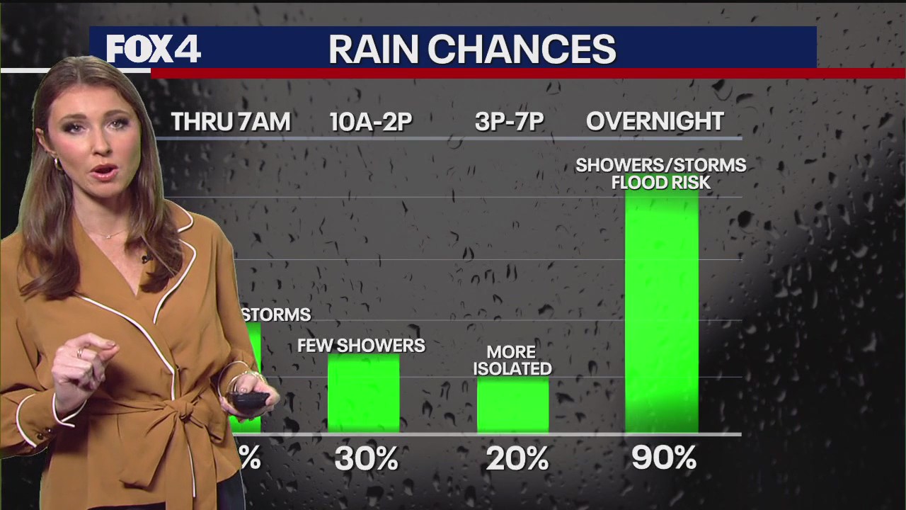
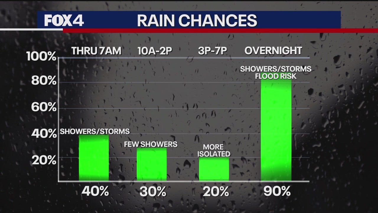
Following the departure of rain in Dallas early Friday, the region is between disturbances. However, there remains a 30 to 35 percent chance of storms throughout the day. Most of the rain will stay west and north of the Dallas-Fort Worth Metroplex.
Gusty southwest winds will prevail Friday, and the air will remain humid as temperatures rise to near 80 degrees Fahrenheit by the afternoon.
The main disturbance arrives Friday evening. The timing is projected to be after sunset west of DFW and late evening, around 9 to 10 p.m., for the Metroplex. High winds are the primary risk. Hail the size of a quarter or less is possible, and western areas face a slight tornado risk.
Widespread rainfall amounts of 1 to 3 inches and isolated amounts of 4 to 5 inches will be possible, according to the National Weather Service. A Flood Watch is in effect from 7 p.m. Friday to 1 p.m. Saturday.
Dallas-Fort Worth Weather: LIVE RADAR  Weekend Forecast: Gusty winds, Hail Threats Possible
Saturday morning will likely be dry before afternoon temperatures rise into the 70s, ahead of the third disturbance. More showers and storms will approach with gusty winds and hail, especially south of DFW. These storms are not currently expected to be severe.
Sunday will begin with clouds and lingering showers in the eastern parts of North Texas. Clouds will eventually clear, leaving a pleasant fall day with temperatures settling in the 70s.
7-Day Forecast: Cooler Weather Hits DFW 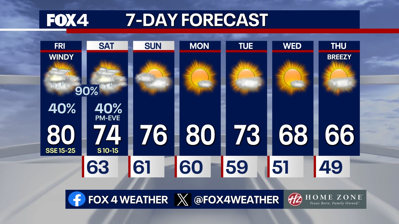
Milder temperatures in the 70s are expected Monday. Tuesday will be breezy with partly sunny skies. Cooler air will linger mid-week, with Wednesday projected to be the coolest day under sunny skies and lighter winds.
LIVE: Dallas-Fort Worth Rainfall Totals 
The Source: Information in this article comes from the National Weather Service.