
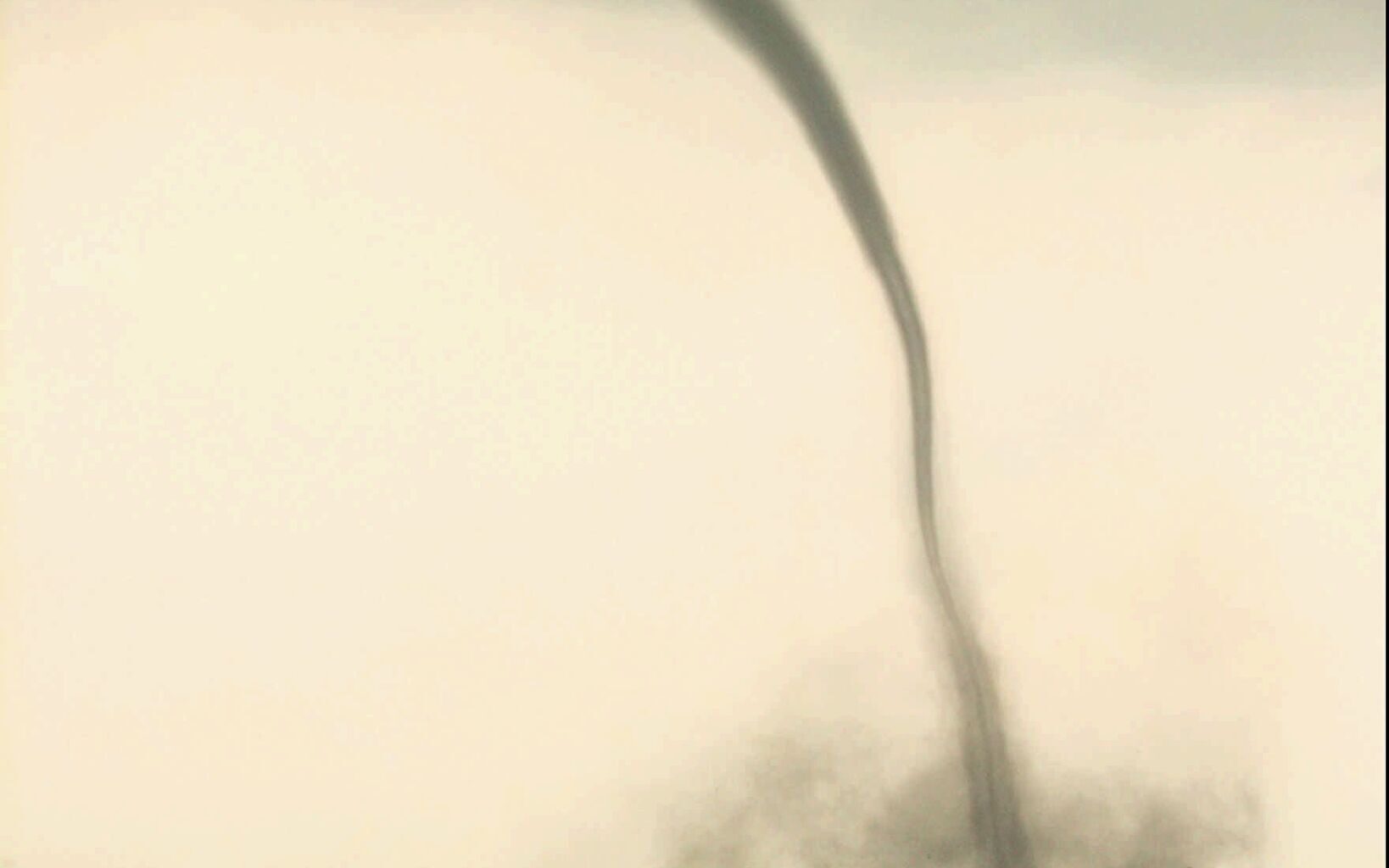
A tornado touches down north of Jarrell in Williamson County along Interstate 35 on May 27, 1997. A tornado is a violently rotating column of air that emerges from the cloud base and makes direct contact with the ground.
TED S. WARREN/ TED S. WARREN/AUSTIN AMERICAN-STATESMA
Severe weather season in Texas has arrived and Central Texas is bracing for a couple of stormy days on the horizon this week. Knowing how thunderstorms develop and identifying cloud formations can help you prepare for whatever the weather brings.

“Everything is bigger in Texas,” and thunderstorms in the state are no exception. North, South-Central and East Texas typically experience 30 to 50 thunderstorm days annually in each region. Southeast Texas, closer to the coast, sees the highest number of thunderstorm days, about 50 to 60 per year, while West Texas experiences the fewest, ranging from 20 to 40 days annually.
Article continues below this ad
How thunderstorms form
Cumulonimbus (or “heaping rain cloud” in Latin) clouds are towering formations that develop when the atmosphere has sufficient atmospheric instability, moisture and lift, or a force to push air upwards.
This graphic from the National Weather Service illustrates the three stages of a thunderstorm.
NOAA
When all these conditions are present, strong upward movements of air, called updrafts, can occur within the cloud, allowing it to grow from 2,000 feet to heights between 40,000 to 60,000 feet. This altitude exceeds the cruising height of most airplanes, which is why pilots often choose to navigate around thunderstorms to avoid a bumpy ride.
Article continues below this ad
Within the cloud, water droplets and ice particles begin to form and create an electrical charge. When this charge is released, it produces lightning and creates the sound of thunder. This typically happens when the storm is reaching its full potential, or mature stage, with the delicate balance of a strong updraft and downdraft producing heavy rainfall and gusty winds. If intense enough, it can evolve into a supercell thunderstorm that can last for several hours and potentially produce tornadoes, damaging winds, hail and flooding rains.
As the thunderstorm nears its end, the downdraft is stronger than the updraft, which had been the storm’s source of warm, moist air. Without this supply from the updraft, the storm weakens and dissipates.
Cloud shapes to watch for
Once a thunderstorm develops, several types of clouds may form within the storm, indicating its strength and severity.
Article continues below this ad
Anvil cloud: At the highest level of a mature thunderstorm, an anvil cloud will form. It is a flat, white cloud that spreads horizontally once it reaches the stratosphere and can no longer grow vertically. Strong upper-level winds will flatten and spread out the icy cloud tops ahead of the main part of the storm. Sometimes you can see the anvil of a storm that is more than 100 miles away, according to the National Weather Service.
This picture, taken from a weather surveillance aircraft, shows an anvil cloud with an overshooting top.
National Weather Service
An overshooting top occurs when a cluster of clouds pushes through the anvil and reaches the lower stratosphere. It appears as a cumulus cloud sitting above the anvil and is positioned directly over the primary storm updraft. This feature signifies a rapid and intense upward motion of air.
Wall cloud: If the storm is strong enough, a low-hanging, rotating cloud will form under the rain-free base of a thunderstorm. This wall cloud develops in the storm’s updraft region and often appears where warm, moist air is being pulled upward through the storm. A wall cloud serves as a vital feature of the storms when identifying a funnel cloud or tornado.
Article continues below this ad
Wall clouds are found underneath the base of a thunderstorm and indicates that the upward motion of air is strong and beginning to rotate.
National Weather Service
Funnel cloud: A funnel cloud is a rotating column of air that extends downward from the base of a wall cloud but remains suspended without touching the ground. In contrast, a tornado is a violently rotating column of air that emerges from the cloud base and makes direct contact with the ground.
A funnel cloud, like this one spotted about 8 miles southwest of Girard on April 16, 2016, is a rotating column of air that extends downward from the base of a wall cloud but remains suspended without touching the ground.
Joe Ponce/National Weather Service Lubbock
Green clouds: These clouds can make a thunderstorm look extraterrestrial, but it’s just the presence of a large amount of hail in the clouds. The National Weather Service explains that hail inside the clouds will scatter the blue light waves, and when illuminated by sunlight, this scattering effect can give the clouds a green appearance.
Article continues below this ad
Green clouds indicate the presence of a large amount of hail in the clouds. The National Weather Service explains that hail inside the clouds will scatter the blue light waves, and when illuminated by sunlight, this scattering effect can give the clouds a green appearance.
Tanya Johnson/National Weather Service