
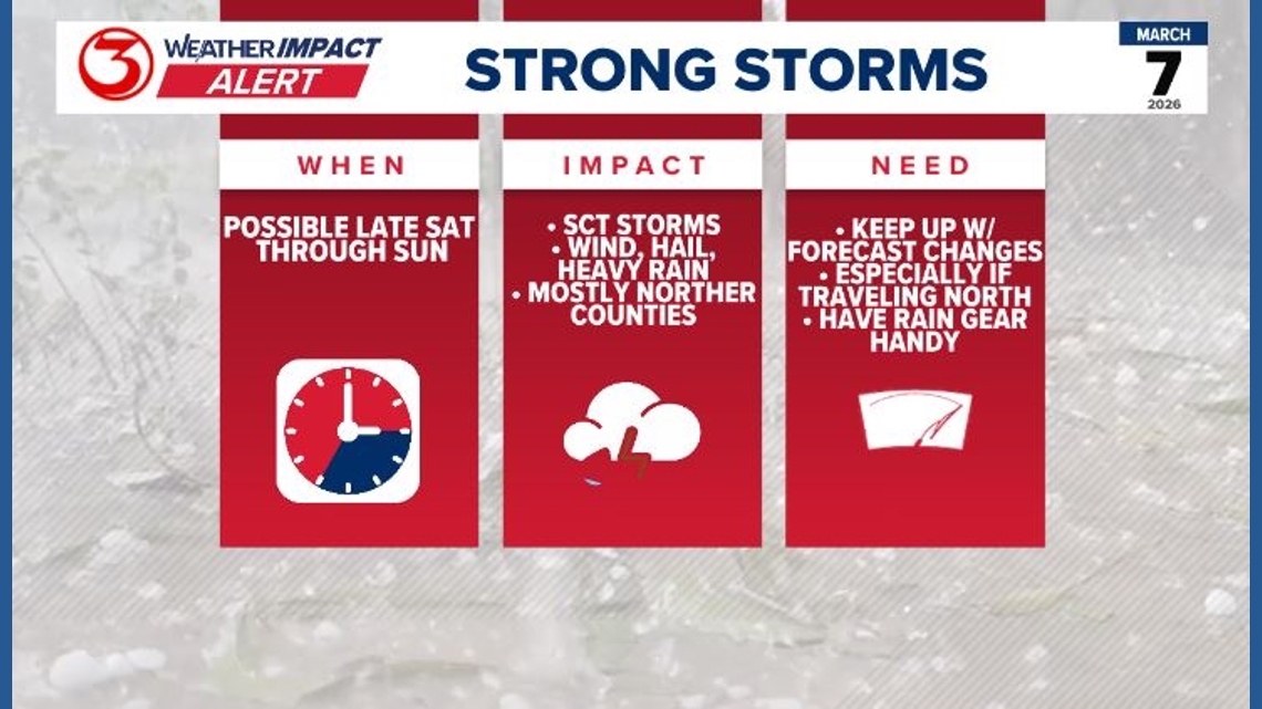
Weather Impact Alert highlights a chance for scattered strong to severe thunderstorms in the Coastal Bend starting Saturday evening
Spring thunderstorms are possible in South Texas while the clocks also spring forward Saturday night. March has been off to an active start across Texas, and the Coastal Bend joins the severe weather risk on Saturday evening.
We are watching a storm system that will move across the Great Plains on Friday, and a cold front will move south across Texas throughout the day on Saturday.
Latest guidance suggests the cold front will approach San Antonio around 5 PM on Saturday. At this point, the front will begin to stall.
We are highlighting Saturday evening and Sunday morning with a Weather Impact Alert for several rounds of strong to severe thunderstorms into Sunday morning.
The main threats will be large hailstones and damaging wind gusts over 60 mph. Northern counties such as Bee, Live Oak and McMullen Counties have the best chance of seeing these thunderstorms. These counties are under a slight (level 2 out of 5) risk of severe weather. While the rest of the Coastal Bend has a marginal (1 out of 5) risk of severe weather. This means rain and thunderstorms is not a guarantee for the region, but there are enough ingredients or signs of severe weather to be on alert, especially if you have outdoor plans. Saturday night or Sunday morning.
Where the cold front stalls makes the forecast tricky for South Texas. If the front stalls along I-10 the severe thunderstorms will stay north of Corpus Christi and we will wind up with very little rainfall.
If the front make it south of San Antonio and into any of the Coastal Bend counites we will see much higher rainfall amounts.
Confidence on the cold front making it as far south as Corpus Christi is about at a 50% chance right now.
This isn’t our only chance for rain. If the front stalls in the Coastal Bend we will see off and on rain on Sunday with a few thunderstorms possible.
Most of Texas looks like it will have a break in thunderstorms on Monday, but another cold front is set to move in Tuesday and Wednesday with an upper level low pressure system tracking west to east across the state.
Thursday looks really nice following the front on Wednesday.