
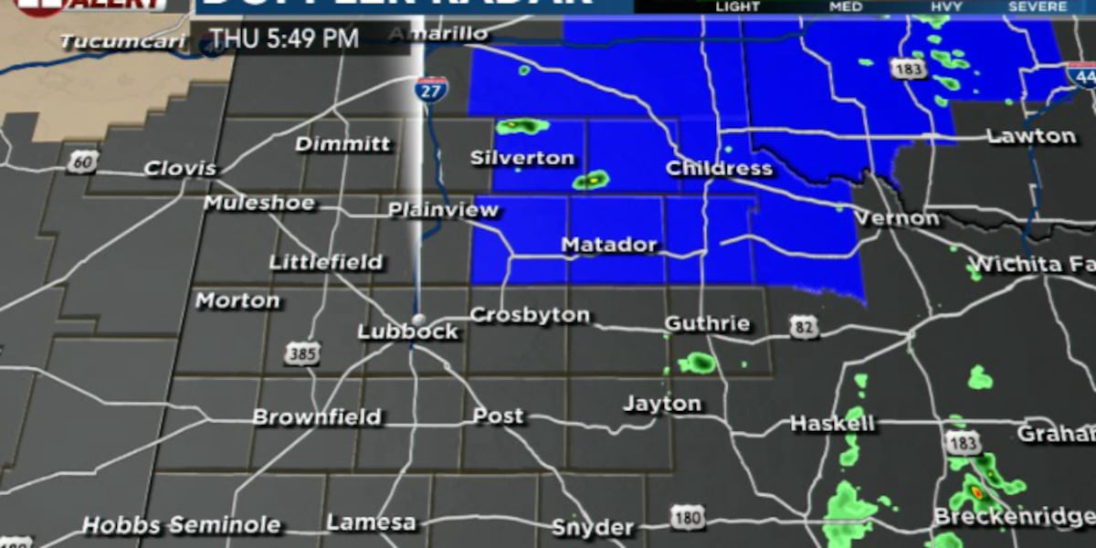
LUBBOCK, Texas (KCBD) – UPDATE 8:15pm – A Tornado watch has been issued for our northeastern counties including: Briscoe, Hall, Motley, Cottle and Floyd until midnight tonight, shown in blue below.
 The Tornado Watch is in effect for the following counties: Motley, Hall, Cottle, Briscoe and Floyd until midnight tonight.(Dylan Smith)
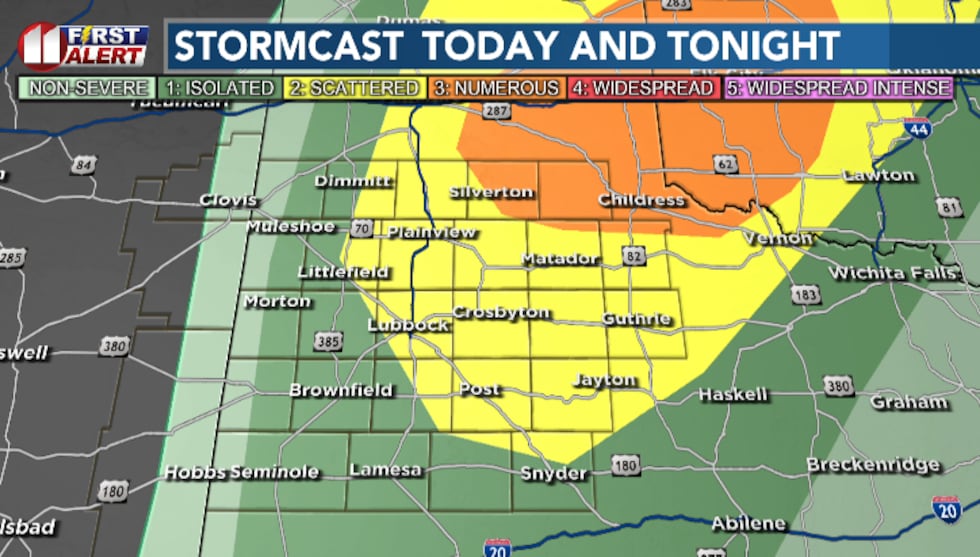
The South Plains could experience rain showers and thunderstorms this afternoon/evening, some of which could reach severe levels. We’re currently under three different levels/categories of severe risk.
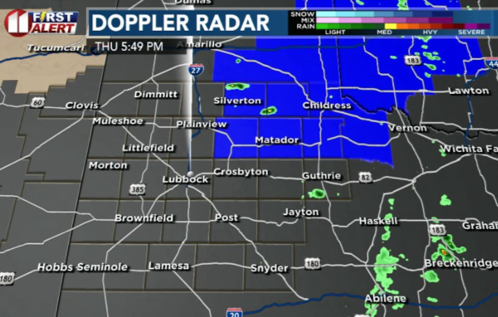
 We’re anticipating seeing a few strong to severe storms across primarily the eastern half of the South Plain this afternoon/evening.(Dylan Smith)
Our southwestern counties are under a Marginal (1/5) Risk of severe weather. The central, northern and eastern counties are under a Slight (2/5) Risk and our northeastern counties are under an Enhanced (3/5) Risk for seeing severe storms over the next several hours.
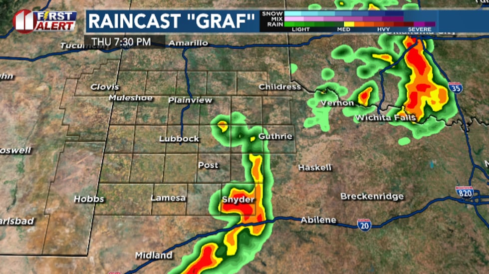 This is one of our high-resolution models that indicated some storms building into a line in the south/southeastern portions of the South Plains.(Dylan Smith)
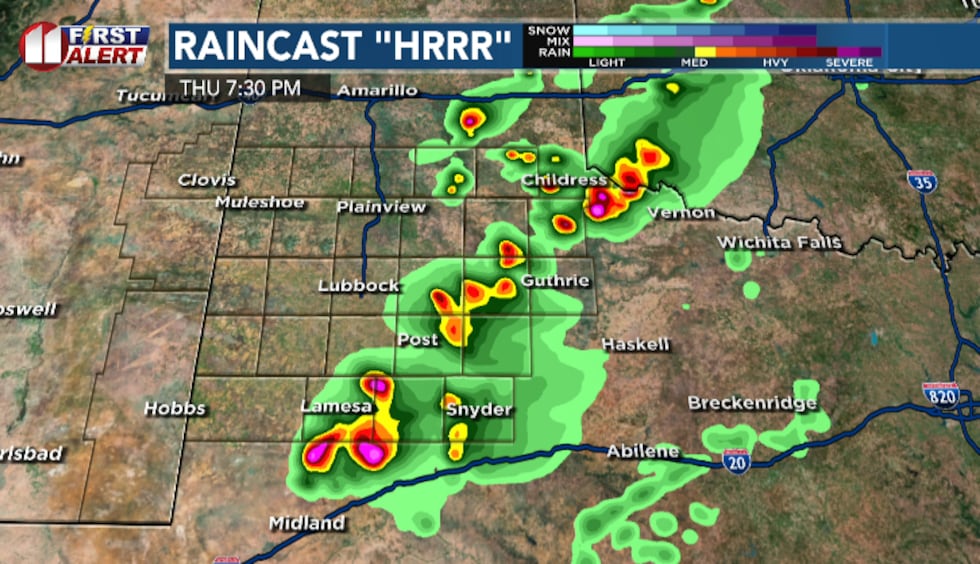 This is another of our high-resolution models that indicate a bit more activity to the north and east of Lubbock compared to the GRAF. This model usually looks more severe than things tend to turn out, giving us a decent idea of “worst” case scenarios.(Dylan Smith)
While it may seem daunting, I don’t anticipate any kind of major severe weather outbreak across the area today. We’ll most likely see a few isolated showers and storms develop across mostly the eastern half of the South Plains, some of which could produce large hail (1-“2″ in diameter) and strong winds of up to 60 to 70 mph.
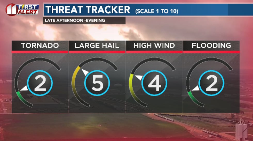 Our primary risk of severe weather will be hail and strong, straight line winds. I’m not ruling out tornadoes/flooding completely but the likelihood of the others is significantly higher.(Dylan Smith)
These will develop and then push to the east/northeast, leaving us quiet for the night ahead.
TONIGHT
 Breezy winds and humid air will keep overnight lows around 20 to 25 degrees above average for this time of year.(Dylan Smith)
Skies will settle down as we get ready for another mild night, with overnight lows dropping down mostly into the mid 50s. Winds stay a bit breezy around 10 to 20 mph out of the south.
FRIDAY
We leave severe storms behind for increasing fire danger today. High temperatures will climb to the mid to upper 70s with winds gusting up to 30 to 35 mph out of the southwest.
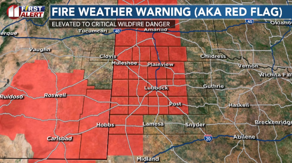 Winds and dry air move back in for Friday, bringing with it another day of increased fire danger for much of the South Plains.(Dylan Smith)
Fire Weather Warnings (Red Flag Warnings) have already been issued for 11am to 7pm Friday for a good chunk of the area.
WEEKEND
A cold front arrives Friday night, dropping high temperatures from the mid to upper 70s Friday afternoon into the lower 60s for Saturday.
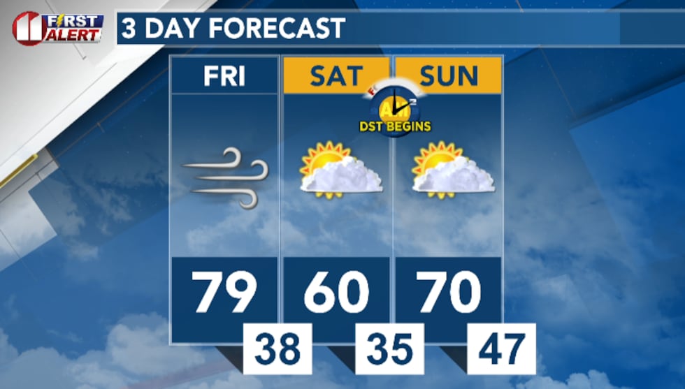 We’ll see a cold front slide through Friday night, dropping temperatures from the 70s and near 80 Friday into the lower 60s and upper 50 by Saturday afternoon.(Dylan Smith)
Temperatures will rebound into the lower 70s by Sunday afternoon. Plenty of sunshine is expected this weekend!
UPCOMING WEATHER PATTERN
Rain chances will resume as we push into next week, spanning Monday through Wednesday at least.
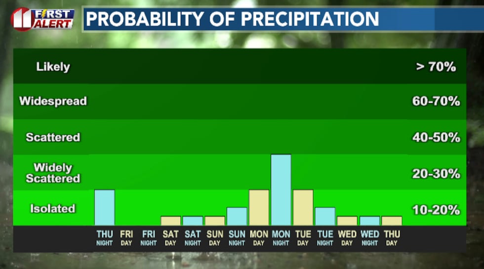 After the round of storms possible this afternoon/evening, we’ll generally get a break this weekend before we see more rain chances move in early next week.(Dylan Smith)
TODAY IN WEATHER HISTORY: 2009
Wildfires were kicked up across portions of the South Plains, fueled by strong winds gusting close to 50 mph. This caused a downed power line that started a grass fire that spread and burned 2,000 acres and caused around $100,000 in damages.
Copyright 2026 KCBD. All rights reserved.