
 article
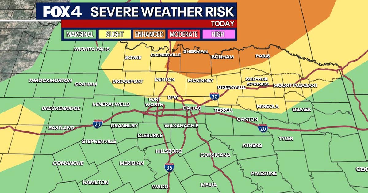
DALLAS – Storms return Friday afternoon, bringing severe threats including flooding, high winds and large hail. While the overall risk is low, a few tornadoes cannot be ruled out.
The active weather pattern will continue through the weekend as a cold front moves into the region and stalls, making heavy rain and strong storms the primary concerns for Saturday and Sunday.
Friday Forecast 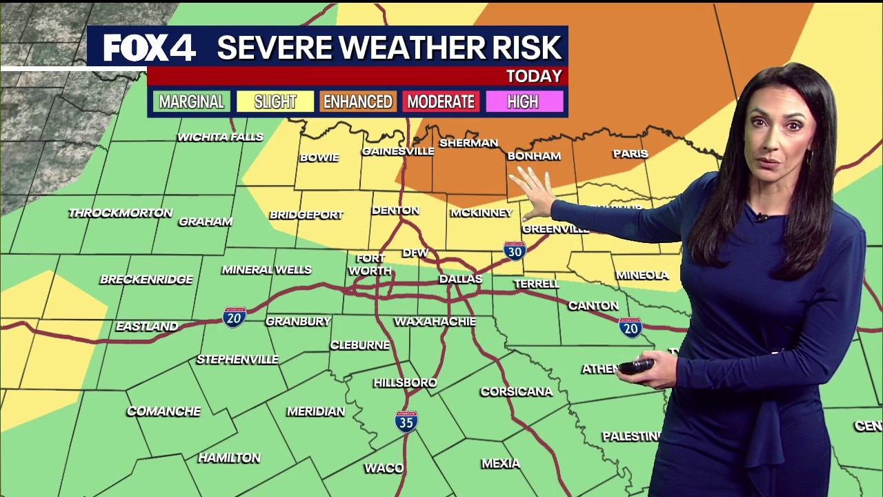
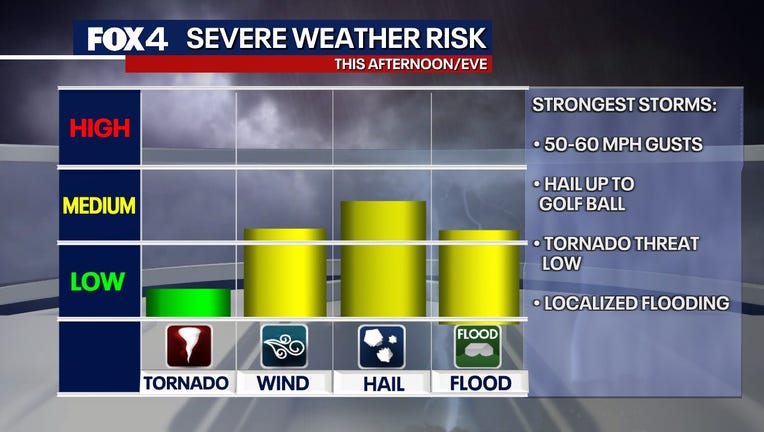
Severe storms are possible Friday afternoon and evening, with the primary window of concern between 3 p.m. and 10 p.m. While the tornado threat remains very low, residents should prepare for hail up to 2 inches in diameter and damaging wind gusts. The highest risk for severe activity Friday sits north of the Metroplex, specifically near Sherman.
LIVE Radar: Dallas-Fort Worth  Weekend Forecast
The potential for heavy rain continues Saturday, heightening flooding concerns. According to the National Weather Service, the flood threat will increase as multiple rounds of showers move through the area. While Central Texas faces the highest risk of severe storms on Saturday, North Texans should still prepare for large hail and damaging winds.
Rainfall totals are expected to reach 1 to 3 inches for most of the region, though isolated totals south of DFW could reach 4 to 5 inches. An upper-level system to the west is expected to keep rain and storm chances in the forecast well into next week.
When is daylight saving time?
As the stormy weather moves in, residents must also prepare for the start of daylight saving time. Clocks should be set forward one hour at 2 a.m. Sunday.
7-Day Forecast 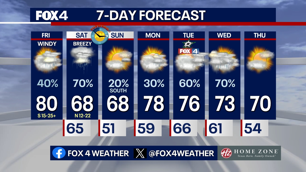
The threat of strong to severe storms returns Tuesday and Wednesday. High temperatures will remain steady in the 70s and 80s, with daily shower chances persisting through mid-week.
The Source: Information in this article comes from the National Weather Service and FOX 4 forecasters.