
AUSTIN, Texas — Governor Greg Abbott has directed the Texas Division of Emergency Management (TDEM) to activate emergency response resources as severe storms are expected to impact parts of Texas starting Wednesday and continuing through the weekend.
According to the National Weather Service, multiple storm systems could bring large hail, damaging winds, heavy rainfall, flash flooding, and possible tornadoes. The threat is expected to shift across North, West, and Central Texas over the coming days.
What to Expect in Central Texas
Our meteorologists say storms are unlikely but possible between 3 p.m. and 7 p.m. on Wednesday, when the atmosphere will be most unstable. Any storm that develops along or west of I-35 could produce large to very large hail, though it’s also possible the afternoon ends with no storms at all.
A similar setup is expected Thursday, but with an even lower storm chance locally as the main risk shifts toward West and Northwest Texas.
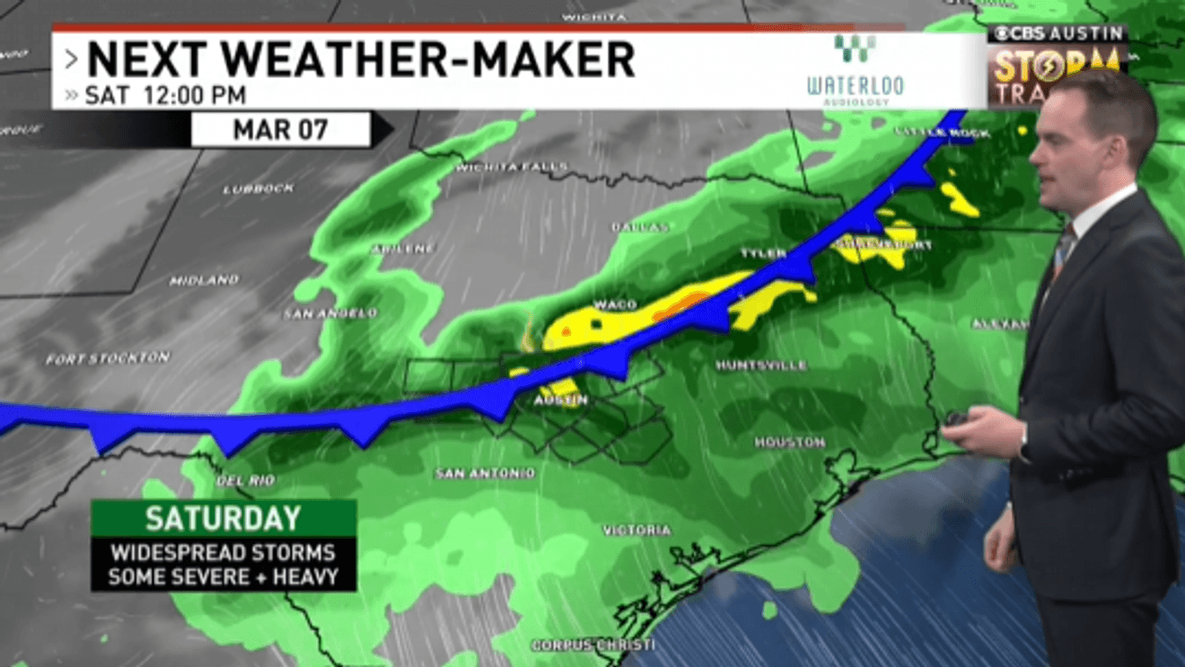
Higher Risk This Weekend
Friday is a weather alert day, with a 40% chance of storms in the afternoon and evening. If storms develop, they could bring large hail, damaging wind gusts, and an isolated tornado, especially near or north of Austin.
Storm chances increase Saturday to 70% as a larger system moves in. While the severe threat appears low-end, hail and strong winds will be the primary concerns. Showers and storms may linger into Sunday, mainly near and south of Austin, as a weak cold front settles just to the south.
ALSO| Trump says he will soon endorse in runoff between John Cornyn and Ken Paxton
Abbott said the state is prepared to assist if needed.
“Texas stands ready to deploy all necessary resources to help local officials respond to potential severe weather across the state,” Abbott said. “Texans are urged to remain weather-aware, regularly check road conditions, and heed the guidance of state and local officials.”
State resources, including the Texas National Guard, search and rescue teams, highway patrol troopers, and medical task forces, are on standby to assist local officials if needed. The State Emergency Operations Center remains at Level III (Increased Readiness).
Residents are encouraged to stay weather-aware and monitor local forecasts as conditions evolve.