
SAN ANTONIO – Storm chances are in the forecast for the upcoming weekend, and that includes the threat of strong to severe storms as well.
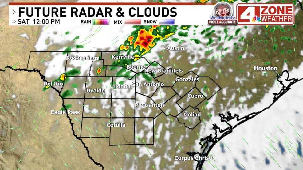
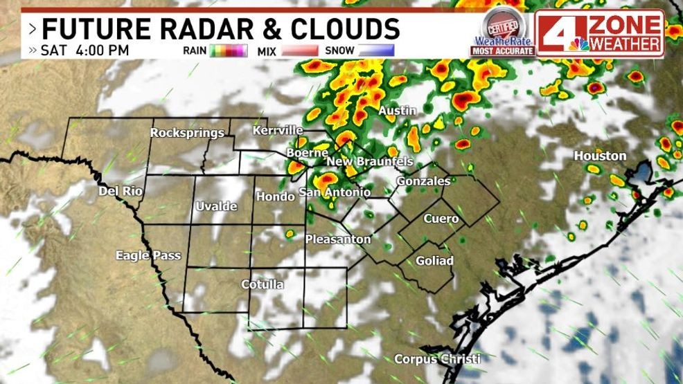
Activity is expected to increase through the day Saturday as a cold front pushes into the region.
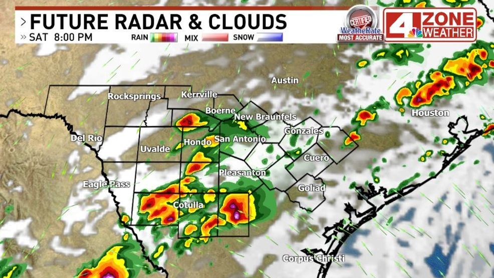
Activity will start in the Hill Country late morning and then gradually shift south into the afternoon and evening.
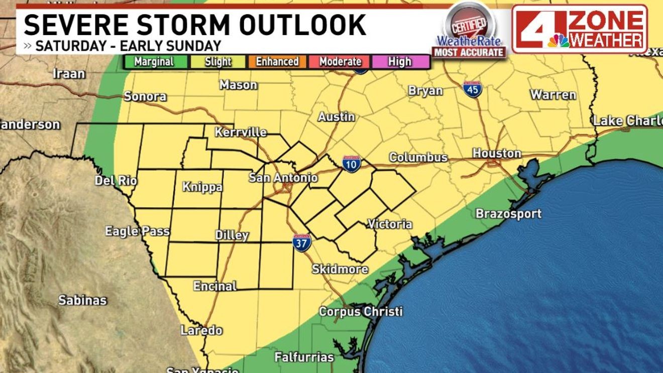
Any activity will have the chance to produce large hail and damaging winds, thus the reason for a ‘slight’ risk, level 2 of 5, across the area.
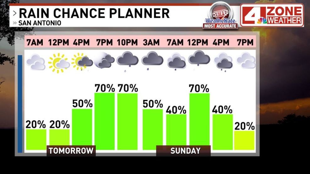
Storm chances will remain high through Saturday night and into early Sunday morning as the cold front will stall out in our region and provide a focal point for additional showers and thunderstorms to develop.
In addition to the severe threat, localized flooding cannot be ruled out if storms train over the same areas.
Sunday will be a breezy and much cooler day behind the front, with temperatures expected to remain in the 60s throughout the day.
The highest rain chance will be the first half of the day Sunday before tapering off Sunday evening.
Additional showers and thunderstorms are possible Monday through Wednesday as well with a secondary storm system moving into the region. This will again bring a threat of severe weather late Tuesday into Wednesday across South Texas.
Comment with Bubbles
BE THE FIRST TO COMMENT
Through the next week, rainfall will generally be in the 1-3 inch range in our area, with locally higher amounts in spots.