
 Houston weather: Sunday, March 8 morning forecast
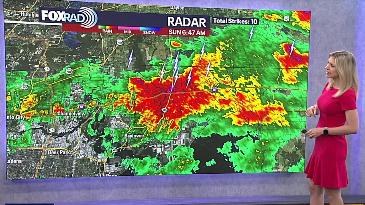
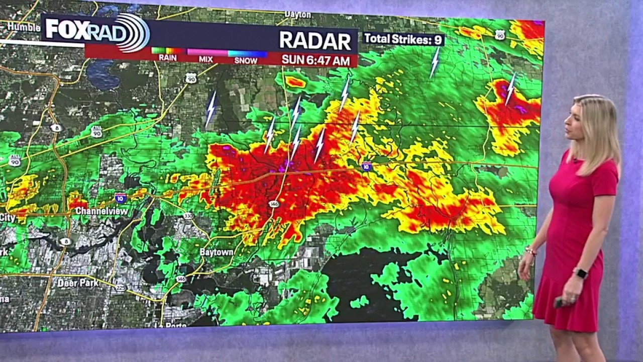
There is a cluster of slow-moving, high-intensity rain cells currently impacting the Gulf Coast. Blinding rain and frequent lightning have been reported along the Interstate 10 corridor, specifically affecting Baytown, Channelview, and southern Liberty and Chambers counties.
HOUSTON – A powerful cold front that triggered deadly tornadoes and destructive winds across the central U.S. is stalling over Southeast Texas on Sunday, shifting the primary weather threat from severe storms to localized flooding and blinding rain.
As the region adjusts to the start of daylight saving time, residents are facing a bifurcated morning: heavy thunderstorms are drenching areas south and east of Houston while northern suburbs remain dry.
Heavy rain and slick roads
There is a cluster of slow-moving, high-intensity rain cells currently impacting the Gulf Coast. Blinding rain and frequent lightning have been reported along the Interstate 10 corridor, specifically affecting Baytown, Channelview, and southern Liberty and Chambers counties.
To the southwest, heavy rain and loud claps of thunder are moving through Sugar Land, Richmond, and Rosenberg. While the overall severe weather threat has decreased since Saturday, officials are urging caution for morning commuters.
Roads are slick, so just take it easy out there. Patchy fog and a lack of daylight until 7:30 a.m. have created hazardous driving conditions.
Check which roads are impacted by high water
Temperatures across the region vary significantly due to the stalled front. While Katy and Brenham woke up to temperatures in the 50s, the rest of the Houston metro area remains humid and in the mid-60s.
Sunday afternoon forecast
The rain is expected to taper off by late morning, with isolated thunderstorms in areas like Manville potentially lingering until 9:00 a.m.
Despite the passage of the front, significant cooling is not expected immediately. High temperatures this afternoon are forecast to reach the mid-70s under mostly cloudy skies. A southeasterly breeze will maintain humidity levels through Tuesday.
Weather for the Houston rodeo 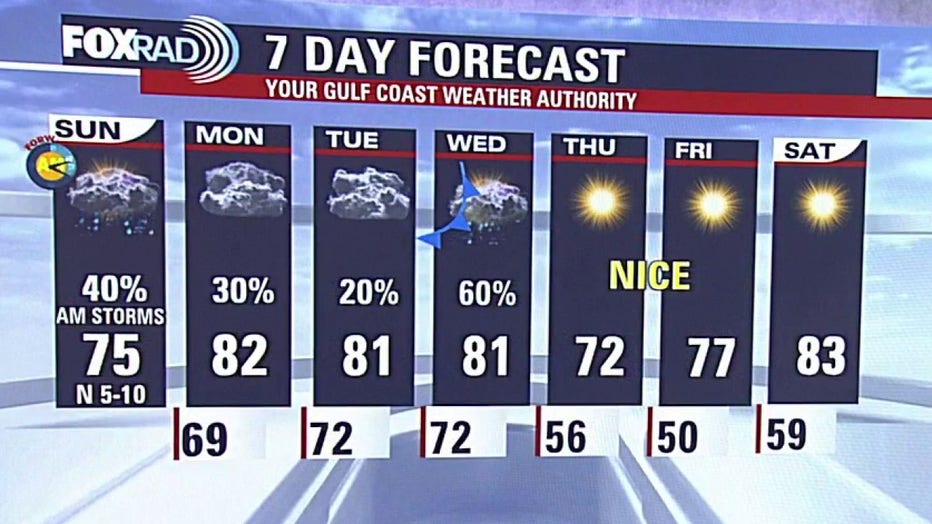
A brief period of dry and warm weather is expected Monday and Tuesday as high pressure temporarily takes hold. However, a second, more robust cold front is scheduled to arrive late Tuesday into Wednesday morning.
This midweek system brings a renewed chance for rain and thunderstorms, which could impact fans heading to the Houston Livestock Show and Rodeo.
Tuesday Night/Wednesday: Increased storm chances as the second front moves through.Thursday/Friday: Conditions are expected to be “picture perfect” for evening concerts. Skies will clear, with highs in the 70s and crisp morning lows in the 50s.Next Weekend: The cooling trend will be short-lived. Forecasters expect a return to the 80s with climbing humidity by Saturday.
The Source: Information in this article is from the FOX 26 Houston weather team.