
Click the livestream above for a livestream from the KCBD First Alert Forecast Center. Matt Ernst has an update on the severe thunderstorm watch now in place and storms developing.
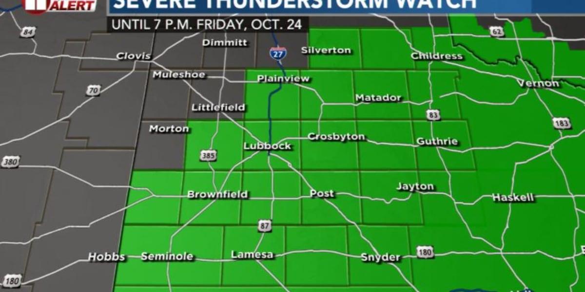
LUBBOCK, Texas (KCBD) – update 12:10 p.m. – The Storm Prediction Center has issued a severe thunderstorm watch for Lubbock and much of the South Plains. It’s in effect until 7 p.m.
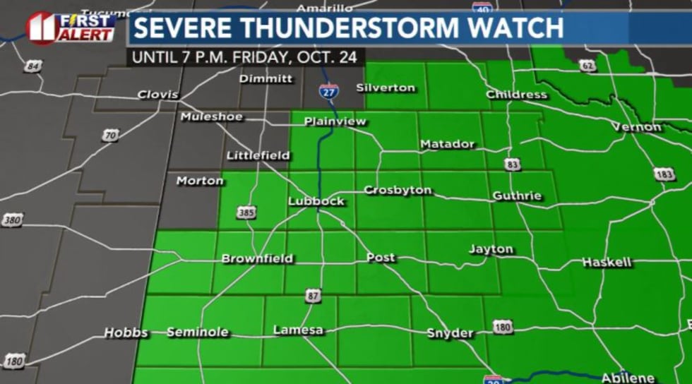 Severe thunderstorm watch in green until 7 p.m. Friday, Oct. 24.(Matt Ernst | KCBD)
This means thunderstorms that develop today will be capable of producing severe weather, primarily large hail and damaging wind.
There are a few showers and thunderstorms over the southern South Plains right now, more widespread into Far West Texas. Lift to generate showers and storms will move this way next few hours.
We expect the first storms to develop somewhere over the western South Plains between 1 and 3 p.m., then spread eastward. These will move fairly quickly, and storms may clear the eastern part of our area by about 7 or 8 p.m.
posted Friday morning -Scattered thunderstorms again are likely in the viewing area this afternoon and early evening. Some, but not all, storms may become severe. The main threats with the stronger storms are hail, strong wind gusts, and heavy rain.
The strongest storms, and heaviest rainfall, is expected to favor the area near and east of the Caprock. Farther west, including the I27-HWY87 area, a few isolated severe storms are possible. The storm and rain potential will be low over the far western viewing area.
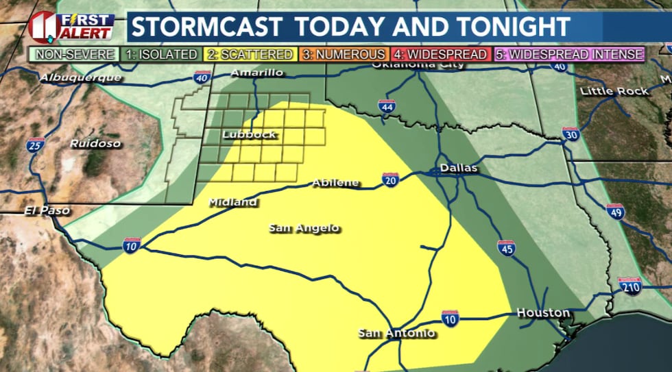 Scattered thunderstorms again are likely in the viewing area this afternoon and early evening. Some, but not all, storms may become severe.(KCBD First Alert)
The severe weather threats, like yesterday, are hail and strong wind gusts. While not every storm will become severe, not every storm will produce damaging hail or wind gusts. However, conditions are supportive of some hail greater than an inch across and wind gusts greater than 60 mph.
Flooding downpours may accompany some storms.
The tornado threat is low for the viewing area.
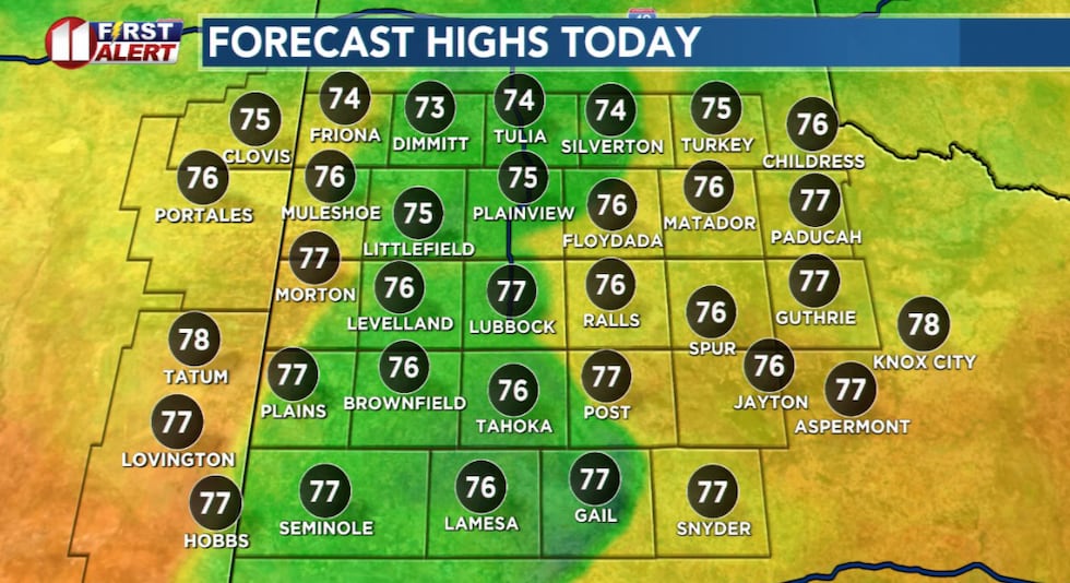 Slightly cooler this afternoon, but highs still slightly above average for the date.(KCBD First Alert)
Thunderstorms may linger over the eastern viewing area into the early morning hours. Otherwise, spotty light rain showers may linger in the Lubbock area through Saturday morning.
There is a chance weather may interrupt high school football games this evening, though mainly over the eastern viewing area. I expect dry weather for tomorrow’s Tech game here against OSU.
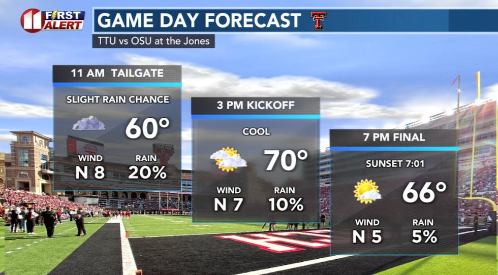 A slight chance of mostly light rain Saturday morning, then dry for the game.(KCBD First Alert)
Stay alert, be weather aware. Download (or update) our free KCBD weather app from your app store. Search for “kcbd weather”. In settings, allow notifications: Turn on “KCBD Alerts” and “Notification Sounds”. You may choose which alerts you want to receive under “Weather Notification Types”. This way, if a watch or warning is issued for your area our app will notify you.
Copyright 2025 KCBD. All rights reserved.