
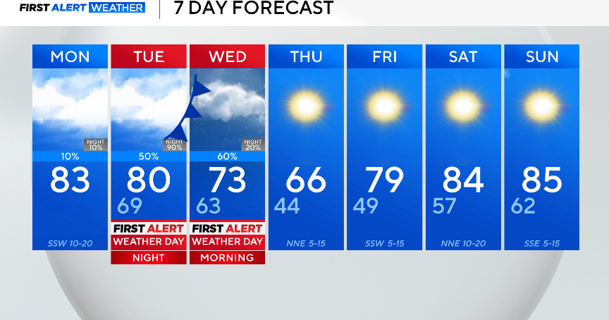
Monday will be cloudy and breezy, with temperatures gradually climbing into the 70s by lunch and reaching the low 80s for the afternoon high.
A few showers and isolated storms will be possible to the east of I-35 Monday, but most of the area will stay dry.

The next system swings through the area on Tuesday, causing the chance of severe weather. As of now, the Storm Prediction Center has highlighted a slight risk, level 2 out of 5, indicating the confidence is high for scattered severe storm development.
In the afternoon, a dryline will pop up a few isolated strong and potentially severe storms; however, there is a capping inversion that will be in place on Tuesday, so severe storms will be dependent on the environmental factors.
In the evening, a cold front will swing through and provide a scattered threat of severe weather and widespread showers. The strongest weather is expected from 4 p.m. through midnight. All modes of severe weather are possible.

Rain will continue overnight through Wednesday as the low-pressure system moves over North Texas. An additional inch or so of accumulation will be possible. After the front swings through, conditions clear.

Thursday will be seasonal, cool and sunny. Temperatures climb through the rest of the week into the weekend due to a ridge of high pressure, perfect weather for the Grand Prix in Arlington!
