
LUBBOCK, Texas (KCBD) – A dangerous combination of warm temperatures, strong winds and low humidity will create critical fire danger across the northwestern portion of the viewing area on Monday, with a quick round of showers and thunderstorms expected to move in Monday night into Tuesday.
 KCBD(KCBD)
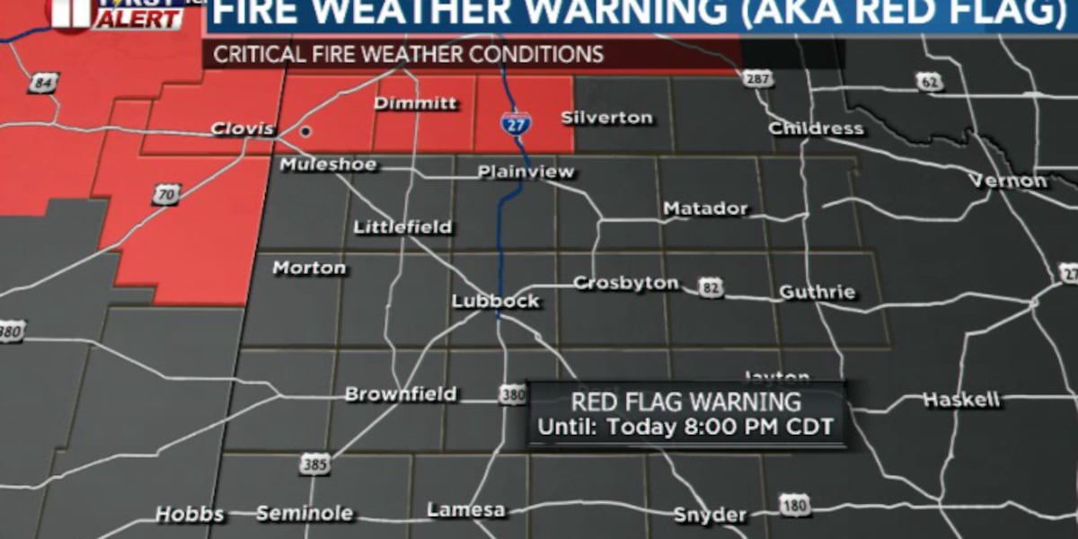
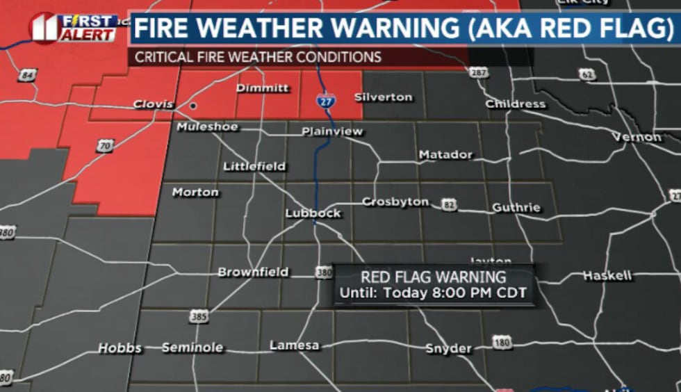
A Red Flag Warning has been issued for Castro, Parmer and Swisher Counties from noon through 8 p.m. Monday, with a Fire Danger Statement in effect for most of the viewing area during the same window. Any fires that develop Monday will likely spread rapidly, therefore outdoor burning is strongly discouraged.
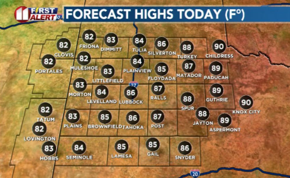
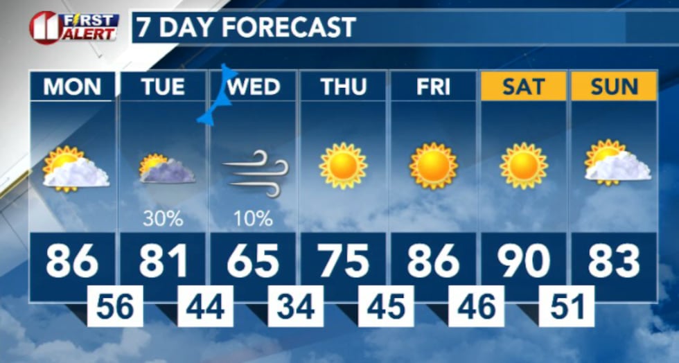
Near-record high temperatures in the upper 80s to low 90s combined with breezy westerly winds and relative humidity values dropping into the single digits will create these critical fire conditions. The record high for todays date is 88° set back in 1911.
 KCBD(KCBD)Slight chance of rain Monday night then again Tuesday
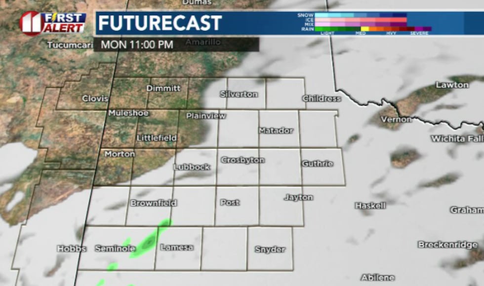
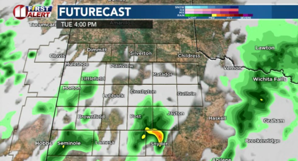
Relief from the fire danger may come in the form of a quick round of showers expected to develop Monday night as a weather system moves into the region. The rain is expected to continue into Tuesday, with more chances for thunderstorms Tuesday night.
 KCBD(KCBD)
While severe weather is not anticipated, lightning will be possible with any storms that develop. If storms do become severe, hazards will be hail near the size of quarters or golf balls, wind gusts up to 60 to 70 mph, and an isolated tornado cannot be ruled out. Rainfall amounts are expected to be light.
 KCBD(KCBD)Breezy Conditions and Warmth Continue Into Weekend
Following the passage of Monday’s weather system, breezy winds are expected to develop mid-week as high pressure builds into the region. Temperatures will warm considerably heading into the weekend, with near-record warmth possible.
 KCBD(KCBD)
Copyright 2026 KCBD. All rights reserved.