
SAN ANTONIO – We’ll be on guard late day Tuesday to early Wednesday for risk of strong to severe storms in our viewing area as the big system driving this recent pattern finally moves across.
The Storm Prediction Center has our western tier counties under a level 3 of 5 severe storm outlook (enhanced). Level 2 of 5 “slight” risk extends just into Bexar County with level 1 of 5 “marginal” risk east of Bexar County.
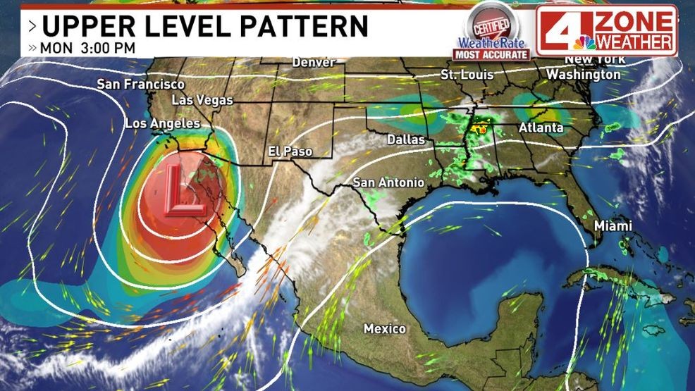
Large cutoff upper low driving the severe weather risk in our area as it moves east{ }
The reason for this outlook, storms will develop first out west where conditions will be most favorable for intensification. As they travel east in the overnight hours, conditions to support severe storms does decrease some. So gradual weakening is expected as they move east but some storms could still maintain strong to even severe levels by time they push near Bexar County.
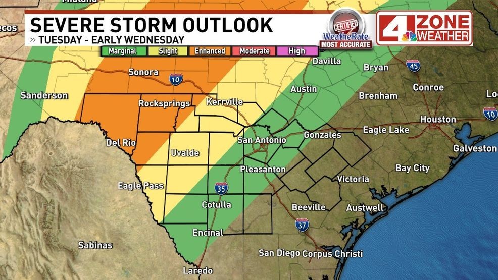
Severe storm outlook Tuesday – early Wednesday from the Storm Prediction Center
In the enhanced risk, higher probabilities of storms with large hail, damaging winds and a couple tornadoes exist. The percentage seen in the outlooks for storm hazards are chance of occurring within 25 miles of any point in highlighted area. The dashed black lines show increased risk of higher end hazards (EF2+ tornado, 2″+ hail, 74+mph winds).
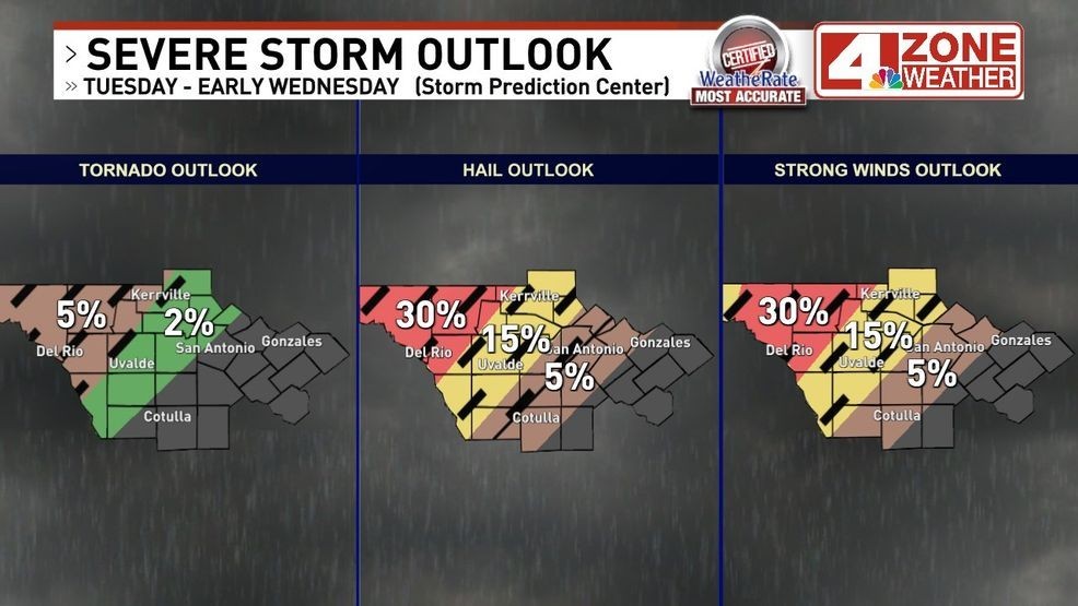
Storm hazard probabilities from SPC.{ } Dashed line risk of EF2+ tornado, 2″+ hail, 74+mph winds
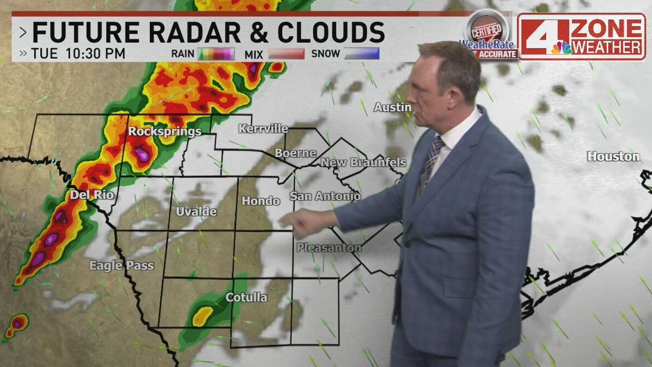
Future radar from one of many models shows the trend of developing storms out west and increasing in coverage then marching east. Noted in this series of images, the gradual weakening as they reach Bexar County but this hi-res model does maintain a couple stronger storms into the I-35 corridor.
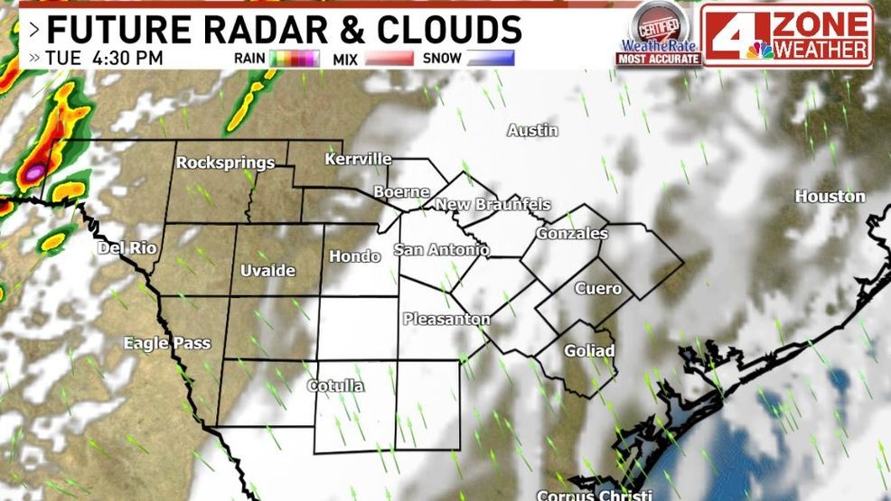
Future radar Tuesday 4:30pm
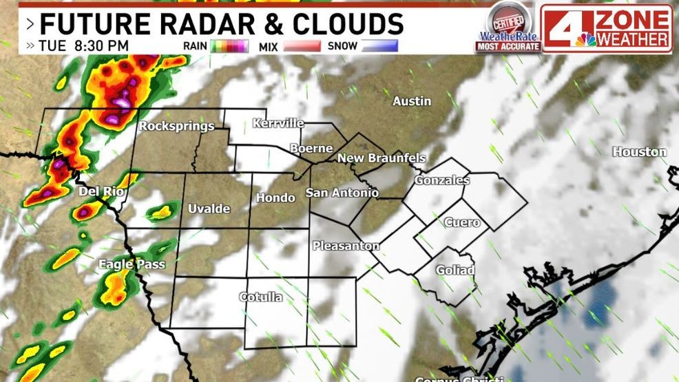
Future radar Tuesday 8pm – 9pm
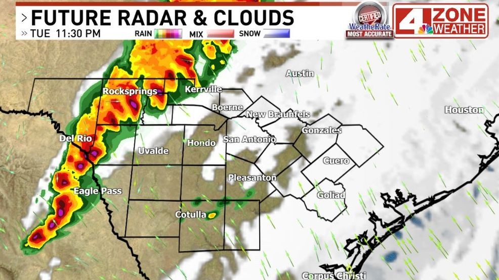
Future radar Tuesday 11:30pm
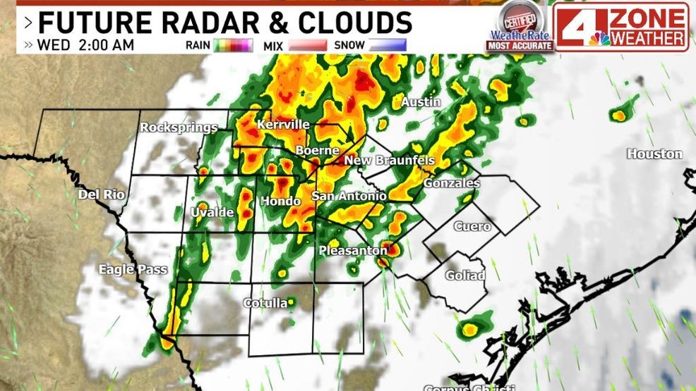
Future radar Wednesday 2:00am
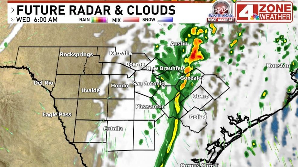 Future radar Wednesday 7:00amComment with Bubbles
BE THE FIRST TO COMMENT
This will be the last of our rain chances as we’ll enter another prolonged dry pattern awaiting the next big spring system.
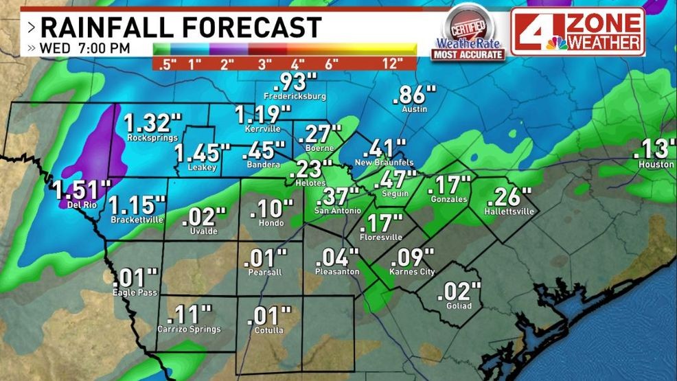
Forecast rainfall from our in-house GRAF model