Strong winds, hail, an isolated tornado and localized flooding will all be possible. Here’s the latest on the storm timeline.
AUSTIN, Texas — After weeks of dry weather, Central Texas is finally set to see rain and likely some storms late Friday into early Saturday. While this rain will be a welcome sight, it also carries the potential for severe weather and localized flooding.
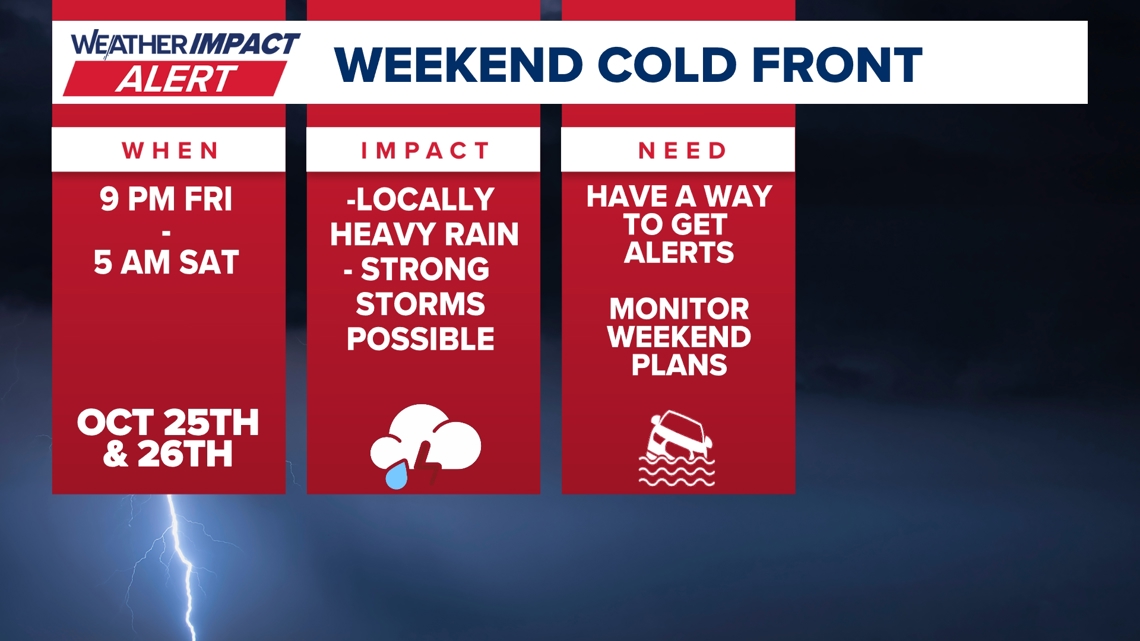
For this reason, the KVUE Weather Team has issued a Weather Impact Alert from 9 p.m. Friday through 5 a.m. Saturday. Make sure you have a reliable way to get weather alerts overnight, and monitor the forecast if you have outdoor weekend plans in this timeframe. Also, be mindful of any Halloween decorations that could be blown away by strong winds.

Timeline: When the expect the storms
Storms are expected to develop first in the Hill Country between 9 p.m. Friday and midnight as activity begins in the west and moves eastward. This should be a solid line of storms, meaning the vast majority of the KVUE area gets a decent round of rain, although not everyone will see severe weather.

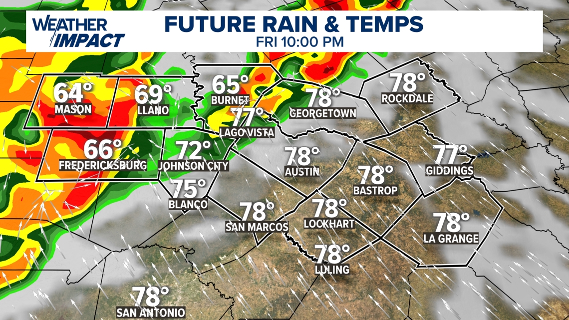
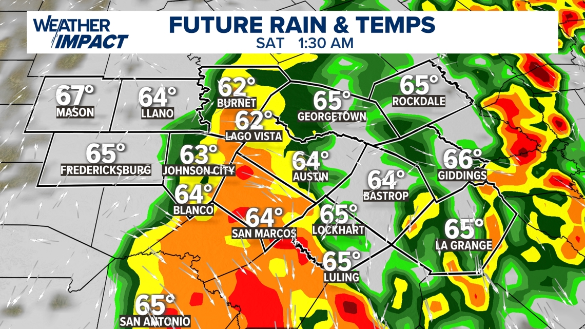
Between 10 p.m. and 3 a.m., the strongest storms are likely to move through the Interstate 35 corridor and the Austin metro area, with the most intense period expected right around midnight or so. Even if they are not severe, these could certainly be some rowdy storms that could wake you up in the middle of the night.

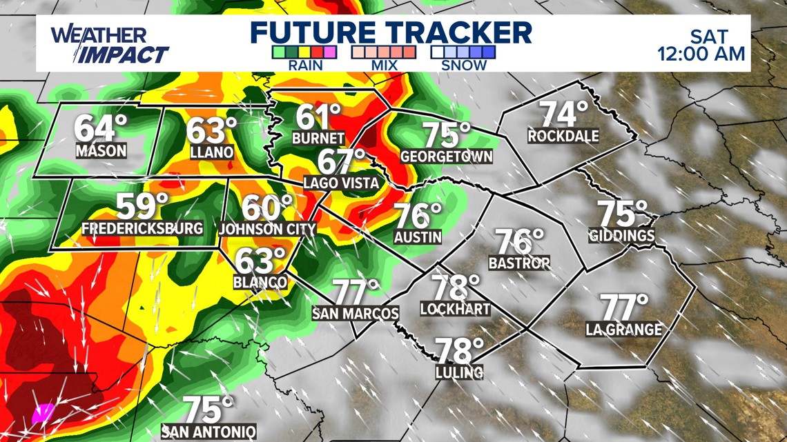
Farther east, across the Coastal Plains and areas east of Austin, storms will arrive later in the night and continue through early morning, generally between midnight and 5 a.m. or so before moving out around sunrise.

Main severe threats and flood risk
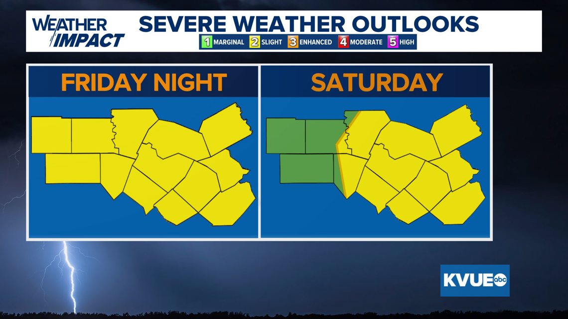
Most of Central Texas will be under a Level 2 out of 5 , or “slight,” risk for severe weather during this timeframe. Damaging winds, hail and an isolated tornado or two will be possible.

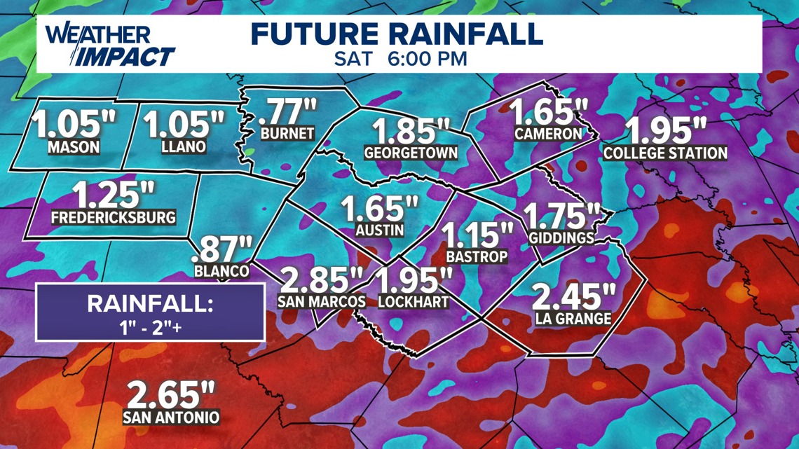
Rainfall amounts are expected to range from about half an inch to 1.5 inches, with some areas seeing locally higher totals that could lead to brief flooding.

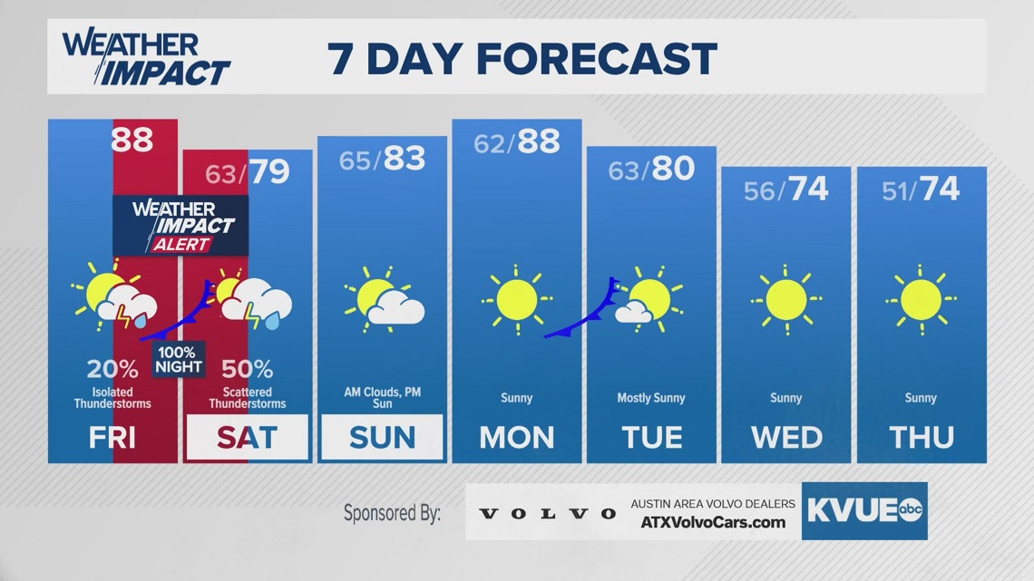
In the wake of the Friday night storms, cooler and drier air will settle in, bringing highs on Saturday down to the upper 70s and low 80s. Most of the rain will be confined to the early morning, but there could still be some scattered showers and storms during the afternoon and evening as well.
Bigger cooldown for next week!
Sunday will bring calmer weather with slightly warmer temperatures in the mid-80s. Early next week, highs will rise again into the upper 80s and low 90s before a midweek cold front ushers in a more lasting cooldown. By Halloween, highs are expected to stay in the 70s with crisp, cool morning lows in the 40s and 50s.
The KVUE Weather Team will continue to track this developing forecast.
In the meantime, the extended forecast can be found below: