
SAN ANTONIO – There is potential severe weather tonight through early Wednesday, with the most significant threats centered on the region’s western counties.
A Tornado Watch has been issued for our western counties, including portions of the southern Edwards Plateau and western Hill Country. This watch is in effect through 10 p.m., but additional extensions in time and area are possible later today.
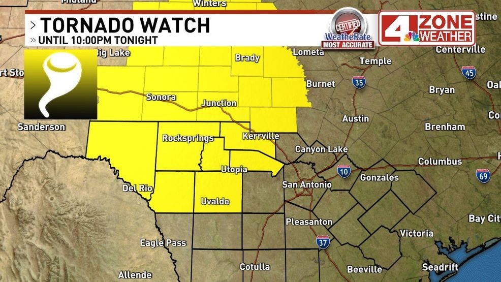
A Tornado Watch has been issued for our western counties, including portions of the southern Edwards Plateau and western Hill Country. This watch is in effect through 10 p.m., but additional extensions in time and area are possible later today.
CLICK HERE to track the storms with over interactive radar…
Parts of the western Hill Country and western zones have been placed under a level 3 of 5 risk for severe storms. Bexar County is currently under a level 1 of 5 risk, with the northwestern tip of the county at a level 2.
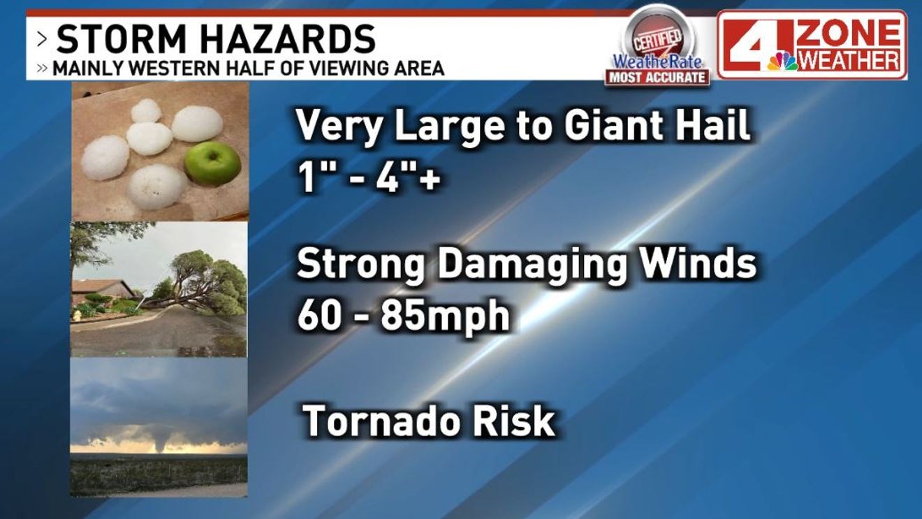
All severe hazards are possible, including large to very large hail up to 2+ inches, damaging wind gusts up to 75 mph, and even isolated tornadoes.
Storm Timeline and Hazards
Breaks in the afternoon sun are expected to push temperatures into the 80s. While a stray shower or thunderstorm is possible earlier in the day, the primary focus begins around 5 p.m. near the Eagle Pass and Del Rio areas.
If storms develop, they are expected to be supercells capable of producing all severe weather hazards, including:
Hail: 1 to 3 inches or larger.Wind: Damaging gusts of 60 to 80 mph or higher.Tornadoes: Possible.Flooding: Localized flash flooding is possible, particularly in areas to the west.
These storms may track northeast toward central-western Hill Country by mid-to-late evening. A second, larger area of storm development is expected near Val Verde and Edwards counties near or after 9 p.m.
CLICK HERE to share your weather photos and video…
Forecasters anticipate a “weakening trend” as storms move east overnight. For San Antonio, the primary window for weather activity is 2 a.m. to 6 a.m. Wednesday. Officials noted that while the risk level drops as storms move toward the city, residents should remain alert. A weather watch is expected for the western portion of the region later today.
On Wednesday morning, eastern counties may see a brief period of storm activity before the weather clears to partly sunny skies with highs in the 70s and low 80s.
Rest of the Week Forecast
The remainder of the week is expected to be clear:
Thursday: Cool and crisp morning; sunny with a high of 70.
Friday: Chilly morning in the 40s; sunny with highs in the upper 70s.
Saturday: Sunny with highs in the 80s.
Sunday: Sunny with highs near 90. A strong cold front is expected to move through by early Sunday evening, bringing a significant cooldown to start next week with lows in the 30s and 40s.
Your Photos and Video
Click here to share your photos and video – or use the form below…