
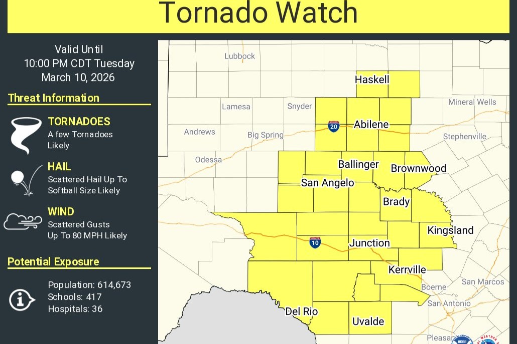
A tornado watch has been issued for the southern Edwards Plateau and western Hill Country through 10 p.m. Tuesday night, the National Weather Service said.
“The primary hazards are large to very large hail, damaging wind gusts, and an isolated tornado from thunderstorms,” forecasters said, adding that more extensions in the time and extent of the tornado watch area are possible later in the day.
Once storms begin to form, they are expected to intensify quickly. The tornado watch area includes Gillespie, Llano, Bandera, Val Verde, Edwards, Real, Kinney, Kerr and Uvalde counties through 10 p.m. This includes the cities of Bandera, Brackettville, Del Rio, Fredericksburg, Kerrville, Leakey, Llano, Rocksprings and Uvalde.
The weather service’s Storm Prediction Center has assigned a level 3 out of 5 risk for severe weather for an area west of the Hill Country, while much of the Hill Country and parts of Central Texas are under a level 2 out of 5 risk. Under level 3, the area would face the prospect of widespread and more numerous severe thunderstorms. Level 2 means severe storms would be more scattered and less frequent.
All modes of severe weather are possible with these storms, including hail larger than golf balls, damaging wind gusts of up to 75 mph, and even a few tornadoes, as the atmosphere remains favorable for strong storm development.
Storms are expected to initially develop as supercells before organizing into a line along a Pacific cold front moving west to east across the region, according to the weather service.
“Low level parameters remain favorable for tornado risk through late tonight, especially if any cells remain discrete ahead of the main line,” forecasters wrote in their Tuesday afternoon forecast. “Even when storms form into a line and strong wind potential increases, brief tornadoes cannot be ruled out mainly over the southern Edwards Plateau and Hill Country.”
Here is a statistical breakdown of severe weather from the National Weather Service:
For the western Hill Country and southern Edwards Plateau:
For the eastern Hill Country, I-35 corridor, and Rio Grande Plains:
For all areas along and west of I-35: If a tornado occurs, there is a 20% chance that it could be significant, such as an EF2 or greater.
As storms continue to move east late tonight and approach the Interstate 35 corridor, the severe threat will diminish as the atmospheric stabilizes. However, we could see the severe weather threat turn into more of a heavy rainfall threat in the Austin area. The weather service’s Weather Prediction Center has Central Texas under a level 2 out of 4 risk for excessive rainfall. Currently, there is a chance we could see a quick 1-3” rain total with locally higher amounts.
Beyond the storms Tuesday night, a chance remains for isolated strong to severe storms along and east of Interstate 35 on Wednesday, with the main hazards again being large hail, damaging winds and heavy rainfall.