
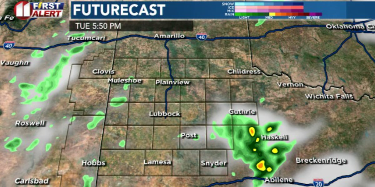
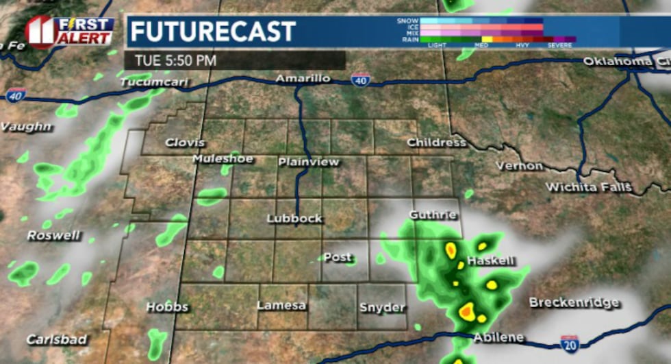
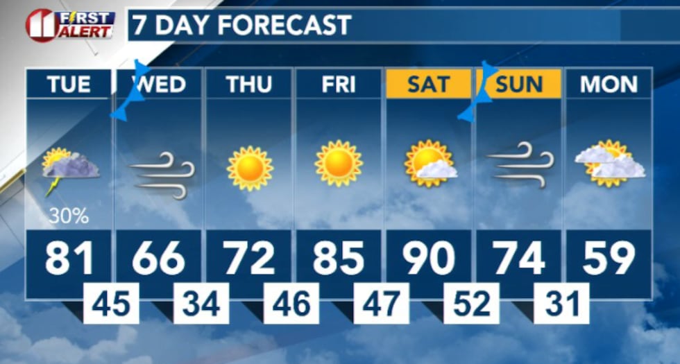
LUBBOCK, Texas (KCBD) – Severe thunderstorms are forecast to move across portions of the viewing area on Tuesday afternoon, bringing the potential for large hail exceeding two inches in diameter and damaging winds up to 70 mph.
 KCBD(KCBD)
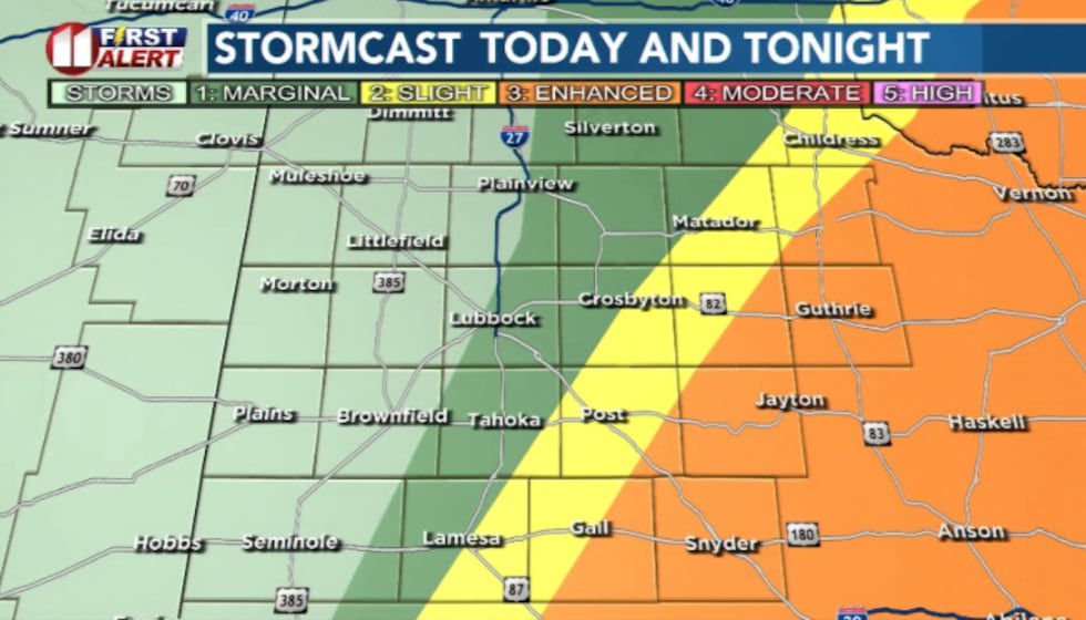
Areas on the Caprock will see a lower risk for storms, though fast-moving, high-based storms are still possible in that area.
What to Expect Tuesday
A strong upper-level system will move into the region Tuesday afternoon, creating conditions favorable for severe thunderstorm development. The main threats will be significant hail and damaging winds, with locally heavy rainfall also possible.
 KCBD(KCBD)
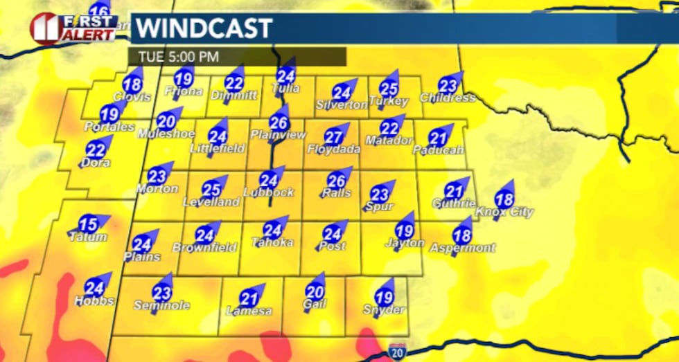
Winds will be elevated area-wide Tuesday afternoon, with southwest winds between 20-30 mph and gusts up to 40 mph. Blowing dust is possible across the Caprock outside of any storm activity.
 KCBD(KCBD)Wednesday: Cold Front Arrives
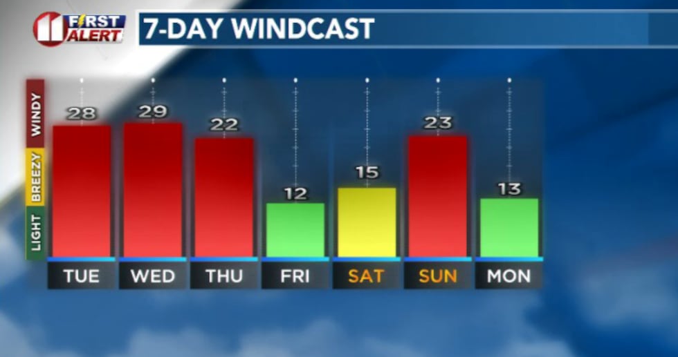 KCBD(KCBD)
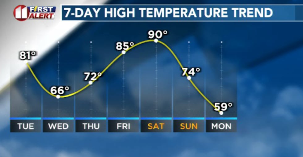
A strong cold front will move through Wednesday morning with a polar cold front arriving near sunrise. This will bring breezy northeast winds and much cooler temperatures to the area.
 KCBD(KCBD)Weekend Warmup
After the cold front passes, temperatures will warm into the weekend with possible record highs expected Saturday.
 KCBD(KCBD)
Copyright 2026 KCBD. All rights reserved.