
The creation of this content included the use of AI based on templates created, reviewed and edited by journalists in the newsroom. Read more on our AI policy here.
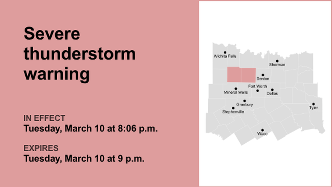
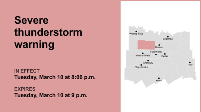
On Tuesday at 8:32 p.m. an updated severe thunderstorm warning was issued by the NWS Fort Worth TX in effect until 9 p.m. The warning is for Hood, Parker, Erath and Palo Pinto counties.
The storms are anticipated to bring wind gusts of up to 65 mph and half-dollar-sized hail (1.25 inches).
“At 8:32 p.m., a severe thunderstorm was located over Brock, or 9 miles west of Weatherford, moving east at 35 mph,” describes the NWS. “Hail damage to vehicles is expected. Expect wind damage to roofs, siding, and trees.”
Be aware that the thunderstorm may affect the following locations:
Weatherford and Brock around 8:35 p.m.Willow Park, Hudson Oaks, and Annetta around 8:50 p.m.Aledo and Lake Weatherford around 8:55 p.m.
Other locations impacted by this severe thunderstorm include Adell, Santo, Dennis, Mambrino, Agnes, Acton, Bennett, Oran, Waples, and New Salem.
According to the NWS, “A Tornado Watch remains in effect until 11 p.m. for north central Texas. For your protection stay inside a sturdy structure and keep away from windows.”
This warning is in effect until 9 p.m.
Weather Watches and WarningsLive, real-time data from the National Weather Service showing official weather watches, warnings, and advisories. Tap or click a highlighted area for details.
Sources: NOAA, National Weather Service, NOAA GeoPlatform, and Esri.
Map by Steve Wilson swilson@star-telegram.comHow to react when facing a lightning hazard?
Around 25 million lightning strikes occur in the United States every year, with most taking place during the summer months. The NWS reports that these strikes result in about 20 fatalities annually. The probability of lightning strikes rises as a thunderstorm approaches and peaks when the storm is directly above. As the storm moves away, this likelihood decreases.
Here are recommendations for maintaining safety during a thunderstorm:
To decrease the risk of getting struck by lightning, when you go outside, establish a plan to reach a safer place.If the sky becomes threatening and thunder can be heard, find a safe place to shelter.Once inside, avoid contact with corded phones, electrical equipment, plumbing, and windows and doors.Wait for 30 minutes after the most recent lightning or thunder before venturing outside.
If finding indoor shelter is not an option:
Stay away from open fields, hill summits, or ridge tops.Avoid tall, isolated trees or other elevated objects. If you are in a forest, stick to areas with shorter tree cover.When in a group, space out to prevent the current from transferring between individuals.When camping in an open environment, select a campsite in a valley, ravine, or low region. Just remember, tents do not offer protection from lightning.Maintain a safe distance from water, wet items, and metal objects. Water and metal do not attract lightning, yet they conduct electricity efficiently.What to do in the rain on the road? Turn on headlights – Even in daylight, using headlights can help improve visibility and let other drivers know where you are.While driving – Stick to the middle lanes and stay on elevated ground. Rainwater tends to accumulate at the road edges.Avoid puddles – Driving into puddles or low rainwater areas can lead to vehicles hydroplaning or losing control.Give ample space to large vehicles – Trucks or buses can create a water spray that diminishes visibility.Avoid flooded zones – If you encounter a flooded road, make a U-turn and go back. The powerful currents of flash floods can carry drivers off the road. Driving through deep water can also damage a vehicle’s mechanical and electrical systems.
What is hydroplaning?
Hydroplaning is when a vehicle starts uncontrollably sliding on wet roads.
This happens when water in front of the tire builds up faster than the vehicle’s weight can push water out of the way. The water pressure then causes the vehicle to rise and slide on a thin layer of water between the tires and the road, making the driver lose control. The three main causes of hydroplaning are:
Vehicle speed – When a vehicle’s speed increases, the tire-traction grip and ability to control the vehicle decreases. Drive at a reduced speed during wet weather.Water depth – The deeper the water, the sooner a vehicle loses traction on the road. It doesn’t matter how deep the water is, even a thin layer can lead to hydroplaning.Tire tread depth – Checking your tire tread before hitting the road is important, as low or no tread can lead to sliding.
In the event of your vehicle hydroplaning, here’s what to know:
Ease off the accelerator – Step off the gas to slow down the vehicle until the tires find traction.Turn into the skid – Turning into the skid can help the vehicle’s tires realign to regain control.Make sure the tires reconnect with the road – During the skid, wait until the tires reconnect with the road and then gently straighten the wheels to regain control.Brake gently as needed – Brake normally if the vehicle has anti-lock brakes and pump brakes gently if in an older vehicle.
Source: The National Weather Service

United Robots Fort Worth
This story was originally published March 10, 2026 at 8:10 PM.