
LUBBOCK, Texas (KCBD) – A cold front has push through the area early Wednesday morning, bringing a significant shift in wind direction and a noticeable cool-down by afternoon.
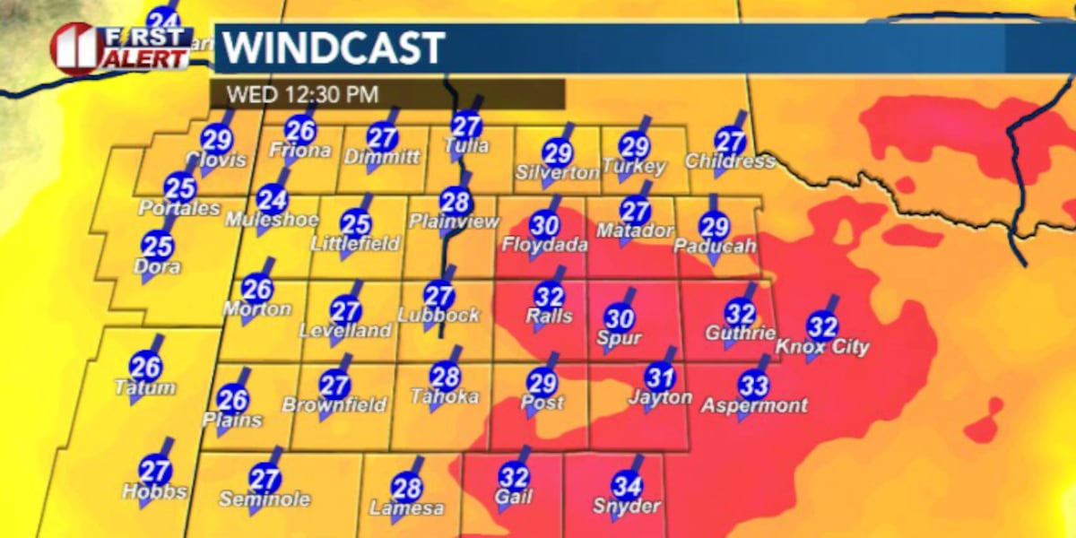
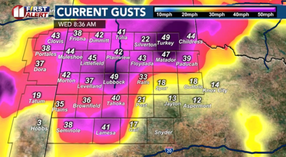
Northerly winds have taken over as our cold front has passed through. These winds will be intense as a pressure gradient tightens between a high-pressure system near the Rockies and a low-pressure system to the south.
 KCBD(KCBD)
 KCBD(KCBD)
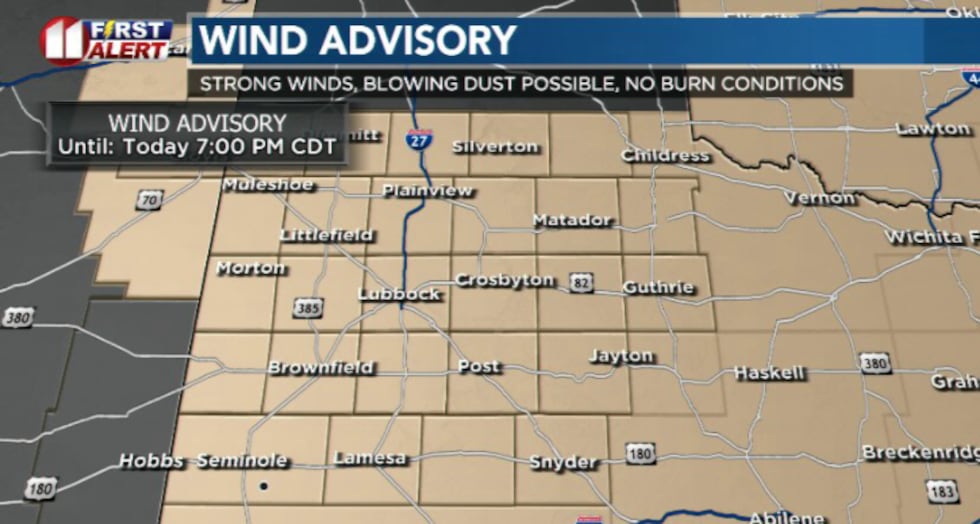
A Wind Advisory remains in effect for the entire forecast area until 7 p.m. Wednesday. Sustained winds are expected to reach up to 40 mph with gusts as high as 55 mph, with the strongest winds anticipated around noon.
 KCBD(KCBD)
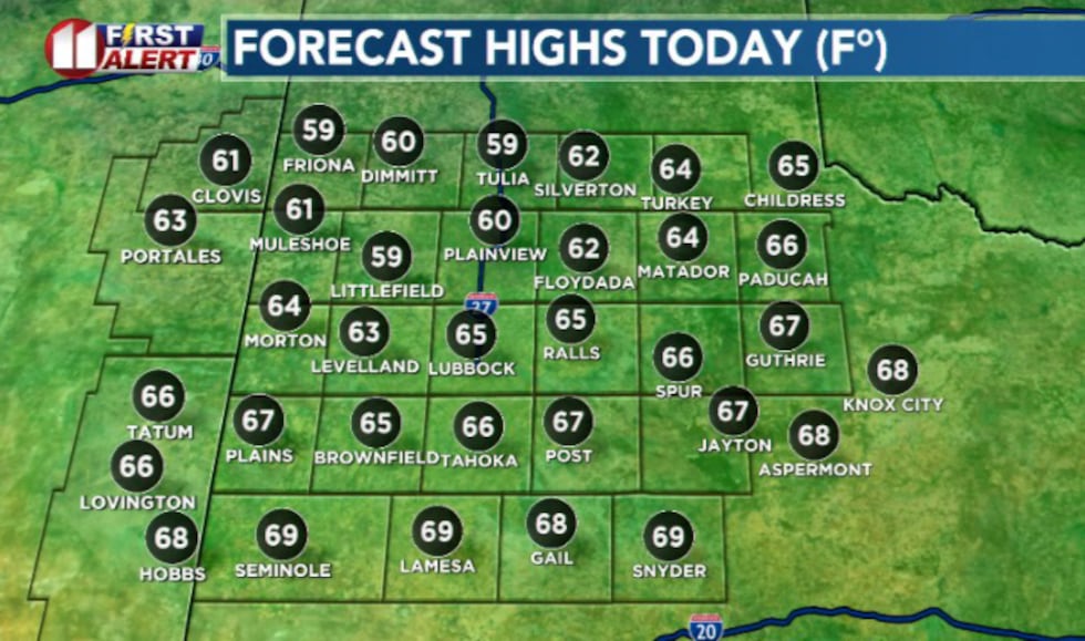
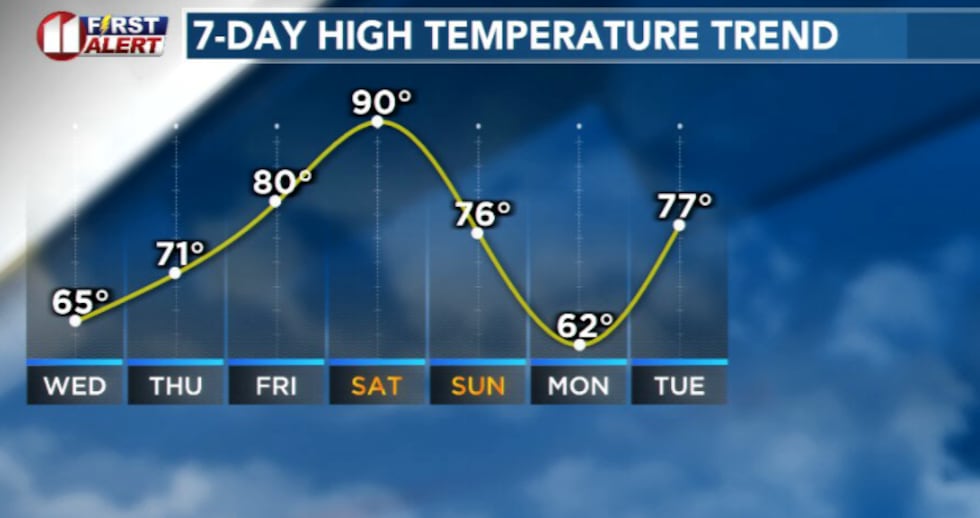
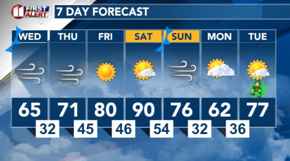
Temperatures will fall into the 60s as the cold front passes through. Winds will gradually diminish through the evening and become light and variable overnight into Thursday morning.
 KCBD(KCBD)
Looking ahead
Conditions will warm back up Thursday a high-pressure system builds back into the region and brings strong winds with it. Highs are expected to reach the low 70s, with breezy southwest surface winds.
 KCBD(KCBD)
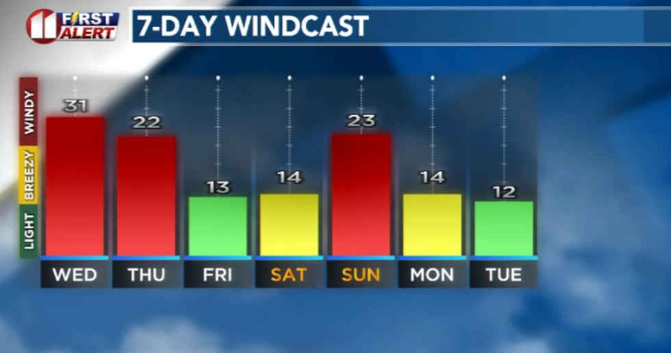 KCBD(KCBD)
Warm and dry conditions are expected to continue through the weekend before a cool-down arrives early next week.
 KCBD(KCBD)
Copyright 2026 KCBD. All rights reserved.