
The Brief
Fox 26 Storm Alert will begin overnight tonight until early Sunday morning.
Waves of Storms Early Saturday – Early Sunday
The FOX 26 Weather Team created a timeline on what to expect for the incoming storms.
HOUSTON – A flood watch is in effect for much of the surrounding counties as heavy storms will begin to move into the Houston-area.
Flood Watch issued for Houston-area
The National Weather Service has issued a flood watch for much of the surrounding area as heavy storms are set to begin to move into the Houston-area overnight until 5 a.m. Sunday morning.
Counties under a flood watch include Austin, Bolivar Peninsula, Brazoria Islands, Brazos, Burleson, Chambers, Coastal Brazoria, Coastal Galveston, Coastal Harris, Coastal Matagorda, Colorado, Fort Bend, Galveston Island, Grimes, Houston, Inland Brazoria, Inland Galveston, Inland Harris, Inland Matagorda, Madison, Matagorda Islands, Montgomery, Northern Liberty, Polk, San Jacinto, Southern Liberty, Trinity, Walker, Waller, Washington and Wharton.
Timeline for incoming storms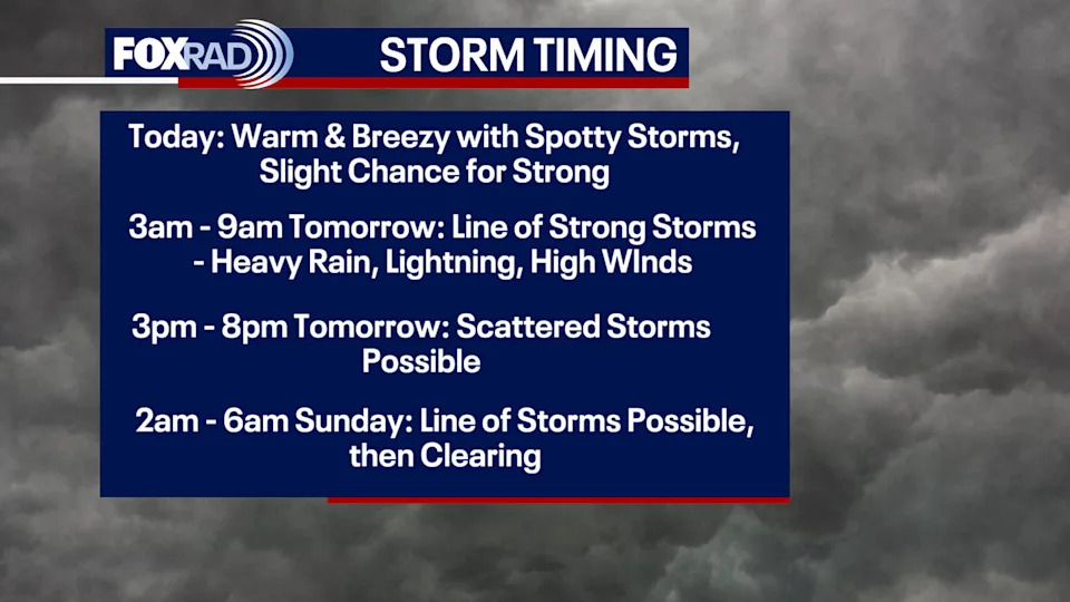
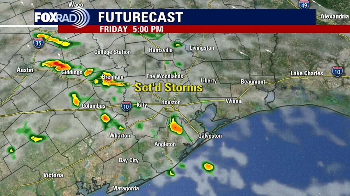
FOX 26 Storm Alert Weekend is ahead of us as multiple lines of strong storms will enter the area both Saturday and Sunday.
Today: Warm and breezy with spotty storms, a slight chance for strong storms.
Saturday, 3 a.m. to 9 a.m.: Line of strong storms with heavy rain, lightning, high winds.
Saturday, 3 p.m. to 8 p.m.: Scattered storms possible.
Sunday, 2 a.m. to 6 a.m.: Line of strong storms once again, clearing out afterwards. Flooding is a HUGE concern this weekend.
Heavy rain expectation, flooding concerns
Flooding is a HUGE concern this weekend as a large storm system is set to move in, bringing the potential for heavy rain and severe weather starting overnight tonight into Saturday morning and lasting through Sunday morning. Flooding today and through the overnight hours: we are at a level 1 risk. Tomorrow into Sunday: we are at a level 2 risk for flooding. Rainfall rates in the strongest storms could exceed two to three inches per hour, which could lead to flash flooding if these rainfall rates occur for a prolonged period of time.
Severe weather is also a possibility. The Storm Prediction Center has put us at a level 2 risk for today through tomorrow morning and another level 2 risk from tomorrow into Sunday morning. Hail potential is also on the lower side. We are primarily focused on the strong wind potential. Tornadoes are not impossible, but also not a high threat. These storms have the potential to rotate, so a quick spin-up tornado cannot fully be ruled out.
Expect rounds of storms tonight, Saturday and possibly early Sunday, with periods of calm between. We have high confidence of strong storms early Saturday morning, then lower confidence about the timing of late Saturday storms and early Sunday storms.
With that in mind, after the initial round of storms, be sure to check FOX Local for the latest updates on additional rain.
The Source
The National Weather Service and Your Gulf Coast Weather Authority