

Welcome to springtime in Austin, where you might need both sunscreen and a jacket on the same weekend.
High atmospheric pressure sliding east of the Lone Star State on Friday will draw southerly winds that will pull warmer and slightly more humid air back into Central Texas. After a cooler Thursday than normal, Friday will be sunny and seasonable with afternoon temperatures in the upper 70s to lower 80s. Clear skies and light south winds Friday night will allow temperatures to fall again, leading to another cool start Saturday morning with temps on either side of 50 degrees.
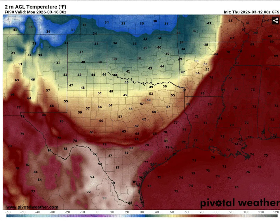
A strong, but dry, cold front will move into Texas on Sunday, accompanied by a big drop in temperatures. (Pivotal)
The weekend will warm up quickly. Saturday will feature sunshine and temperatures topping out in the 80s, while Sunday could surge into the 90s as clouds increase ahead of the next cold front. Saturday’s daily heat record of 96 degrees, set just last year, should remain safe, but Sunday’s daily record of 92 degrees, set on March 15, 2016, could be challenged as southwest winds push afternoon temperatures into the lower to mid-90s ahead of our next cold front.
That cold front will move quickly across the Lone Star State, sweeping through North Texas Sunday morning and exiting Central Texas by Sunday evening. No rain will accompany the front, but blustery north winds will rush in behind the front, sending temperatures tumbling nearly 50 degrees from Sunday afternoon to Monday morning.
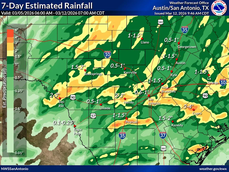
Cumulative rainfall totals over the past week have mainly ranged between an inch and 2 inches. (National Weather Service )
Drought update
The rain this past week was a welcome sight across drought-stricken Central Texas, where several locations picked up as much as 2 to 3 inches of rain since last Friday. At Camp Mabry, Austin’s main weather observation site, the March rainfall total has reached 1.42 inches — a surplus of 0.4 inch above normal. However, at Austin-Bergstrom International Airport, the monthly total remains under an inch, leaving a small deficit from normal of about 0.3 inch.
TEXAS SIZED HAIL: Massive hail pounds Central Texas during severe storm.
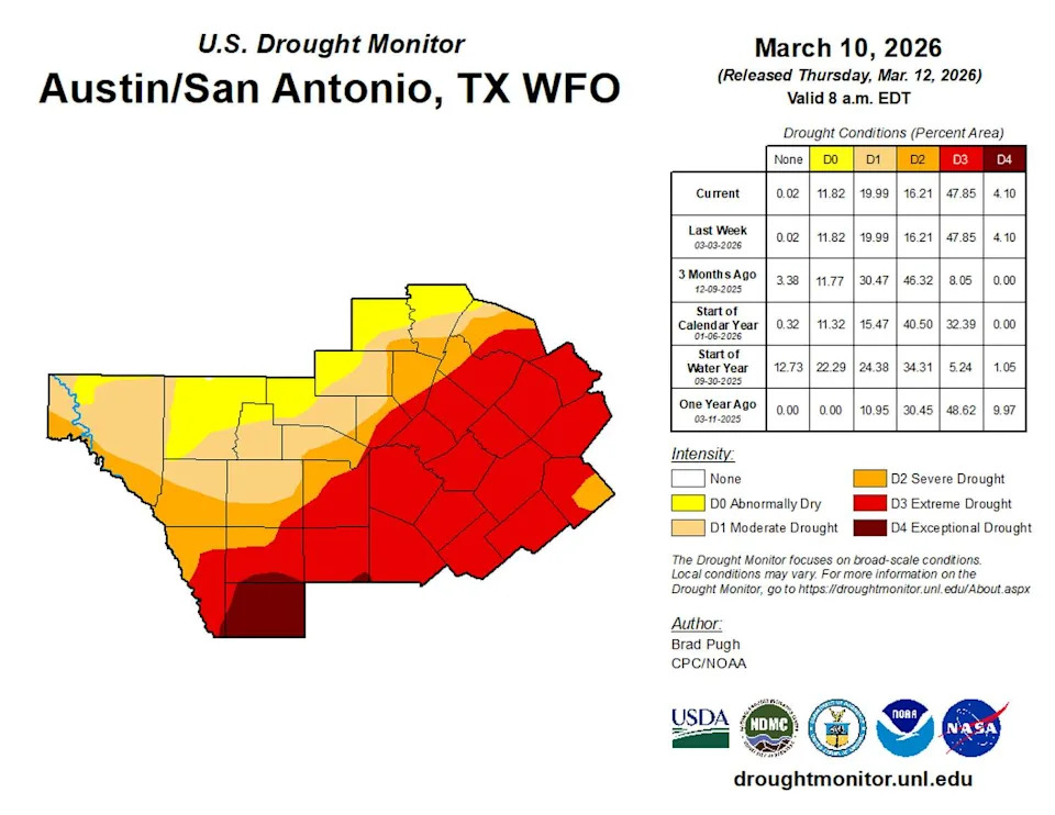
The latest data set for South and Central Texas from the U.S. Drought Monitor, which was released Thursday, did not count the rainfall that fell late Tuesday through Wednesday. It is possible that next week’s update from the U.S. Drought Monitor will show slight improvement in South and Central Texas. (National Weather Service)
The bulk of the rain this week fell west of the Interstate 35 corridor:
Pedernales Falls State Park: 1.89 inches
Buchanan Lake Village: 1.44 inches
Marble Falls: 1.39 inches
Dripping Springs: 1.38 inches
LBJ State Park: 1.3 inches
The latest update from the U.S. Drought Monitor still shows areas of extreme drought across Central Texas, especially along and east of the I-35 corridor.
Overall, Central Texas remains behind on cumulative rainfall for the season. The region is running about 2 inches below normal since early February and 6 inches below normal since December.
Beyond the dip in temperatures early next week, drier and warmer air will settle in for the next six to 10 days.