
Meteorologist Kim Castro explains why it could be good for hurricane season, but not so much for spring storms.
HOUSTON — A pattern shift is forming over the Pacific Ocean that could shape the months ahead. NOAA has officially issued an El Niño watch.
That means forecasters are expecting the Pacific Ocean to warm and winds there to weaken. Those are conditions that often trigger a ripple effect on weather worldwide.
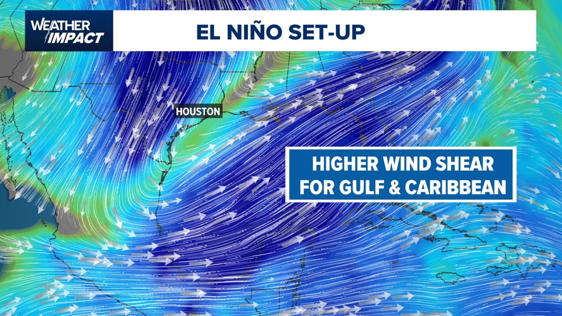
“When we’re in an El Niño phase, the Pacific is warm and the wind is light, which means the opposite happens here in the Atlantic,” KHOU 11 Meteorologist Kim Castro explained. “We see some really strong wind which shears the storms apart, breaks them up, in colder temperatures.”
In short, El Niño years typically bring a quieter hurricane season for the Gulf and Atlantic basins because that stronger upper-level wind disrupts tropical system formation. Though as we’ve seen, it only takes one hurricane to make the season devastating, so you always want to be prepared!
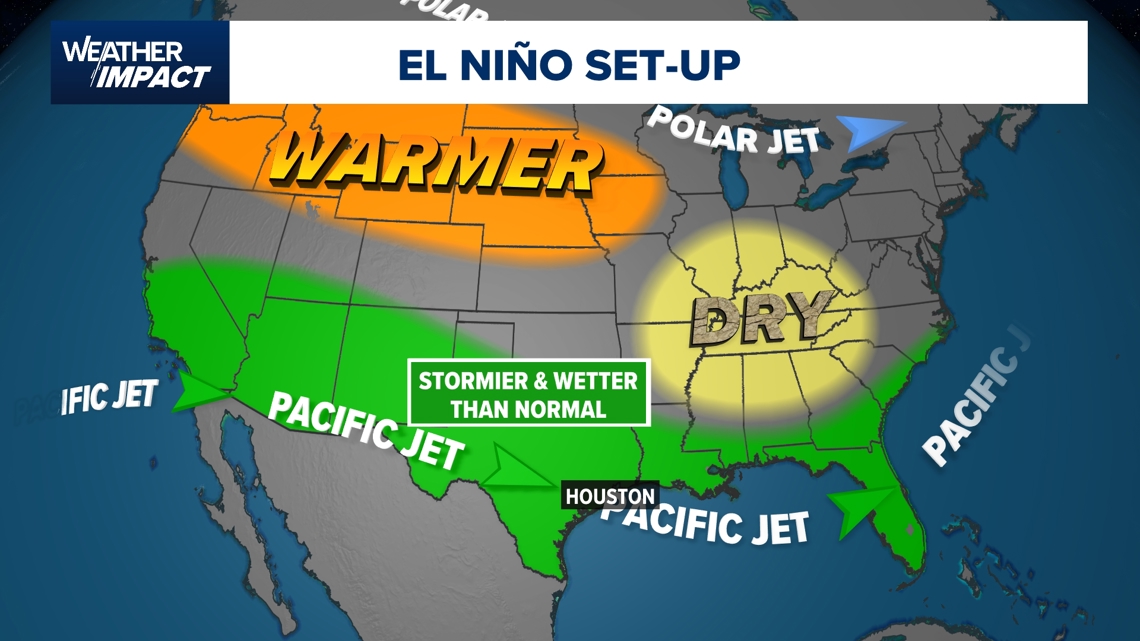
There’s a tradeoff for Texas.
Castro says El Niño can make spring stormier than normal, nudging the Pacific jet stream farther north and allowing more frequent storm systems to move across the Lone Star State.
That can lead to wetter and slightly cooler spring weather compared with neutral or La Niña years.

While no immediate impacts are showing up in the extended forecast, the El Niño watch signals that shifting global conditions may soon start influencing local weather trends — from rainfall patterns to spring storm intensity.
READ MORE: Understanding El Niño and La Niña patterns
Got a news tip or story idea? Email us at newstips@khou.com or call 713-521-4310 and include your name and the best way to reach you.