
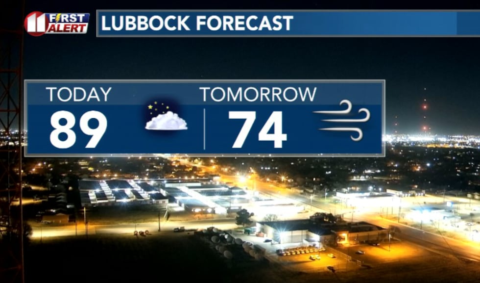
LUBBOCK, Texas (KCBD) -First Alert Weather Day Sunday- Record-heat today, followed by a crash in temperatures and strong winds Sunday.
 Near-record heat and cooler tomorrow(KCBD)
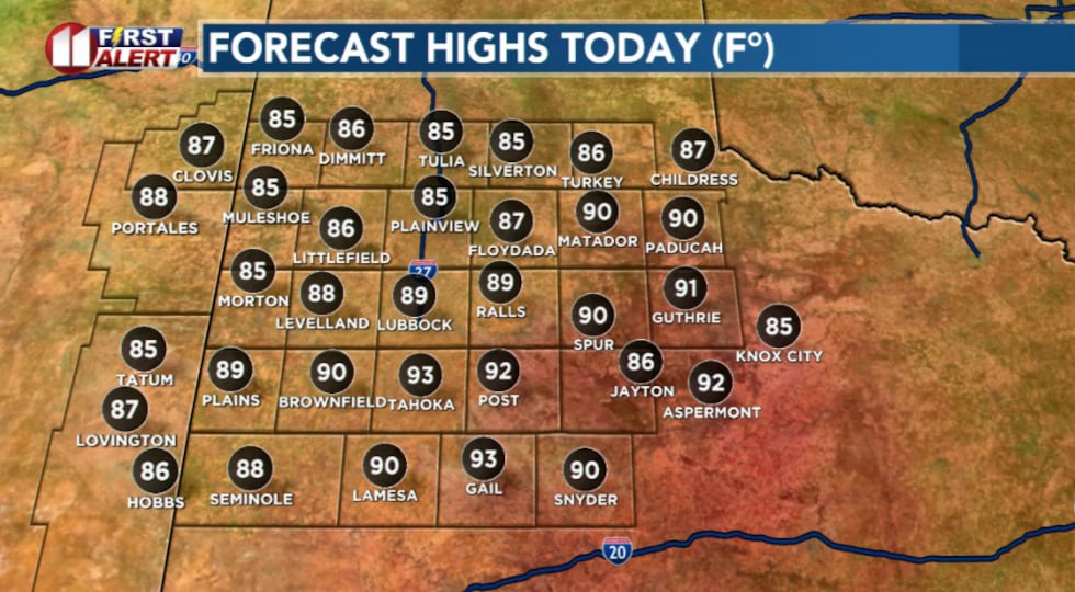
It will be a taste of summer today as highs are expected to climb near 90 degrees.
 Highs today will feel like summer(KCBD)
Lubbock could break its record daily high of 86 degrees set back in 1972.
The heat will arrive with breezy west winds, creating an elevated fire danger across the region today.
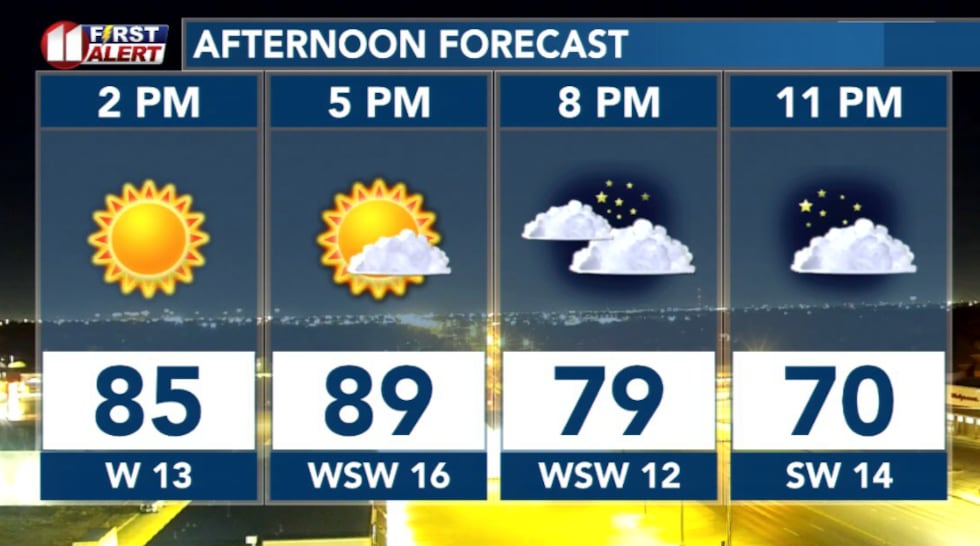 This afternoon(KCBD)
While today’s focus is on the heat, the bigger weather story arrives Sunday which has been designated a First Alert Weather Day.
First Alert Weather Day Sunday
A strong cold front will move through West Texas during the morning, bringing much stronger winds across the South and Rolling Plains.
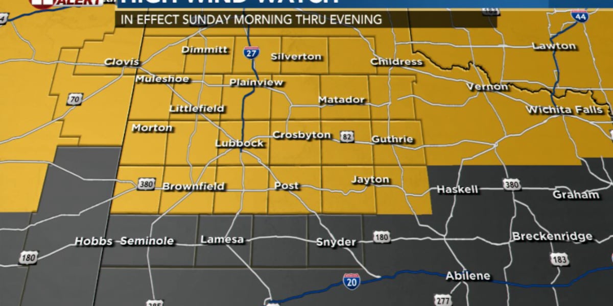
High Wind Watch is in effect for the entire forecast area between 7 AM and 7 PM Sunday.
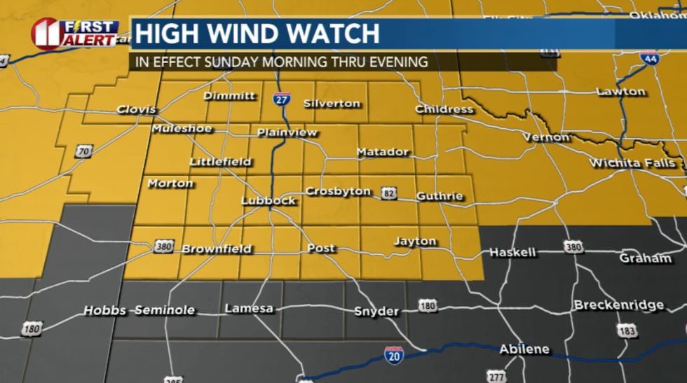 High wind watch in effect(KCBD)
Sustained winds between 30-50 mph, with gusts up to 65 mph, are forecast. Blowing dust will result in reductions to visibility.
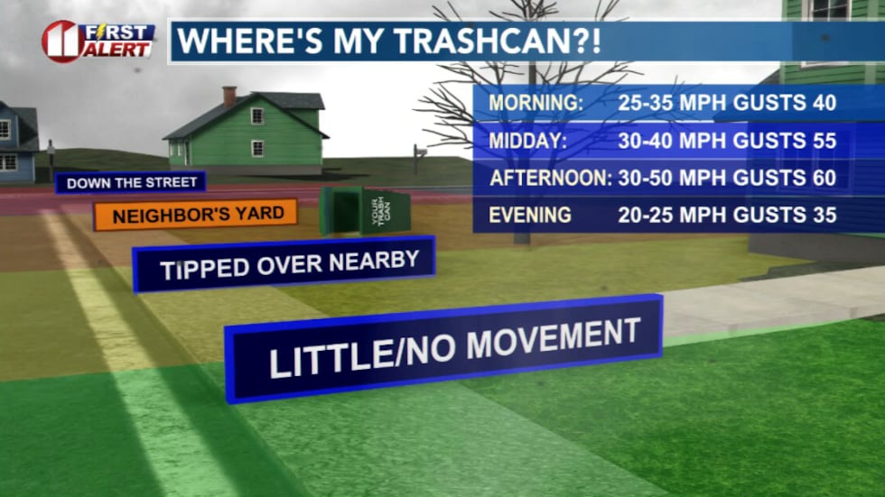 Trashcan forecast: expect high winds on Sunday(KCBD)
Highs on Sunday will be noticeably cooler in the 70s. Despite this, the air will remain very dry.
That combined with the winds will result in critical fire danger across much of the region.
Which is why a Fire Weather Watch is in effect for the entire forecast area between 7 AM and 9 PM CDT Sunday.
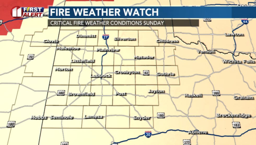 Fire Weather Watch is in effect for the entire forecast area between 7 AM and 9 PM CDT Sunday.(KCBD)
The high winds and very low relative humidity will result in the rapid growth and spread of wildfires.
Helpful Tips: If you’re driving, slow down as strong crosswinds can push vehicles. Blowing dust may reduce visibility. Use caution with empty trailers. Secure loose outdoor items like trashcans and patio furniture. Make sure tow chains are secured so they don’t drag and spark fires.
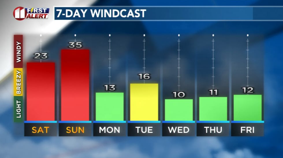 Windcast(KCBD)
What’s driving the heat?
There are three things driving this surge in heat.
First, winds are coming down off the higher terrain in New Mexico, and sinking air naturally warms as it compresses.
Second, the atmosphere mixes during the afternoon, which pulls even warmer air down from a few thousand feet up.
And third, the air is extremely dry, so the sun heats it up much faster. Since there’s no almost no moisture in the atmosphere today, the sun’s energy goes straight into warming the air instead of evaporating water.
Why will winds be so strong on Sunday?
A powerful storm system will intensify across the central U.S. overnight.
As it races toward the Midwest, it pulls air northward like a vacuum, while a strong cold front surges through West Texas Sunday morning. At the same time, pressure rises quickly behind the front.
This creates a large pressure difference across the region, and the air rushes from high pressure toward lower pressure. The stronger the pressure difference becomes, the stronger the winds at the surface.
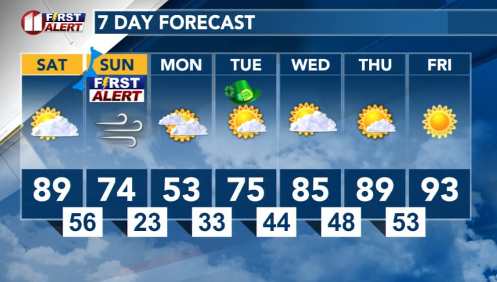 7 Day Forecast(KCBD)
Copyright 2026 KCBD. All rights reserved.