SAN ANTONIO – Warm to record hot temperatures this weekend before a strong late season cold front arrives. This front will bring a more than 50-degree swing in temperatures Sunday to Monday morning!
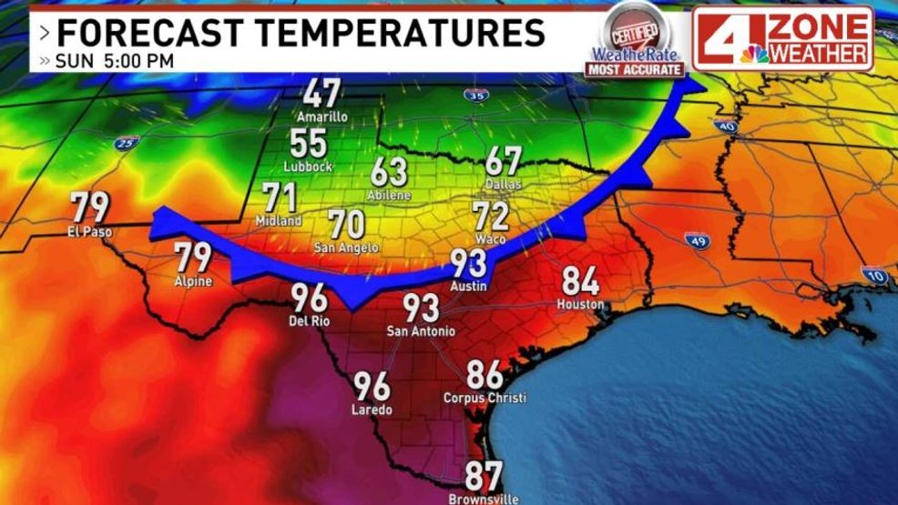
Your afternoon today is in the mid 80s then settles back into a delightful evening. Sunday starts cloudy and in the 60s. Clouds will decrease for sunshine by midday with temperatures spiking into the low – mid 90s by mid to late afternoon before the cold front arrives. The record high in San Antonio is 91 set in 1908.
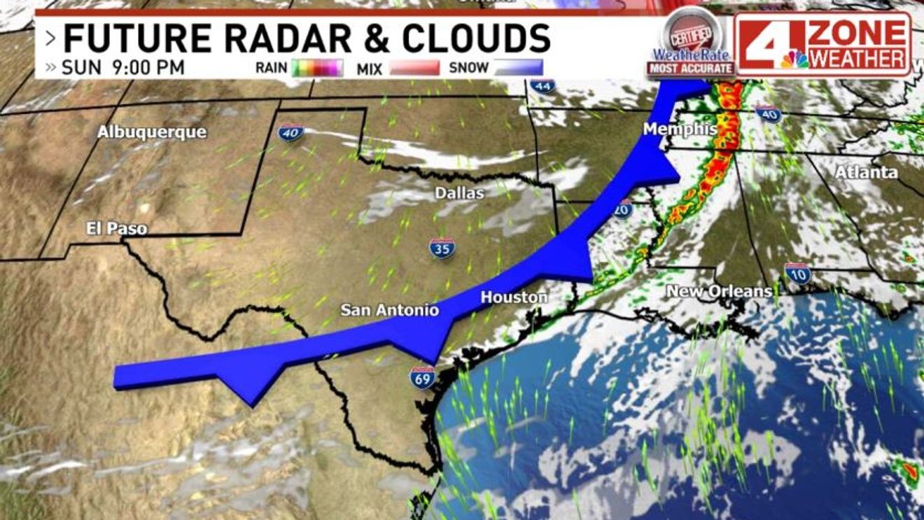
This front will be surging across Texas during the day. In the afternoon, there will be a range from the 40s in Amarillo to near 100 in South Texas. This front is attached to a blizzard in the Midwest which will be pushing cold air south.
Huge temperature swing across Texas Sunday
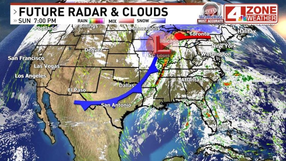
Blizzard in Midwest pushing cold front across Texas
The latest timing on this cold front has it moving into San Antonio 5PM to 7PM and a little sooner in the Hill Country. You’ll know when it arrives as winds will strengthen behind the front with gusts reaching 40 – 50mph or even a little higher in spots into Sunday night. The National Weather Service will likely have a Wind Advisory issued to cover this. Winds gusting to 50mph or higher can cause light damage with tree branches, yard furniture that’s not secured and even a few outages in the area.
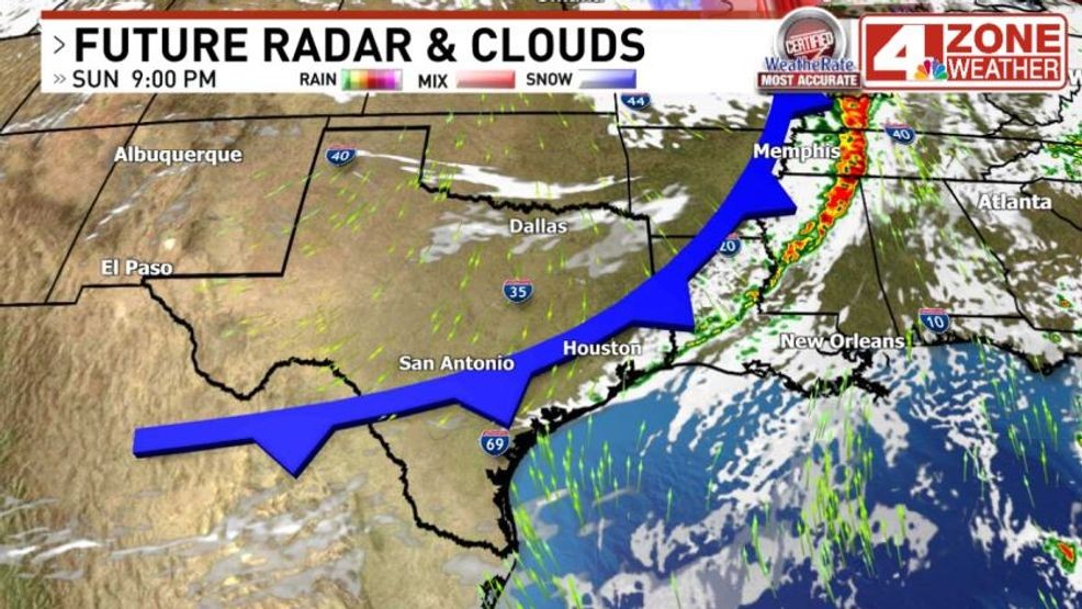
Cold front Sunday evening
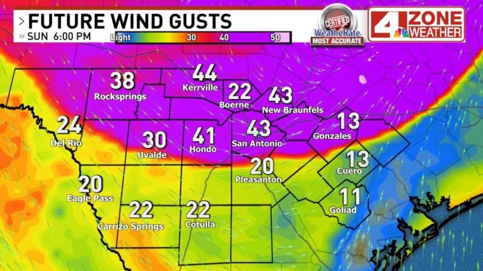
Gusty winds moving in with cold front 6PM Sunday
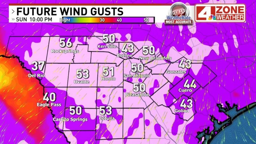
Forecast wind gusts Sunday night
Temperatures for most Monday morning will be cold but safely above freezing. A few spots in the Hill Country could briefly hit freezing for a very light freeze. Gusty winds Monday morning will make it feel 10 to 12 degrees colder at times too.
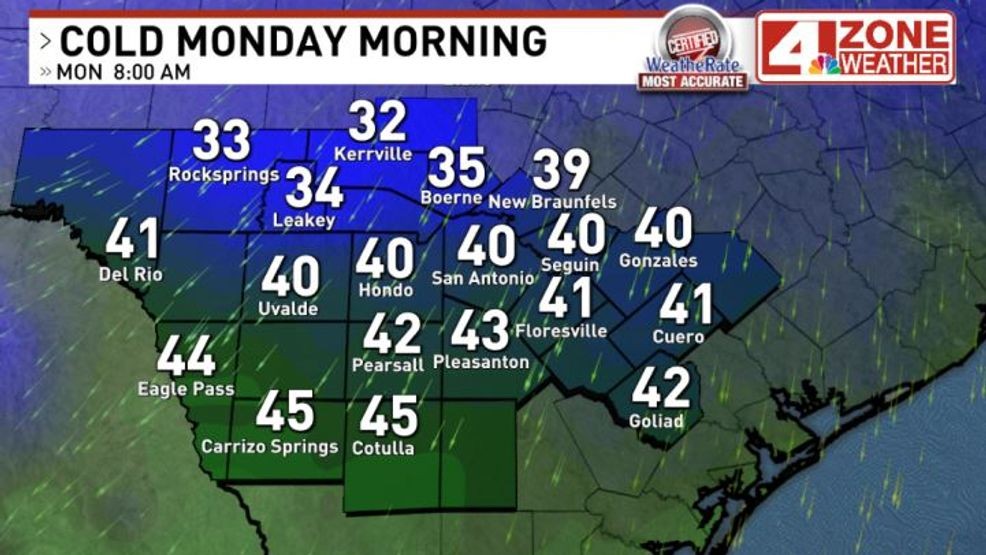
Forecast low temperatures Monday morning
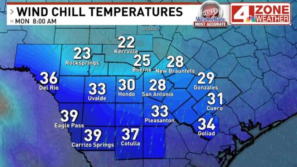
Monday morning wind chill temperatures
The colder night will likely be Monday night into Tuesday morning. Skies will be mostly cloudy the first part of the night then those clouds will move out of the area. This will expose us to light winds, very dry air with no blanket of clouds overhead. Ideal conditions for radiational cooling. Temperatures in the mid 30s in and around San Antonio with some frost possible. A freeze in parts of the Hill Country in this scenario.
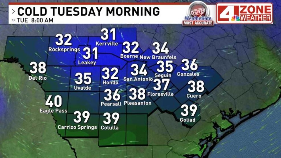
Forecast low temperatures Tuesday morning
Comment with Bubbles
JOIN THE CONVERSATION (1)
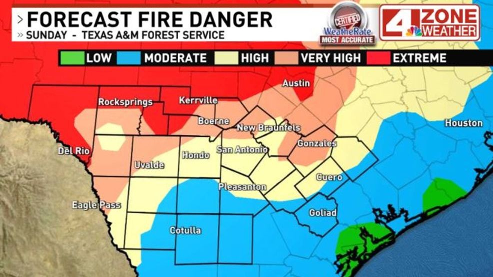
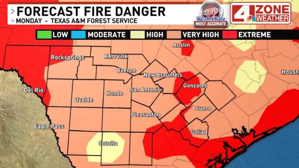
Fire danger will be elevated Sunday through Monday too. Sunday’s combination of heat, dry air and breezy conditions will create high to extreme fire danger in much of our area. On Monday, bone-dry humidity levels with gusty winds will be favorable fire conditions.