
SAN ANTONIO – A Flood Watch is in effect for the San Antonio metro area until 1 pm Saturday.
A strong line of storms is expected to move in from the west tonight. The region could pick up 1 to 3 inches of rain, with isolated pockets seeing much more. Areas at risk for flooding — including creeks, streams, low water crossings, and some streets.
Storms are expected to approach the Hill Country and southern Edwards Plateau between about 8 – 9 p.m., then punch into Bexar County, the I-35 corridor, before or near midnight.
A second round of rain will arrive between 3 a.m. and 5 a.m. Storm threats include damaging wind gusts, large hail, and even the possibility of an isolated tornado.
If you’re out late or starting early tomorrow, be alert for rapidly changing conditions, especially in low-lying parts of the city.
—
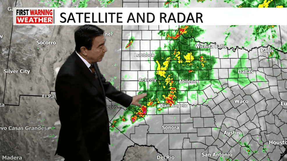
A significant weather system is impacting West Texas, with rain and storms moving through northern areas near San Angelo.
Moisture from the Gulf is contributing to the weather pattern, affecting the San Antonio area this evening.
An atmospheric river is bringing additional moisture into the region, with a cold front pushing larger storms toward San Angelo. Rain is also moving through Wilson County and the east side of San Antonio.
Temperatures are expected to drop from 80 degrees to 74 degrees by 10 p.m., with potential for larger storms in the hill country.
Tomorrow morning may start with leftover rain, but temperatures are expected to rise into the 80s by the afternoon, promising a pleasant day.
Sunday is forecasted to be sunny with temperatures in the 80s.
For updates, you can also find information on active warnings and watches at the National Weather Service website.