
Click the livestream player above for a live look at current conditions, weather cameras and radar.
LUBBOCK, Texas (KCBD) – Today will be a high impact weather day across Lubbock and the South Plains, with powerful winds, blowing dust, and dangerous fire weather developing after a strong cold front pushes through.
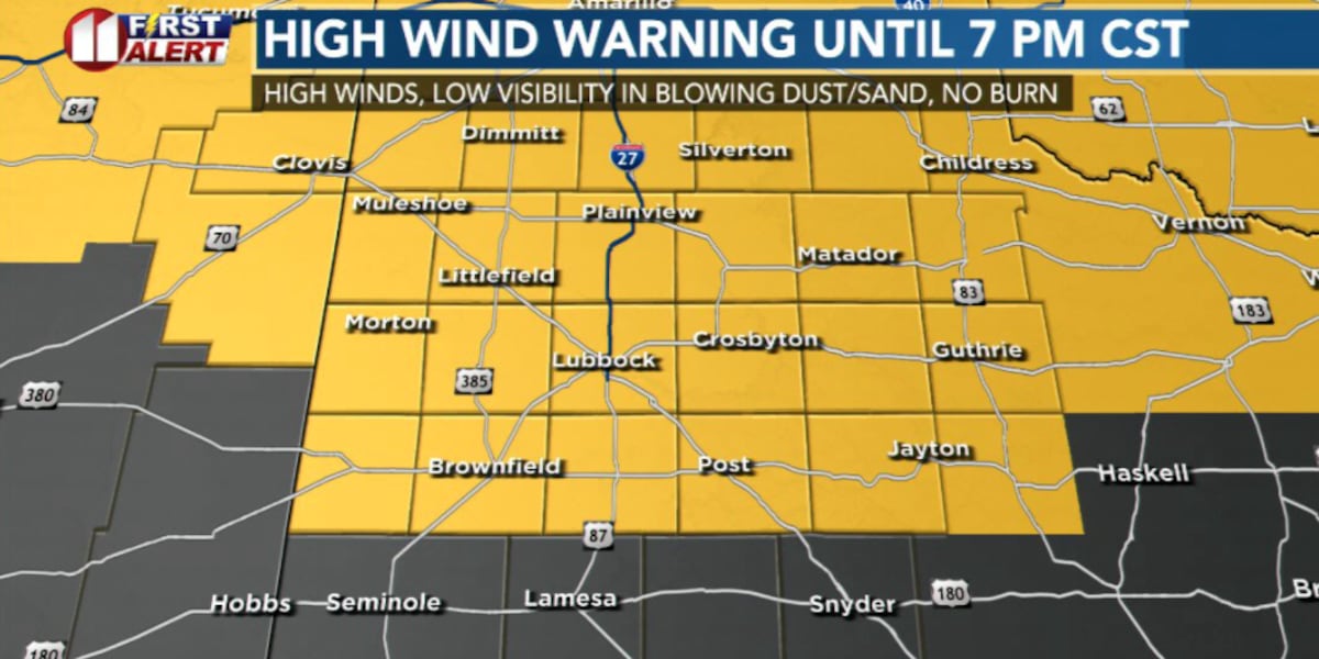
High Wind Warning in effect until 7 PM tonight.
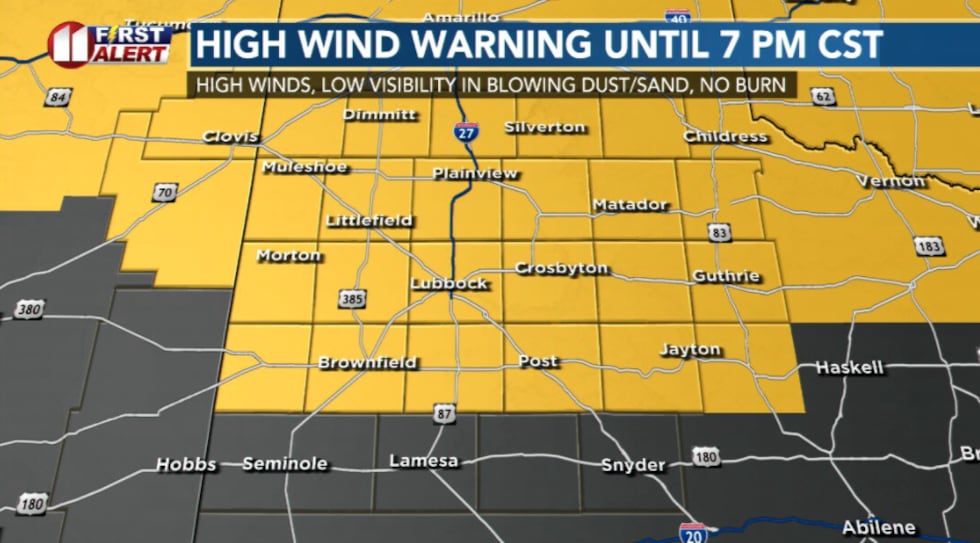 High wind warning in effect until 7pm with gusts up to 65 mph possible(KCBD)
Sustained winds between 35-45 mph, with gusts up to 65 mph, are forecast. Blowing dust will result in reductions to visibility.
A Blowing Dust Advisory is in effect from 7 AM until 7 PM. Visibility at times will fall to between 1/4 mile and 1 mile.
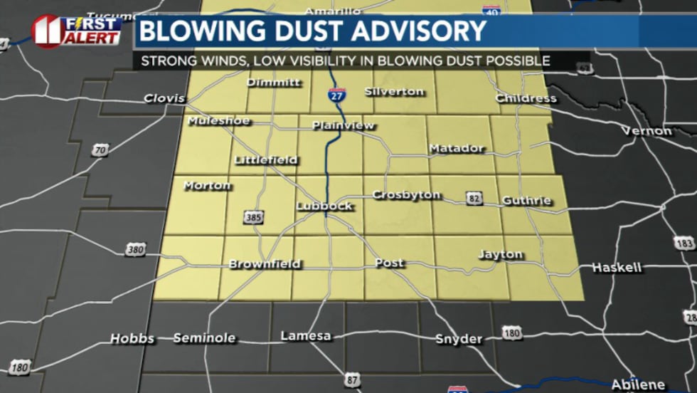 Blowing dust advisory in effect(KCBD)
A Red Flag Warning is in effect for the entire forecast area between 7 AM and 9 PM. The high winds and low relative humidity will result in the rapid growth and spread of any potential fires.
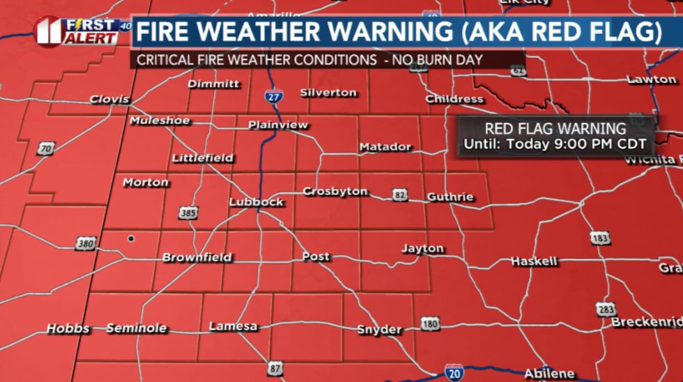 Red flag warning in effect today. No burn day!(KCBD)
Temperatures actually begin fairly mild, sitting in the mid-60s low 70s. The temperature will drop steadily through the afternoon, to the low 50s by late afternoon.
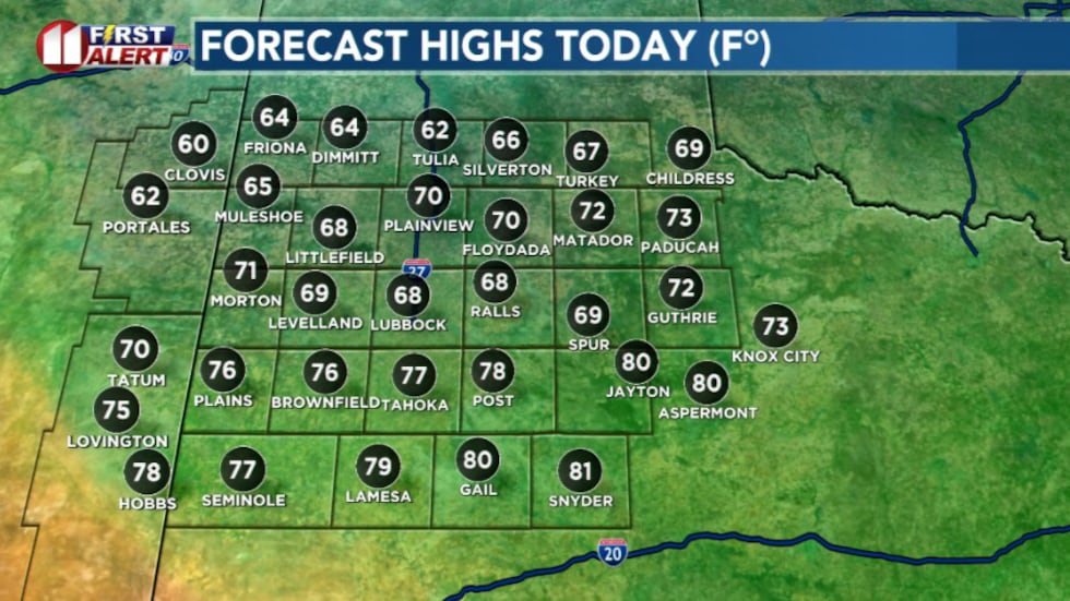 Highs today(KCBD)
As the front approaches late this morning/early this afternoon, winds will ramp up quickly. Behind the front, northwest winds of 35-45 mph with gusts up to 60-65 mph are expected across much of the region.
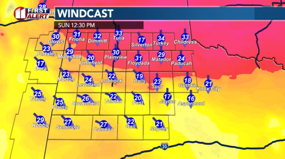 Wind Cast(KCBD)
Even if sustained winds are slightly weaker, the gusts alone justify the High Wind Warning.
These strong winds will likely kick up widespread blowing dust, which could reduce visibility at times and create dangerous driving conditions, especially on open highways.
High-profile vehicles like semis, RV, and trucks pulling trailers may have a difficult time particularly on east-west roads.
At the same time, the atmosphere is bone dry, with humidity dropping near 10-15%. Combined with the strong winds and dry vegetation, that creates critical fire weather conditions.
Winds begin to settle overnight as colder air filters into the region. By Monday morning, temperatures will likely crash into the teens and low 20s.
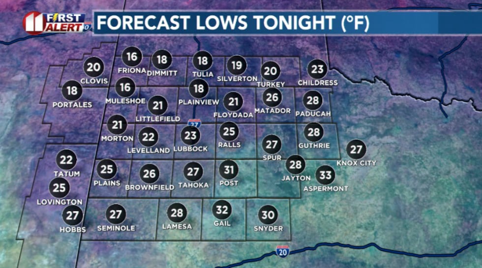 Lows tonight(KCBD)
Monday itself will feel much cooler, with afternoon highs only reaching the low 50s, as high clouds move overhead.
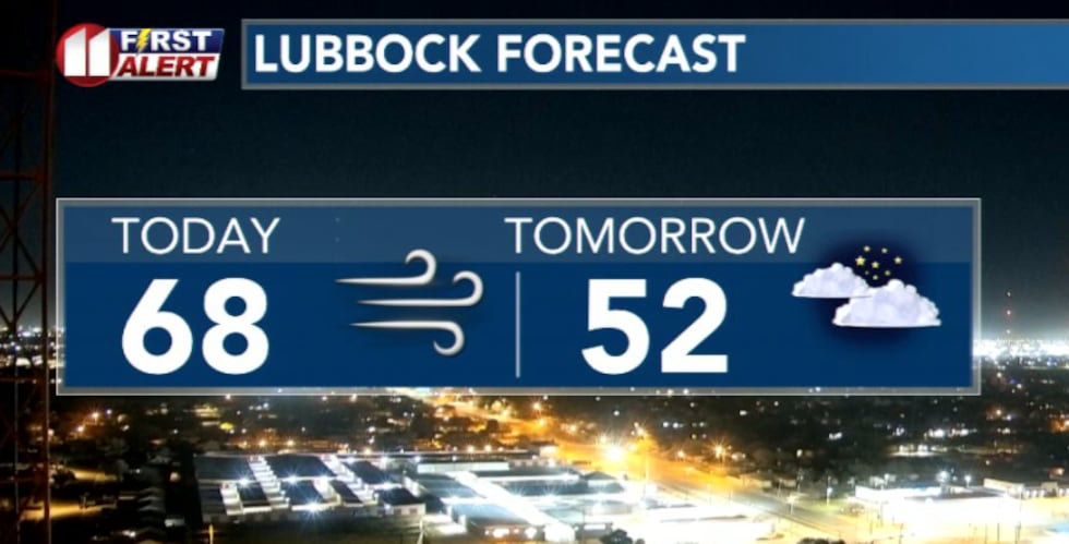 Tomorrow will feature much cooler temperatures with high clouds throughout the day(KCBD)
Cooler temperatures won’t last long. Beginning Tuesday, a strong ridge of high pressure builds over the western U.S., opening the door for much warmer air to spread across the area.
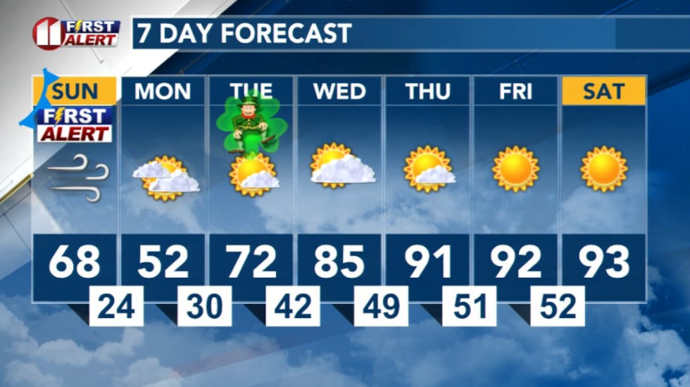 7 Day Forecast(KCBD)
Copyright 2026 KCBD. All rights reserved.