

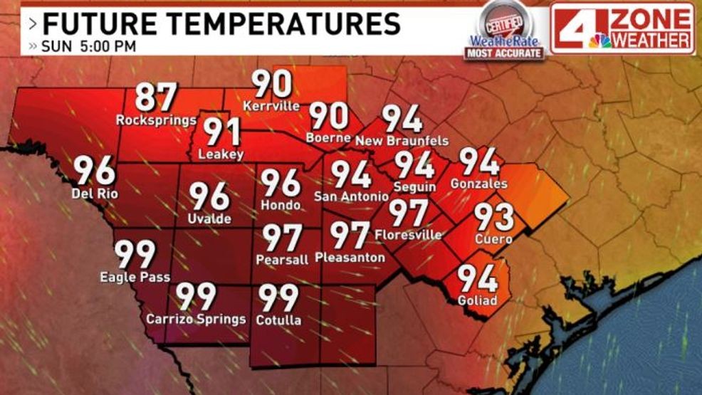
SAN ANTONIO – An 118-year-old heat record could fall Sunday afternoon as temperatures surge into the mid-90s ahead of a powerful late-season cold front expected to move through the region later.
The current record high for March 15 is 91 degrees, set in 1908. Temperatures across San Antonio will climb into the mid-90s, with triple-digit heat possible in counties south of the city before the cold front arrives.
Cold front in Texas and moving south
The strong front, currently moving south through Texas, is expected to reach the Hill Country first and then San Antonio between 5 p.m. and 7 p.m.
Behind the front, winds will rapidly increase, with gusts between 40 and 50 mph possible Sunday night into early Monday morning. A Wind Advisory is scheduled to take effect at 3 p.m. Sunday and remain in place until 5 a.m. Monday.
The strong winds, combined with dry conditions, will also raise the risk of wildfires across the region. A Red Flag Warning remains in effect through 8 p.m. Monday due to elevated fire danger..
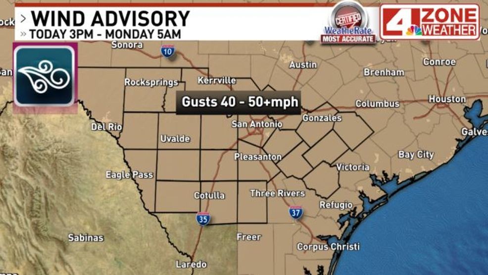
Wind Advisory through Monday morning 5AM
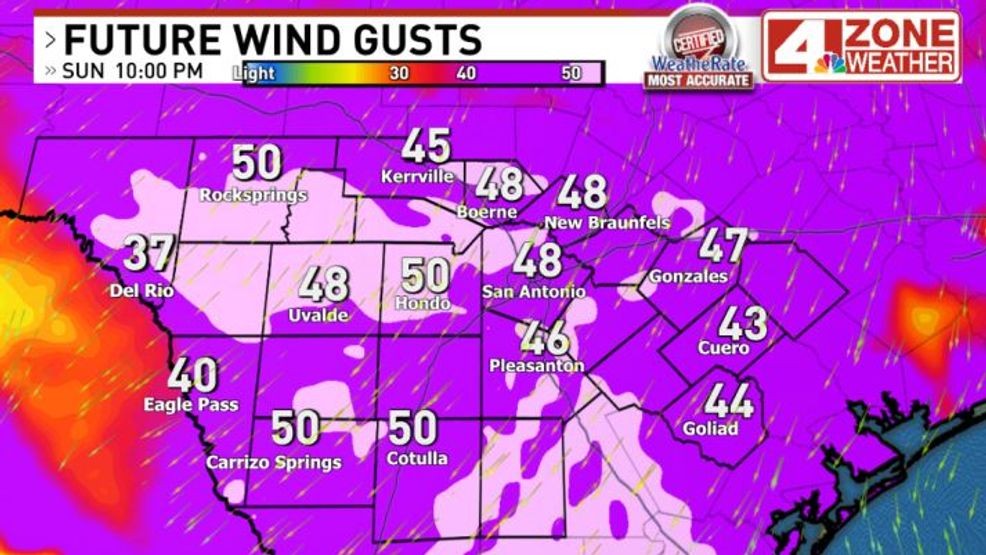
Forecast wind gusts late evening – tonight
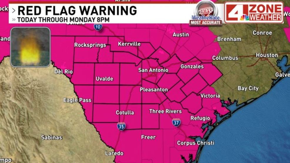
Red Flag Warning through Monday evening
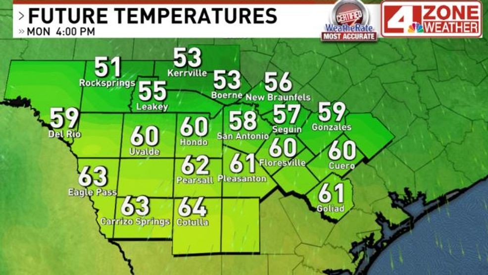
Morning temperatures on Monday will range from the upper 30s to low 40s around San Antonio, with a spot or two in the Hill Country that could see a brief light freeze. Gusty winds will make it feel like it’s in the 20s to low 30s Monday morning. Afternoon temperatures will hold in the 50s.
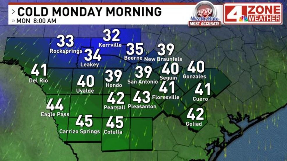
Forecast lows Monday morning
Forecast temperatures Monday
Temperatures are expected to plunge after the front passes, dropping from the mid-90s Sunday afternoon to the upper 30s and low 40s by Monday morning. With gusty winds continuing overnight, it could feel like the 20s to low 30s early Monday.
Monday will remain much cooler, with afternoon highs expected to reach only the upper 50s. Winds will gradually calm throughout the day, leading to quieter conditions by Monday night.
Comment with Bubbles
BE THE FIRST TO COMMENT
Even colder temperatures are expected on Tuesday morning. Most areas will dip into the 30s, with some Hill Country locations possibly experiencing a light freeze. If skies clear overnight Monday, some areas could also see frost Tuesday morning before temperatures warm into the upper 60s by the afternoon.