
After more than a month without meaningful rain in Austin, our first real chance has finally arrived and the weather this weekend comes with a serious threat of severe thunderstorms and possible flooding across Texas.
An upper-level storm system will move into the southern Rockies on Friday, helping to strengthen the southerly air flow over Central Texas, which will draw in more moisture from the Gulf of Mexico. Adding to the upper-level low are strong atmospheric winds and a Pacific cold front, which will create enough atmospheric instability to support severe thunderstorms and two rounds of heavy rainfall across Texas.
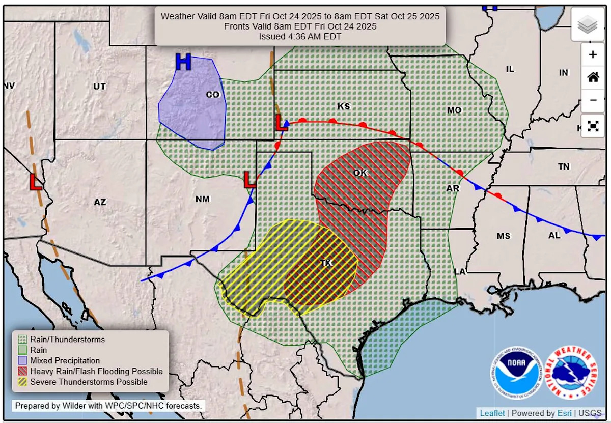
The National Weather Service’s severe weather specialists at the Storm Prediction Center have designated an area from Big Bend National Park northeast to the Texas-Oklahoma border to be under a level 2 out of 5 risk for severe weather on Friday.
That means scattered severe thunderstorms, — that are capable of producing damaging winds, including a tornado, and large hail — are possible Friday evening into the overnight hours. The affected area includes the Texas Hill Country and the Austin metro area.
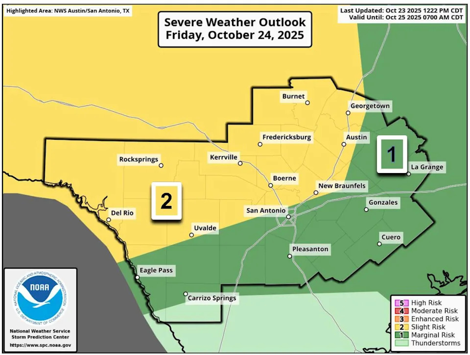
Strong and severe storms are possible with a squall line on Friday night from the Hill Country to the Austin metro area. (National Weather Service )
Locally heavy rainfall with this storm system could produce up to 3 inches of rain in the Austin metro area. The weather service’s flood forecasters at the Weather Prediction Center have placed the Edwards Plateau, the Hill Country and much of the Interstate 35 corridor under a level 2 out of 4 risk, or at least a 15% chance, of excessive rainfall. Such rainfall could lead to scattered flash flooding in urban areas with poor drainage, small streams and low water crossings.
These risks for excessive rainfall also indicate a likelihood that projected rainfall will exceed flash flood guidance, which is the amount of rainfall in a 1-hour, 3-hour or 6-hour period that would bring rivers and streams to bank full conditions, according to the National Weather Service.
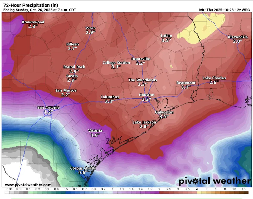
Heavy rainfall in Texas is expected with two rounds of storms: the first on Friday night into Saturday morning, and the second on Saturday afternoon and evening. (Pivtoal)
The weather service’s regional office for Austin gives a 50% to 70% chance that the Austin metro area will receive at least 2 inches of rain from Friday evening until Sunday.
Timing of the storms
We’ll wake up on Friday to muggy conditions under a mostly cloudy sky. Winds will be out of the southeast at 5 to 10 mph, with temperatures in the lower 70s, which is well above the late-October average low of 58 degrees.
Most of the day will be dry, with only a small chance of coastal showers streaming in. Rain chances will be near 30%, especially east of I-35. Temperatures will warm into the mid to upper 80s, with gusty south-southeast winds.
Friday evening, a line of storms will develop in West Texas and track east, arriving in the Hill Country before midnight, moving into Austin around 2 a.m., and continuing to produce heavy rain through about 8 a.m. Saturday.
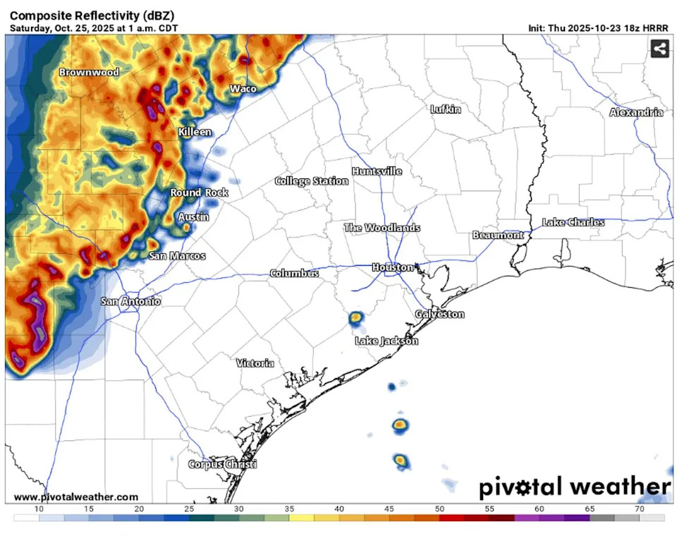
This future weather radar model shows a wide line of thunderstorms moving across the Interstate 35 corridor around 1 a.m. early Saturday. (Pivotal)
We’ll catch a brief break from the rain by mid-morning Saturday, but by the afternoon, the second round of showers and thunderstorms tied to the upper-level part of the storm system will move through, bringing more moderate to heavy rainfall and a level 1 of 5 risk for severe weather.
“This second round is more uncertain as the airmass may be worked over from the first round and will rely on some clearing to allow for the airmass to become unstable again,” the weather service wrote in a forecast update on Thursday.
Temperatures will be cooler on Saturday with highs in the lower 80s.
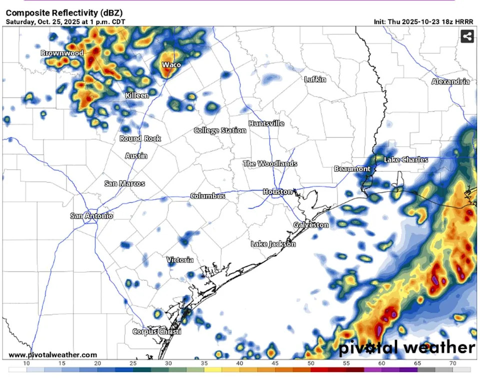
This future weather radar model shows a batch of afternoon thunderstorms moving north of Austin around 1 p.m. Saturday. (Pivotal)
Flash flooding tips
Because most of the rain is expected to fall overnight, it’s safest to stay off the roads during those hours. The National Weather Service reminds drivers that, while it’s difficult to spot flooded roads during the day, it’s impossible at night. Remember, it takes only about a foot of moving water to sweep a car off the road. If you encounter a barricaded or closed roadway, turn around, don’t drown, and find an alternate route. You can monitor road closures using the ATX Floods website for real-time updates.