

National Weather Service
A cold front blew into the Houston area on Sunday, bringing gusty winds and weather-related disruptions.
More than 40,000 homes and businesses in the region lost electricity after storms hit Sunday evening, according to CenterPoint Energy, which supplies power to much of the Houston area. About 8,000 customers were still without electricity as of 8 a.m. Monday.
Sign up for the Hello, Houston! daily newsletter to get local reports like this delivered directly to your inbox.
Windy weather also was causing flight delays at Bush Intercontinental Airport. Departures from the north Houston airport were delayed by more than 2 hours on average Monday morning, according to the Federal Aviation Administration.
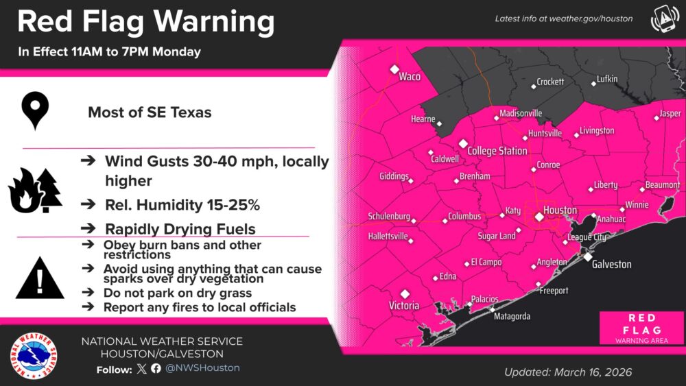
Gusty conditions were expected to continue throughout the day Monday as a wind advisory was put into effect by the National Weather Service until 6 p.m. A red flag warning, meaning conditions are conducive to the rapid spread of fires, is slated to be in place from 11 a.m.-7 p.m.
“The highest winds should be this morning,” said Cameron Self, a meteorologist with the National Weather Service. “We’ve seen gusts over 50 mph near the coast. In the Houston metro area, it’s generally been around 35-45 mph.”
Sunday’s cold front also brought a significant temperature drop. The high temperature forecasted for Monday is 55 degrees, with a nighttime low of 40.
The weather is expected to warm up as the week progresses, with forecasted highs of 61 on Tuesday, 74 on Wednesday and 80 on Thursday.
“If you don’t like the cold, it’s going to get a lot warmer as we go later in the week,” Self said. “The high temperature could actually be approaching 90 degrees, particularly to the west and north of the city, as we get to the end of the week.”
Houston Public Media’s Thomas Perumean contributed to this report.